Home
States
Colorado
Connecticut
Maine
Massachusetts
New Hampshire
New York
Rhode Island
Utah
Vermont
View All
Lists
NE 4,000 Footers
NE 100 Highest
NH 4,000 Footers
NH 100 Highest
NH 52 With A View
NH Belknap Range
NH Ossipee 10
Links
Trail Conditions
Trip Log
Sunrises
Sunsets
About
|
Middle Mountain
Conway, NH
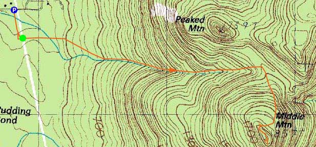
Trailheads, measurements, times, distances, and maps are all approximate and relative to the hike(s) as shown below.
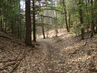
The Middle Mountain Trail
Route: Middle Mountain Trail, (Middle Mountain), Middle Mountain Trail
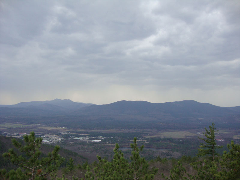
Starting at 82 degrees, it was a warm afternoon for an April hike. Fortunately, based upon recent hikes in the general vicinity, I knew I could leave my winter gear (such as snowshoes) behind and travel light, allowing me to jog in places. Reaching the summit without touching any snow (only a few minor patches seen anywhere), I had decent views, though troubling clouds were moving in.
As I descended, rain started to fall. While I had a rain jacket with me, I opted to enjoy the cooling rain. By the time I reached the parking area, the temperature had dropped 15 degrees.
| Hike Ratings |
|
Getting To Trailhead: |
Easy |
| Destination: |
Middle Mountain |
|
Length: |
Moderate |
|
Steepness: |
Moderate |
|
Navigation: |
Easy |
|
Views: |
Excellent |
|
Crowds: |
Minimal |
|
| Hike Stats |
|
Date Hiked: |
Wednesday, April 7, 2010 |
| Hike Commenced: |
4:33 PM |
| Parking Elevation: |
535' |
| Destination: |
Middle Mountain |
| Ascent Commenced: |
4:37 PM |
| Summit Reached: |
5:12 PM |
| Time Elapsed: |
00:35 |
| Trailhead Elevation: |
545' |
| Summit Elevation: |
1,857' |
| Vertical Gain: |
1,342' |
|
|
| Hike Ended: |
5:45 PM |
| Hike Time Elapsed: |
01:12 |
| Hike Vertical Gain: |
1,402' |
|
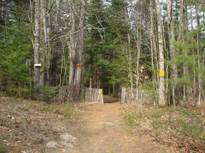
Middle Mountain Trail trailhead under the power lines

Mt. Chocorua and the Moats as seen from Middle Mountain
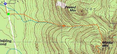

Directions to trailhead: From Routes 16/302 in North Conway, take Artist Falls Road past the railroad tracks. Take a right onto Thompson Road. A small Town of Conway/Pudding Pond Conservation Area signed parking lot will be on the right shortly thereafter.
Back to Middle Mountain Profile
|