Home
States
Colorado
Connecticut
Maine
Massachusetts
New Hampshire
New York
Rhode Island
Utah
Vermont
View All
Lists
NE 4,000 Footers
NE 100 Highest
NH 4,000 Footers
NH 100 Highest
NH 52 With A View
NH Belknap Range
NH Ossipee 10
Links
Trail Conditions
Trip Log
Sunrises
Sunsets
About
|
Middle Sister
Albany, NH
Trailheads, measurements, times, distances, and maps are all approximate and relative to the hike(s) as shown below.
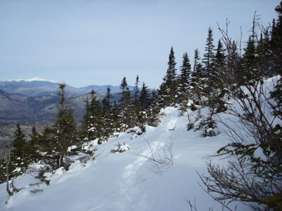
Looking up the Champney Falls Cutoff trail
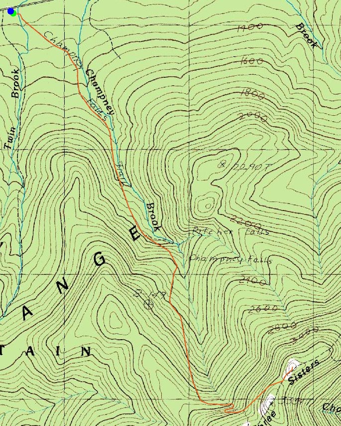
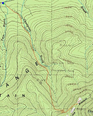
Route: Champney Falls Trail, Champney Falls Cutoff, Middle Sister Trail, (Middle Sister), Middle Sister Trail, Champney Falls Cutoff, Champney Falls Trail
The day before was supposed to be my day off - not a cloud in the sky, pleasant temperatures...a nice day. Nonetheless, there was work to do. Postponed 24 hours, I started my hike with single digit temperatures and quickly clouding skies.
Other than some folks going to the falls, I was the first one to ascend the Champney Falls Trail this day. Above the falls spur trail, I was surprised to see that the trail had been packed down by skis - something I haven't seen too much of in my limited White Mountain winter hiking experience.
The Champney Falls Trail is pretty gradual going. Arriving at the Champney Falls Cutoff, I put on crampons for the first time. This took me awhile...and then a few steps later, I found myself readjusting them. I lost probably a good 15 minutes easily fooling with these things. I needed them, however, as the cutoff trail had not been broken out since the last snowstorm and I knew just a few inches underneath was bulletproof ice.
Arriving at the Middle Sister Trail, I saw an unbroken trail and clouds overtaking the summit. If it weren't for the test run on with crampons, I probably would have made it to the summit in the clear! They did prove to be necessary near the top, as the rocks were covered with a somewhat thick coat of ice.
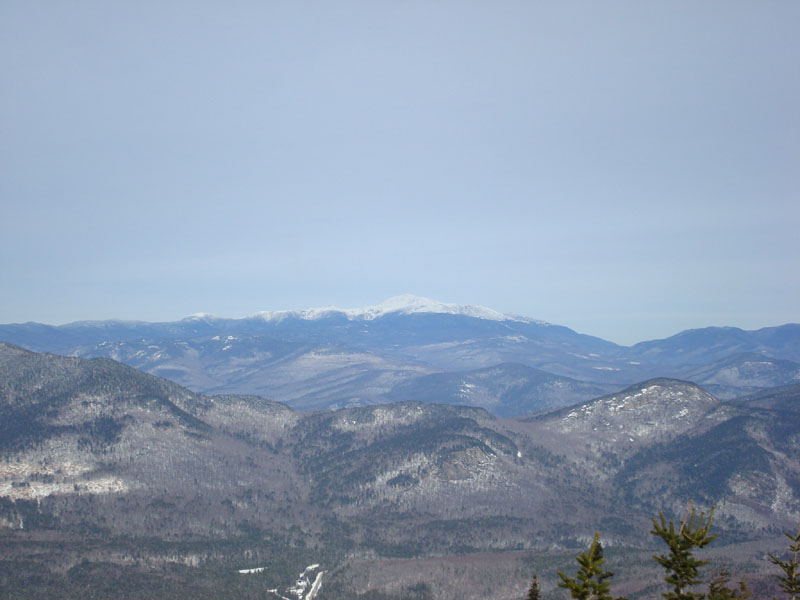
Perturbed by the clouds, I cussed for awhile, before looking up to see some views poking through. Sure enough, waiting around for 10 minutes provided me with some opportunities to see Mt. Washington, Mt. Chocorua, the Wildcats, and part of the Pemi with decent visibility.
Knowing there was a storm somewhere behind this, and hearing the winds, I decided to pass up on the optional Mt. Chocorua ascent - I only intended to go there if I was doing well for time and if the weather was perfect. After being up there in extreme winds just over a month earlier, I decided it wasn't worth it today.
For practice really, I wore crampons most of the way back (even though I had barebooted most of the way up). I also had an ice axe with me, which wasn't necessary at all for this trip. Better safe than sorry.
| Hike Ratings |
|
Getting To Trailhead: |
Easy |
| Destination: |
Middle Sister |
|
Length: |
Moderate |
|
Steepness: |
Moderate |
|
Navigation: |
Easy |
|
Views: |
Excellent |
|
Crowds: |
Minimal |
|
| Hike Stats |
|
Date Hiked: |
Thursday, January 17, 2008 |
| Hike Commenced: |
9:11 AM |
| Parking Elevation: |
1,260' |
| Destination: |
Middle Sister |
| Ascent Commenced: |
9:11 AM |
| Summit Reached: |
11:07 AM |
| Time Elapsed: |
01:56 |
| Trailhead Elevation: |
1,260' |
| Summit Elevation: |
3,340' |
| Distance: |
3.5 miles |
| Vertical Gain: |
2,175' |
|
|
| Hike Ended: |
1:07 PM |
| Hike Time Elapsed: |
03:56 |
| Hike Distance: |
7 miles |
| Hike Vertical Gain: |
2,270' |
|
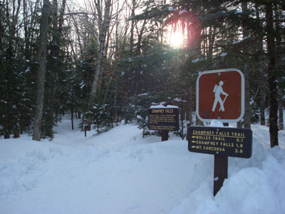
The Champney Falls Trail trailhead

Looking at Mount Washington from the Middle Sister summit

Directions to trailhead: Take Route 112 West past the visitor center on the right. The Champney Falls Trail pay parking lot and trailhead are around the next curve on the left.
Back to Middle Sister Profile
|