Home
States
Colorado
Connecticut
Maine
Massachusetts
New Hampshire
New York
Rhode Island
Utah
Vermont
View All
Lists
NE 4,000 Footers
NE 100 Highest
NH 4,000 Footers
NH 100 Highest
NH 52 With A View
NH Belknap Range
NH Ossipee 10
Links
Trail Conditions
Trip Log
Sunrises
Sunsets
About
|
Mittersill Peak, Cannon Mountain
Franconia, NH
Trailheads, measurements, times, distances, and maps are all approximate and relative to the hike(s) as shown below.
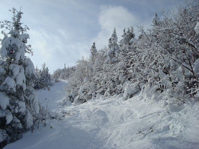
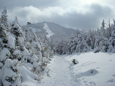
Looking up one of the ski trails on the way to the top of Mittersill
Route: Various old ski trails along the old double chairlift line, Taft Trail, (Mittersill Peak), Taft Trail, spur trail, (Cannon Mountain), spur trail, (summit lodge), Taft Trail, (Mittersill Peak), Taft Trail, various ski trails along the old double chairlift and T-Bar lines.
Since, like the previous week or so, the forecast called for clouds, clouds and more clouds, I decided to do some lost ski area photography and link it to a larger hike.
Arriving at the old Mittersill double chairlift base area parking lot, I was surprised to see a bunch of cars - Mittersill is quite popular after a powder day! I put on my snowshoes and headed up to the summit of the Mittersill peak, roughly following the old double chairlift line, and then the Taft Trail. Since I was going pretty much straight up, it was pretty steep for awhile - before becoming more moderate at the top of the chairlift and on the Taft Trail.
Surprisingly, I was greeted with somewhat blue skies on top of Mittersill - the Franconia Ridge was quite a sight! It was also interesting to see how many people were climbing up the Taft trail to do some "back country" skiing.
Continuing down the Taft Trail, I had to step out of the way of tucking skiers trying to get as far uphill as they could. At one point, I stepped too far off and ended up in a pretty deep spruce trap - doh!
Now on the groomed portion of the Taft Trail, I was getting quite a lot of comments and surprised looks from skiers - apparently they were surprised to see someone snowshoeing on a February powder day wearing only a teeshirt. What can I say!
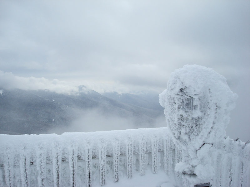
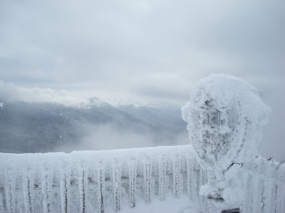
After reaching the top of the Cannonball Quad chairlift, I quickly headed past the counterweight up a spur trail to the true summit - and just as I arrived there, some low flying clouds moved in. The most difficult part of the hike followed - getting up the stairway to the observation deck! The gap between the risers and treads had filled in with ice, making basically a continous icy slope.
After seeing a few very brief views in between clouds, I headed down to the summit lodge (odd statement). It's pretty awesome to be able to ascend a 4,000 footer in the winter and eat fresh chicken tenders and fries in a warm building!
On the way down I did some more poking around at the old ski area, heading straight down the old T-Bar line.
| Hike Ratings |
|
Getting To Trailhead: |
Easy |
| Destination: |
Mittersill Peak |
|
Length: |
Moderate |
|
Steepness: |
Difficult |
|
Navigation: |
Moderate |
|
Views: |
Excellent |
|
Crowds: |
Heavy |
| Destination: |
Cannon Mountain |
|
Length: |
Moderate |
|
Steepness: |
Difficult |
|
Navigation: |
Easy |
|
Views: |
Moderate (due to weather) |
|
Crowds: |
Heavy |
|
| Hike Stats |
|
Date Hiked: |
Saturday, February 9, 2007 |
| Hike Commenced: |
9:13 AM |
| Parking Elevation: |
1,860' |
| Destination: |
Mittersill Peak |
| Ascent Commenced: |
9:15 AM |
| Summit Reached: |
10:16 AM |
| Time Elapsed: |
01:01 |
| Trailhead Elevation: |
1,880' |
| Summit Elevation: |
3,617' |
| Vertical Gain: |
1,737' |
| Destination: |
Cannon Mountain |
| Ascent Commenced: |
10:17 AM |
| Summit Reached: |
10:44 AM |
| Time Elapsed: |
00:27 |
| Trailhead Elevation: |
3,617' |
| Summit Elevation: |
4,100' |
| Vertical Gain: |
605' |
|
|
| Hike Ended: |
12:39 PM |
| Hike Time Elapsed: |
03:26 |
| Hike Vertical Gain: |
2,539' |
|
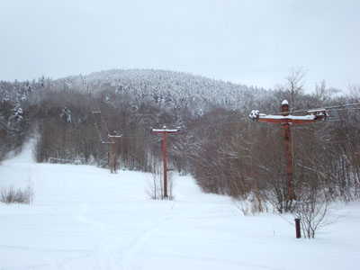
Looking up the old Mittersill ski area
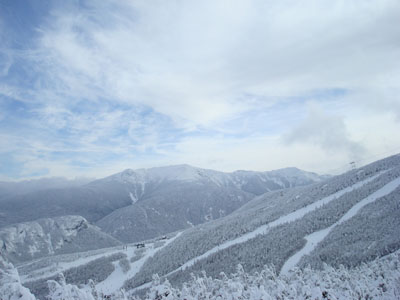
Looking east at Mt. Lafayette from the Mittersill summit
Looking down the Taft Trail on the way to Cannon Mountain
Looking east through the clouds at Franconia Ridge from the Cannon Mountain summit
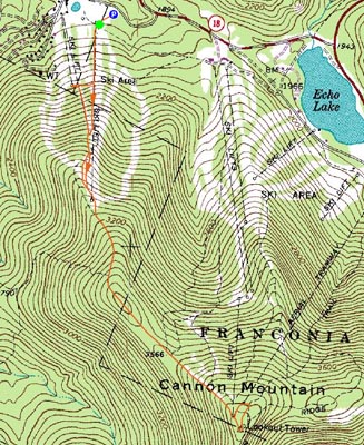

Directions to trailhead: Take I-93 North to the Cannon Mountain Peabody Slopes exit. Continue past the Cannon entrance, taking a left at the Mittersill sign. There are multiple parking areas on the left a fraction of a mile down this road. The old ski trails start (end) at the back of these lots.
Back to Mittersill Peak Profile
Back to Cannon Mountain Profile
|