Home
States
Colorado
Connecticut
Maine
Massachusetts
New Hampshire
New York
Rhode Island
Utah
Vermont
View All
Lists
NE 4,000 Footers
NE 100 Highest
NH 4,000 Footers
NH 100 Highest
NH 52 With A View
NH Belknap Range
NH Ossipee 10
Links
Trail Conditions
Trip Log
Sunrises
Sunsets
About
|
Monadnock Mountain
Jaffrey, NH
Trailheads, measurements, times, distances, and maps are all approximate and relative to the hike(s) as shown below.

Looking at Monadnock from Bald Rock
Monadnock Mountain is the second most hiked mountain in the world and the most hiked mountain in the country, according to sources to be remained unreferenced. Despite being so popular, it shouldn't be taken as an easy hike - there are steep portions and minor climbing is required.
There's a pretty good variety of trails, ranging from dirt roads (Old Toll Road), to steep wooded trails (Do Drop Trail), to straight out rock ascents (upper White Arrow trail).
| Hike Ratings |
|
Getting To Trailhead: |
Easy |
| Destination: |
Bald Rock |
|
Length: |
Moderate |
|
Steepness: |
Difficult |
|
Navigation: |
Easy |
|
Views: |
Excellent |
|
Crowds: |
Moderate |
| Destination: |
Monadnock Mountain |
|
Length: |
Moderate |
|
Steepness: |
Difficult |
|
Navigation: |
Easy |
|
Views: |
Excellent |
|
Crowds: |
Heavy |
|
| Hike Stats |
|
Date Hiked: |
Saturday, September 16, 2006 |
| Hike Commenced: |
10:17 AM |
| Parking Elevation: |
1,509' |
| Destination: |
Bald Rock |
| Ascent Commenced: |
10:20 AM at Halfway Trail trailhead |
| Summit Reached: |
11:16 AM |
| Time Elapsed: |
00:56 |
| Trailhead Elevation: |
1,520' |
| Summit Elevation: |
2,630' |
| Vertical Gain: |
1,075' |
| Destination: |
Mount Monadnock |
| Ascent Commenced: |
11:32 AM |
| Summit Reached: |
12:03 PM |
| Time Elapsed: |
00:31 |
| Trailhead Elevation: |
2,630' |
| Summit Elevation: |
3,165' |
| Vertical Gain: |
635' |
|
|
| Hike Ended: |
2:13 PM |
| Hike Time Elapsed: |
03:56 |
| Hike Vertical Gain: |
1,771' |
|

Trailhead for Halfway House Trail

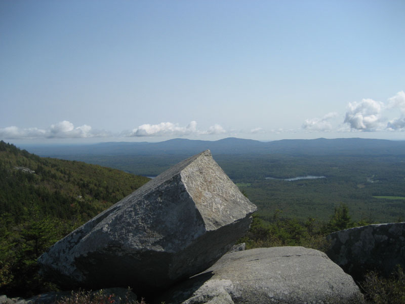
Looking east toward the Pack Monadnocks from the Bald Rock summit

Beginning of the ascent to Monadnock from Bald Rock, marked with cairns

Trail to Monadnock summit

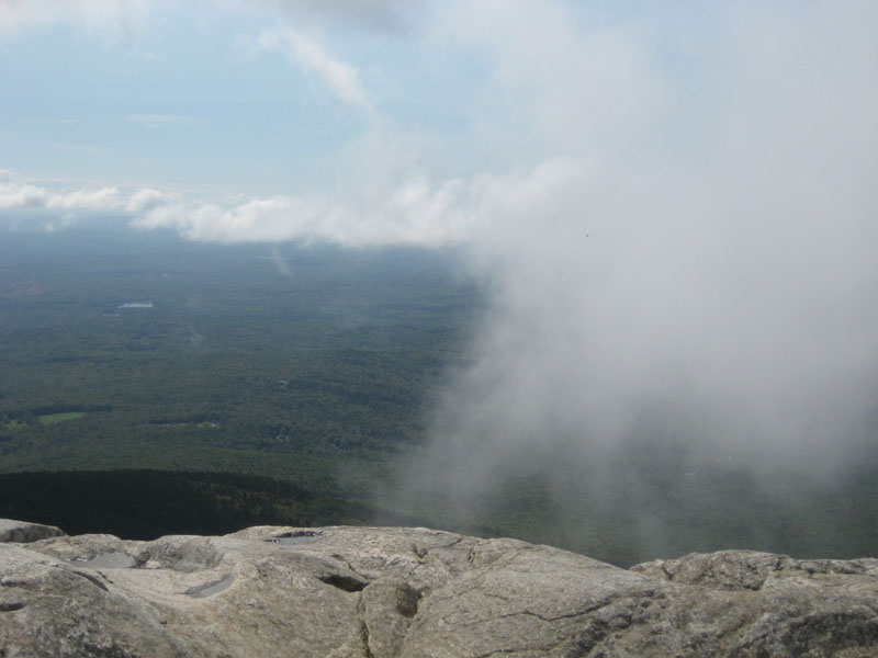
View from Monadnock summit as a cloud moves through


Directions to trailhead: Take Route 124 East to the Old Toll Road parking area. A per-person fee is charged ($3 as of September 2006).
Back to Monadnock Mountain profile
|