Home
States
Colorado
Connecticut
Maine
Massachusetts
New Hampshire
New York
Rhode Island
Utah
Vermont
View All
Lists
NE 4,000 Footers
NE 100 Highest
NH 4,000 Footers
NH 100 Highest
NH 52 With A View
NH Belknap Range
NH Ossipee 10
Links
Trail Conditions
Trip Log
Sunrises
Sunsets
About
|
Moose Mountain (North Peak), Moose Mountain (South Peak)
Lyme, NH, Hanover, NH
Trailheads, measurements, times, distances, and maps are all approximate and relative to the hike(s) as shown below.

Looking up the Moose Mountain Trail
Route: Moose Mountain Trail
For the second hike of the day, I headed up to the North Peak of Moose Mountain. Due to a decent number of blowdowns, it was a bit slow going. There was a significant variety of wildflowers, though, to add some color. Reaching the first knob, I bushwhacked just east of the trail to the highest point, then continued to a limited, ledgy view. From this view, it sure seemed like the next bump to the south was slightly higher (as indicated on older maps). So, I continued onward, passing over that wooded bump.
Beyond the that bump, I headed past the Moose Mountain Shelter (taking the sidepath on the way back) and up to South Moose Mountain, where there were limited views to the southeast. In addition, there was some scattered wreckage from the 1968 plane crash. Since I hadn't planned to visit the peak, I hadn't researched the wreck too much and thus didn't poke around to see if there was more wreckage downhill.
| Hike Ratings |
|
Getting To Trailhead: |
Easy |
| Destination: |
Moose Mountain (North Peak) |
|
Length: |
Moderate |
|
Steepness: |
Moderate |
|
Navigation: |
Easy |
|
Views: |
Moderate |
|
Crowds: |
Minimal |
| Destination: |
Moose Mountain (South Peak) |
|
Length: |
Moderate |
|
Steepness: |
Moderate |
|
Navigation: |
Easy |
|
Views: |
Moderate |
|
Crowds: |
Minimal |
|
| Hike Stats |
|
Date Hiked: |
Sunday, May 8, 2011 |
| Parking Elevation: |
950' |
| Destination: |
Moose Mountain (North Peak) |
| Time Elapsed: |
00:52 |
| Trailhead Elevation: |
950' |
| Summit Elevation: |
2,300' |
| Distance: |
1.7 miles |
| Vertical Gain: |
1,380' |
| Destination: |
Moose Mountain (South Peak) |
| Time Elapsed: |
01:02 |
| Trailhead Elevation: |
2,300' |
| Summit Elevation: |
2,290' |
| Distance: |
2 miles |
| Vertical Gain: |
420' |
|
|
| Hike Time Elapsed: |
03:42 |
| Hike Vertical Gain: |
2,240' |
|

Moose Mountain Trail trailhead

Hepatica on the Moose Mountain Trail

Mt. Cardigan as seen from near the northern knob of North Moose Mountain

The Moose Mountain Trail between the peaks

Remains of Northeast Airlines Flight 946 from October 25, 1968

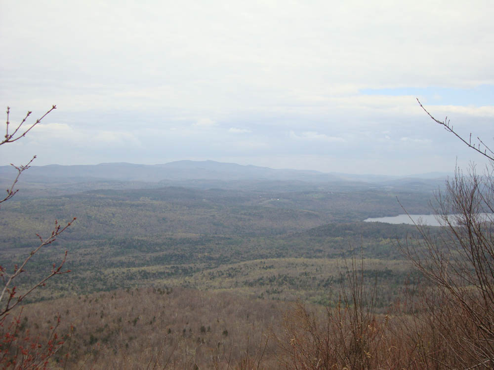
Mt. Kearsarge as seen from South Moose Mountain


Directions to trailhead: From Route 10 south of Lyme, take Goose Pond Road. The Appalachian Trail crossing is located just before a sometimes gated dirt road section. There is a pullover for parking just past the Appalachian Trail crossing.
Back to Moose Mountain (North Peak) Profile
Back to Moose Mountain (South Peak) Profile
|