Home
States
Colorado
Connecticut
Maine
Massachusetts
New Hampshire
New York
Rhode Island
Utah
Vermont
View All
Lists
NE 4,000 Footers
NE 100 Highest
NH 4,000 Footers
NH 100 Highest
NH 52 With A View
NH Belknap Range
NH Ossipee 10
Links
Trail Conditions
Trip Log
Sunrises
Sunsets
About
|
Moose Mountain (South Peak)
Hanover, NH
Trailheads, measurements, times, distances, and maps are all approximate and relative to the hike(s) as shown below.

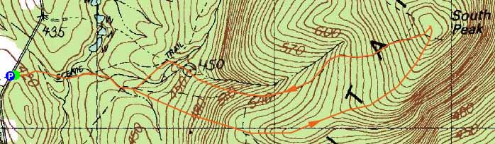
The Moose Mountain Trail
Route: Moose Mountain Trail, (Moose Mountain South Peak), Nat Thompson Trail, Harris Trail, Moose Mountain Trail
Decent jogging loop. Moose Mountain Trail never overly steep. Limited views from summit. Nat Thompson Trail very smooth in places, muddy in others.
| Hike Ratings |
|
Getting To Trailhead: |
Easy |
| Destination: |
Moose Mountain (South Peak) |
|
Length: |
Moderate |
|
Steepness: |
Moderate |
|
Navigation: |
Easy |
|
Views: |
Moderate |
|
Crowds: |
Minimal |
|
| Hike Stats |
|
Date Hiked: |
Monday, May 21, 2012 |
| Parking Elevation: |
1,400' |
| Destination: |
Moose Mountain (South Peak) |
| Time Elapsed: |
00:32 |
| Trailhead Elevation: |
1,400' |
| Summit Elevation: |
2,290' |
| Distance: |
1.9 miles |
| Vertical Gain: |
990' |
|
|
| Hike Time Elapsed: |
01:07 |
| Hike Vertical Gain: |
1,040' |
|

The Moose Mountain Trail trailhead

Remains of Northeast Airlines Flight 946 on Moose Mountain's South Peak

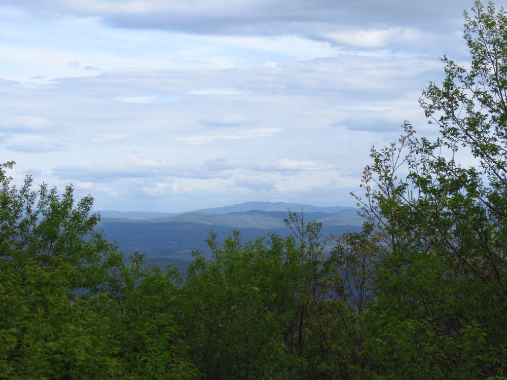
Slight views from Moose Mountain's South Peak


Directions to trailhead: From US 4 in Enfield near Mascoma Lake, take Ruddsboro Road north. Take a right onto Three Mile Road. The Moose Mountain Trail trailhead will soon be on the right, with a small parking area on the left.
Back to Moose Mountain (South Peak) Profile
|