Home
States
Colorado
Connecticut
Maine
Massachusetts
New Hampshire
New York
Rhode Island
Utah
Vermont
View All
Lists
NE 4,000 Footers
NE 100 Highest
NH 4,000 Footers
NH 100 Highest
NH 52 With A View
NH Belknap Range
NH Ossipee 10
Links
Trail Conditions
Trip Log
Sunrises
Sunsets
About
|
Mt. Chocorua
Albany, NH
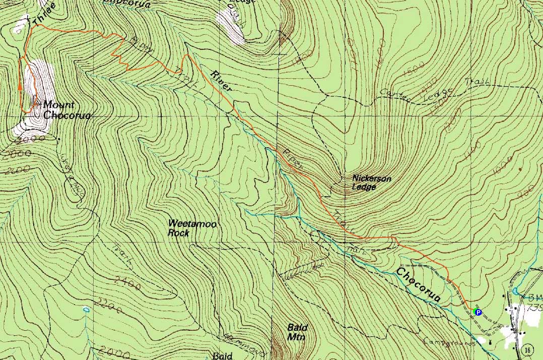
Trailheads, measurements, times, distances, and maps are all approximate and relative to the hike(s) as shown below.

Looking up Piper Trail
Route: Piper Trail, (Mt. Chocorua), Liberty Trail, West Side Trail, Piper Trail
With some nice weather, I headed over to the Piper Trail for a hike up Chocorua. The trail was fairly smooth sailing, though wind slowed me down as I reached treeline.
The skies were not as clear as forecasted, but nonetheless the views were quite strong in most directions. After taking in the views a bit, I headed down to check out the West Side Trail for the first time. The footing on that trail was fairly good and it passed a few ledge slide viewpoints. Nonetheless, the extra distance and vertical, as well as lack of treeline views (as opposed to returning via the top of the Piper Trail), probably will result in me seldom going there again.
The descent on the Piper Trail was fairly smooth, though I found one or two of the ledge slabs a bit slippery. Nonetheless, a nice local hike.
| Hike Ratings |
|
Getting To Trailhead: |
Easy |
| Destination: |
Mt. Chocorua |
|
Length: |
Moderate |
|
Steepness: |
Difficult |
|
Navigation: |
Easy |
|
Views: |
Excellent |
|
Crowds: |
Heavy |
|
| Hike Stats |
|
Date Hiked: |
Monday, July 26, 2010 |
| Hike Commenced: |
3:16 PM |
| Parking Elevation: |
780' |
| Destination: |
Mt. Chocorua |
| Ascent Commenced: |
3:16 PM |
| Summit Reached: |
5:04 PM |
| Time Elapsed: |
01:48 |
| Trailhead Elevation: |
780' |
| Summit Elevation: |
3,474' |
| Distance: |
4.3 miles |
| Vertical Gain: |
2,824' |
|
|
| Hike Ended: |
7:07 PM |
| Hike Time Elapsed: |
03:51 |
| Hike Vertical Gain: |
2,994' |
|

The Piper Trail trailhead

Looking up Piper Trail

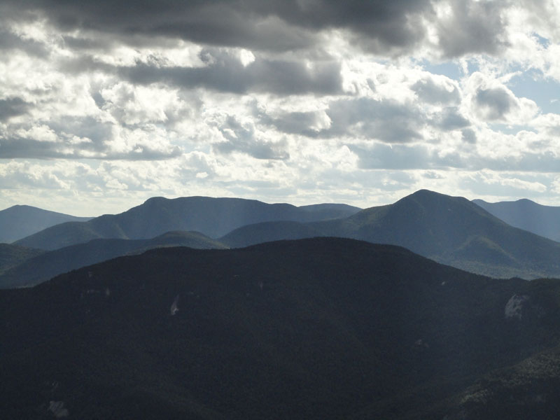
Looking over Mt. Paugus at Mt. Whiteface and Mt. Passaconaway from Mt. Chocorua

The West Side Trail


Directions to trailhead: Take Route 16 North from Tamworth. The Piper Trail WMNF sign is on the left, immediately after a general store. The WMNF fee parking area is about a minute or off Route 16. The Piper Trail trailhead is at the back corner of the parking lot.
Back to Mt. Chocorua Profile
|