Home
States
Colorado
Connecticut
Maine
Massachusetts
New Hampshire
New York
Rhode Island
Utah
Vermont
View All
Lists
NE 4,000 Footers
NE 100 Highest
NH 4,000 Footers
NH 100 Highest
NH 52 With A View
NH Belknap Range
NH Ossipee 10
Links
Trail Conditions
Trip Log
Sunrises
Sunsets
About
|
Mt. Adams, Mt. Madison
Randolph, NH, Low and Burbank's Grant, NH, Thompson and Meserve's Purchase, NH
Trailheads, measurements, times, distances, and maps are all approximate and relative to the hike(s) as shown below.
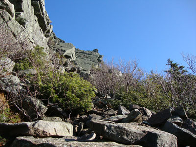
Looking up Chemin Des Dames
Route: Air Line, Short Line, King Ravine Trail, Chemin Des Dames, Air Line, (Mt. Adams), Air Line, Gulfside Trail, Osgood Trail, (Mt. Madison), Osgood Trail, Valley Way, Fallsway
With the passage of the storm formerly known as Hurricane Ida, the weekend seemed to be a crap shoot. After a relatively dry morning on Cabot the day earlier, the skies opened and drenched everything. Noticing a low wind forecast the night before, as well as a chance of clearing, I decided to wait for the MWO Higher Summits Forecast prior to heading out in the morning.
Sure enough, there were a few patches of blue sky as I drove up. Heading up the damp Air Line Trail, I had a hankering for some variety - thus I turned right and headed up the Short Line. While things were wet, the temperatures had been high enough that I was fairly confident that I wouldn't encounter any ice (and if I did, I had Microspikes and crampons in my pack). Reaching the King Ravine Trail, I was slipping and sliding around on wet boulders - not too much fun. For my exit out of the ravine, I opted for Chemin Des Dames.
The trail started off gradually at first, as it weaved itself around some big boulders. I found the faded blazes and sparse cairns a bit tricky to follow in places. Nonetheless, the trail had very little in way of slabs, so the scrambling was doable (despite having essentially no grip due to having slippery winter boots on wet rocks).
The trail became more interesting once I had to crawl under a rock (had to push my backpack through first) - it then passed through some dwarf birch stands, prior to the final climb up to the Air Line.
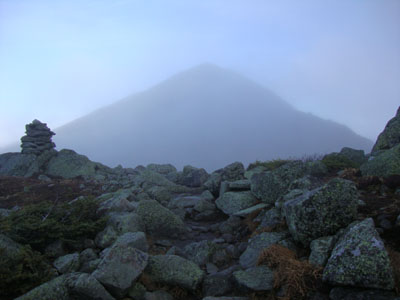
I had to continue to take my time as I climbed, due to continued slipping on wet rocks. While I was in the clear for much of the ascent up the Air Line, the clouds climbed just after I reached the Air Line summit. Thanks to mild temperatures, I was able to sit on the windy summit with only a shirt on for a few minutes without getting cold.
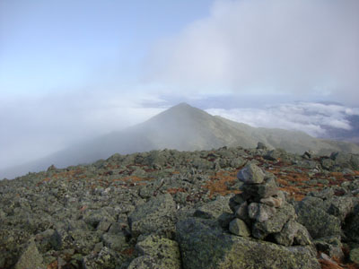
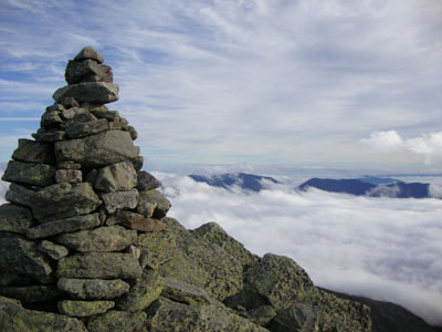
Heading back down the Air Line, I turned onto the Gulfside and descended to the closed hut, as the clouds started to move out again. After another slippery ascent up the Osgood Trail, I arrived at the summit of Mt. Madison with tremendous views - an awesome undercast blue skies overhead. Though I hung out for awhile, I decided not to linger for too long, as I only had about two hours of daylight left.
Since I was sick of the winds, I opted to dive into the valley quickly via the Valley Way, a trail I have grown to loathe (actually, I don't think I ever didn't loathe it). Though it dragged on forever (as usual), it was quite nice to see the power lines and hence the end of it. Nonetheless, I pleasantly nice day for mid November in the Presidentials!
| Hike Ratings |
|
Getting To Trailhead: |
Easy |
| Destination: |
Mt. Adams |
|
Length: |
Moderate |
|
Steepness: |
Very Difficult |
|
Navigation: |
Moderate |
|
Views: |
Excellent |
|
Crowds: |
Minimal |
| Destination: |
Mt. Madison |
|
Length: |
Difficult |
|
Steepness: |
Very Difficult |
|
Navigation: |
Moderate |
|
Views: |
Excellent |
|
Crowds: |
Minimal |
|
| Hike Stats |
|
Date Hiked: |
Sunday, November 15, 2009 |
| Hike Commenced: |
9:01 AM |
| Parking Elevation: |
1,311' |
| Destination: |
Mt. Adams |
| Ascent Commenced: |
9:01 AM |
| Summit Reached: |
12:26 PM |
| Time Elapsed: |
03:25 |
| Trailhead Elevation: |
1,311' |
| Summit Elevation: |
5,774' |
| Distance: |
4.7 miles |
| Vertical Gain: |
4,513' |
| Destination: |
Mt. Madison |
| Ascent Commenced: |
12:41 PM |
| Summit Reached: |
1:59 PM |
| Time Elapsed: |
01:18 |
| Trailhead Elevation: |
5,774' |
| Summit Elevation: |
5,367' |
| Distance: |
1.5 miles |
| Vertical Gain: |
607' |
|
|
| Hike Ended: |
4:39 PM |
| Hike Time Elapsed: |
07:38 |
| Hike Vertical Gain: |
5,240' |
|
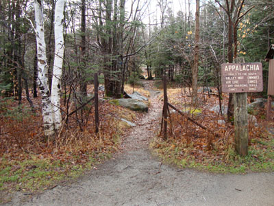
The Air Line Trail trailhead at Appalachia
Looking down the Air Line Trail as clouds move in
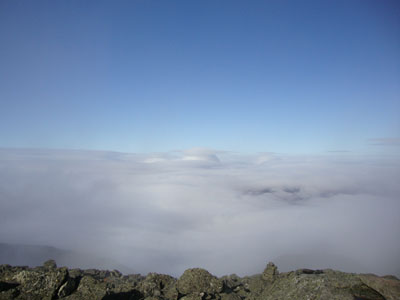
A mushroom cloud seen amongst the undercast from Mt. Adams - the Iranians nuked Randolph!
Looking down the Gulfside Trail on the way to Mt. Madison
The Osgood Trail on Mt. Madison
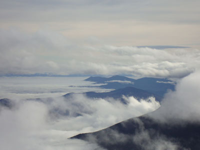
Looking south into the Mount Washington Valley from Mt. Madison

Directions to trailhead: Take US 2 West from Gorham to the Appalachia trailhead/parking lot.
Back to Mt. Adams Profile
Back to Mt. Madison Profile
|


