Home
States
Colorado
Connecticut
Maine
Massachusetts
New Hampshire
New York
Rhode Island
Utah
Vermont
View All
Lists
NE 4,000 Footers
NE 100 Highest
NH 4,000 Footers
NH 100 Highest
NH 52 With A View
NH Belknap Range
NH Ossipee 10
Links
Trail Conditions
Trip Log
Sunrises
Sunsets
About
|
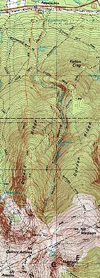
Mt. Adams, Mt. Madison
Randolph, NH, Low and Burbank's Grant, NH, Thompson and Meserve's Purchase, NH
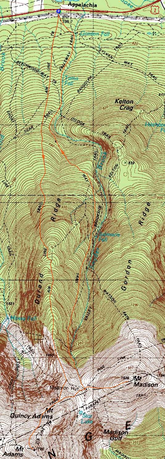
Trailheads, measurements, times, distances, and maps are all approximate and relative to the hike(s) as shown below.
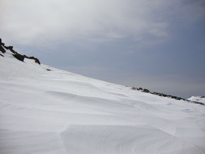
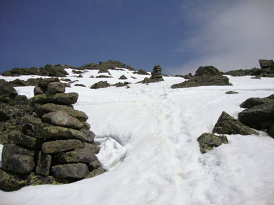
Looking up the snowfields on the way to Mt. Adams
Route: Air Line, snowfields, (Mt. Adams), snowfields, Gulfside Trail, Osgood Trail, (Mt. Madison), Osgood Trail, Valley Way
While the forecast called for a sunny day, clouds were fast approaching from the south and west. Starting on bare ground in Appalachia, we hit melting snow about a mile or two up Air Line. Nearing treeline, it was time for snowshoes, as the recent new snow was amounting to a foot or two (on top of a few feet of old snow).
Emerging from the trees, trail conditions ranged from bare ground to five foot drifts of recent snow. With stretches too long and awkward for snowshoes, it made for some slow going pushing through the drifts.
Upon reaching the Gulfside, I sought out the snowfields and snowshoed to the summit of Adams, where the views were still quite strong, despite the increasing clouds. Heading back down the snowfields, I worked my way to the hut, dropped my snowshoes, then climbed up the Osgood Trail to Madison.
Back at the hut, it was time for a late lunch, prior to heading down the Valley Way - big mistake. The top portion of the trail hadn't been used in quite some time, resulting in very tough conditions - an icy sideslope with about one to two feet of wet snow on top. Finally reaching the point in the trail in which folks had departed into the drainage, we were able to have smoother sailing back to the trailhead.
| Hike Ratings |
|
Getting To Trailhead: |
Easy |
| Destination: |
Mt. Adams |
|
Length: |
Moderate |
|
Steepness: |
Very Difficult |
|
Navigation: |
Moderate |
|
Views: |
Excellent |
|
Crowds: |
Heavy |
| Destination: |
Mt. Madison |
|
Length: |
Difficult |
|
Steepness: |
Very Difficult |
|
Navigation: |
Moderate |
|
Views: |
Excellent |
|
Crowds: |
Heavy |
|
| Hike Stats |
|
Date Hiked: |
Saturday, May 1, 2010 |
| Hike Commenced: |
8:50 AM |
| Parking Elevation: |
1,311' |
| Destination: |
Mt. Adams |
| Ascent Commenced: |
8:50 AM |
| Summit Reached: |
1:15 PM |
| Time Elapsed: |
04:25 |
| Trailhead Elevation: |
1,311' |
| Summit Elevation: |
5,774' |
| Distance: |
4.3 miles |
| Vertical Gain: |
4,513' |
| Destination: |
Mt. Madison |
| Ascent Commenced: |
1:19 PM |
| Summit Reached: |
2:10 PM |
| Time Elapsed: |
00:51 |
| Trailhead Elevation: |
5,774' |
| Summit Elevation: |
5,367' |
| Vertical Gain: |
607' |
|
|
| Hike Ended: |
5:15 PM |
| Hike Time Elapsed: |
08:25 |
| Hike Vertical Gain: |
5,250' |
|
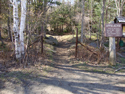
The Air Line Trail trailhead at Appalachia
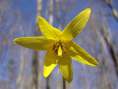
Trout lilly along the Air Line Trail

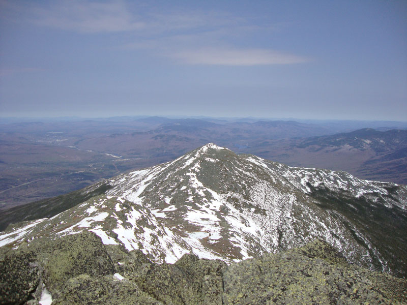
Mt. Madison as seen from the summit of Mt. Adams
Looking up the Osgood Trail on the way to Mt. Madison
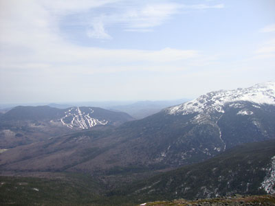
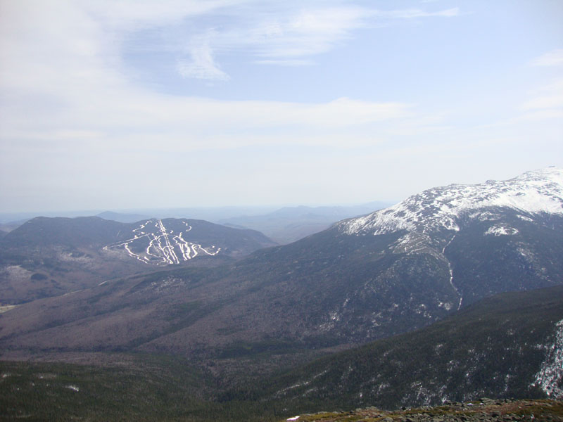
The Wildcats and the side of Mt. Washington as seen from Mt. Madison

Directions to trailhead: Take US 2 West from Gorham to the Appalachia trailhead/parking lot.
Back to Mt. Adams Profile
Back to Mt. Madison Profile
|