Home
States
Colorado
Connecticut
Maine
Massachusetts
New Hampshire
New York
Rhode Island
Utah
Vermont
View All
Lists
NE 4,000 Footers
NE 100 Highest
NH 4,000 Footers
NH 100 Highest
NH 52 With A View
NH Belknap Range
NH Ossipee 10
Links
Trail Conditions
Trip Log
Sunrises
Sunsets
About
|
Mt. Adams, Mt. Madison
Randolph, NH, Low and Burbank's Grant, NH, Thompson and Meserve's Purchase, NH
Trailheads, measurements, times, distances, and maps are all approximate and relative to the hike(s) as shown below.

Looking up Air Line on the way to Mt. Adams
Route: Air Line, snowfields, (Mt. Adams), snowfields, Gulfside Trail, snowfields, Osgood Trail, (Mt. Madison), Osgood Trail, Valley Way
Snowshoes round trip.
Air Line had not seen any recent use above the initial flats. Initially only an inch of powder (some nasty postholes too), but trailbreaking began around 4,000 feet, ranging from a few inches to a foot of powder, heavily drifted. Good snow cover above treeline and occasional boilerplate.
Plenty of postholes arond Gulfside. I opted to go a little west of Air Line and go up the snowfields, which were perfect for snowshoes.
Also due to the postholes and some monorail, I opted to bail off the Gulfside on the way toward the hut, staying south of it, then bee lining up Madison. Pretty good going in snowshoes.
Monorail on Osgood with barebooters breaking through and postholing in the warming temperatures today.
Valley Way was trashed early this afternoon, as barebooters were postholing in the drifted snow. I tried to fix what I could, but there were more barebooters on the way, installing more postholes. A bit more firm in the lower elevations, but still decent snowshoeing.
Snow pack is perhaps 2 feet down low, increasing 3 to 5 feet once ascending. Some isolated areas (wind scoured above treeline or perks in the woods) will probably go bare with the upcoming weather, but the woods will likely retain multiple feet of snowpack.
Nice weather, few folks out. Winds were noticeable atop King Ravine and Madison, but otherwise not too bad. Sun and temps felt like late March.
| Hike Ratings |
|
Getting To Trailhead: |
Easy |
| Destination: |
Mt. Adams |
|
Length: |
Moderate |
|
Steepness: |
Very Difficult |
|
Navigation: |
Moderate |
|
Views: |
Excellent |
|
Crowds: |
Minimal |
| Destination: |
Mt. Madison |
|
Length: |
Difficult |
|
Steepness: |
Very Difficult |
|
Navigation: |
Moderate |
|
Views: |
Excellent |
|
Crowds: |
Minimal |
|
| Hike Stats |
|
Date Hiked: |
Thursday, December 20, 2018 |
| Parking Elevation: |
1,311' |
| Destination: |
Mt. Adams |
| Time Elapsed: |
03:23 |
| Trailhead Elevation: |
1,311' |
| Summit Elevation: |
5,774' |
| Distance: |
4.3 miles |
| Vertical Gain: |
4,513' |
| Destination: |
Mt. Madison |
| Time Elapsed: |
00:42 |
| Trailhead Elevation: |
5,774' |
| Summit Elevation: |
5,367' |
| Vertical Gain: |
587' |
|
|
| Hike Time Elapsed: |
06:04 |
| Hike Vertical Gain: |
5,230' |
|

The Air Line Trail trailhead at Appalachia

Snowfields on Mt. Adams

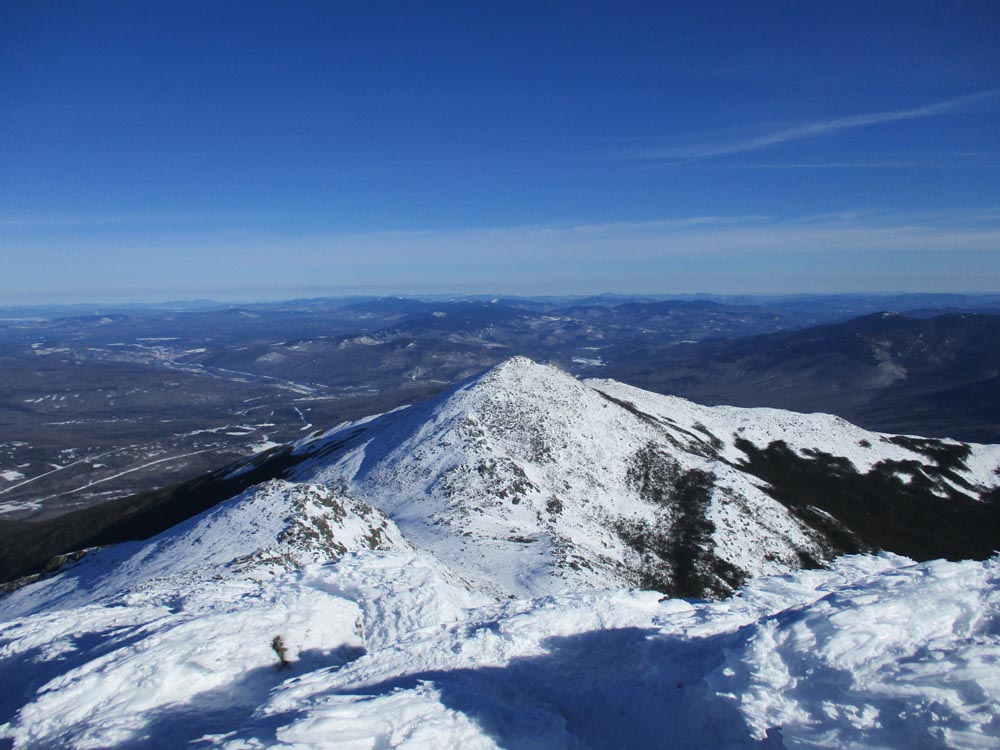
Mt. Madison as seen from the summit of Mt. Adams

Looking down snowfields on the way to Mt. Madison

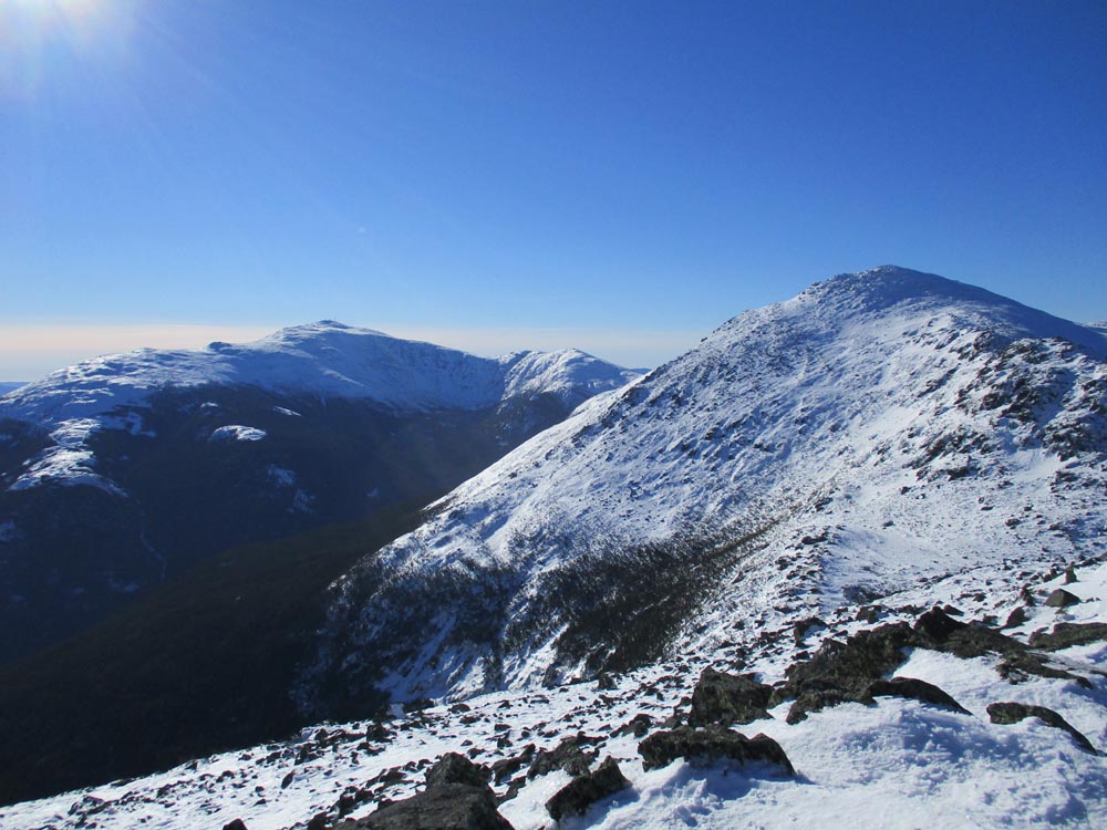
Mt. Washington and Mt. Adams as seen from Mt. Madison
Directions to trailhead: Take US 2 West from Gorham to the Appalachia trailhead/parking lot.
Back to Mt. Adams Profile
Back to Mt. Madison Profile
|