Home
States
Colorado
Connecticut
Maine
Massachusetts
New Hampshire
New York
Rhode Island
Utah
Vermont
View All
Lists
NE 4,000 Footers
NE 100 Highest
NH 4,000 Footers
NH 100 Highest
NH 52 With A View
NH Belknap Range
NH Ossipee 10
Links
Trail Conditions
Trip Log
Sunrises
Sunsets
About
|
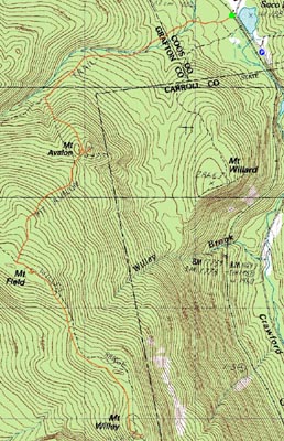
Mt. Avalon, Mt. Field, Mt. Willey
Carroll, NH, Bethlehem, NH
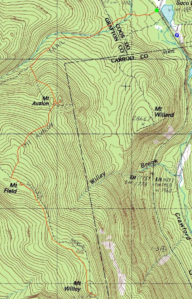
Trailheads, measurements, times, distances, and maps are all approximate and relative to the hike(s) as shown below.
Looking up the Avalon Trail
Route: Avalon Trail, (spur trail to summit), (Mt. Avalon), (spur trail from summit), Avalon Trail, Willey Range Trail, (Mt. Field), Willey Range Trail, (Mt. Willey), Willey Range Trail, (Mt. Field), Willey Range Trail, Avalon Trail
Since it was basically the only decent day in the forecast, I decided to get out of work early and head up to Crawford Notch.
Despite the fairly clear skies (other than clouds over the Presidentials), the hiking parking areas heading up 302 were mostly empty.
There was snow on the ground starting at the trailhead. After the second water crossing, the trail was covered in snow as well. Part way up the Avalon Trail above the A-Z junction, the ice began. While it probably would have been wise to put on my Microspikes, I took my chances without traction.
The views from Mt. Avalon were tremendous, despite most of the Presidentials being in the clouds.
The next stop was Mt. Field. While the flats were in decent shape, the steeps up the Avalon Trail were fairly icy. The summit area of Mt. Field was covered in rime - it's not even Thanksgiving yet! Come on!
The viewpoint near the summit was stronger than I remembered - it seems like, at the very end of the spur path, the views looking westward are stronger than before.
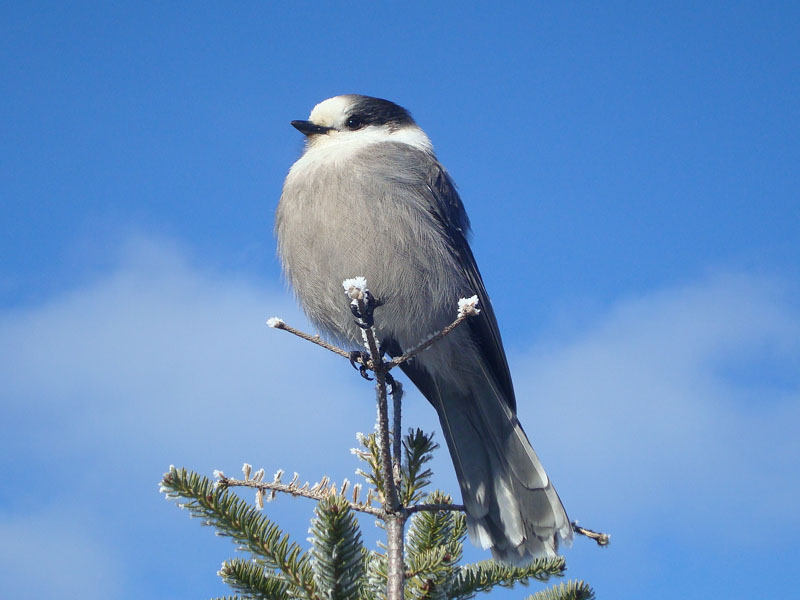
After having a quick lunch (some of it...three gray jays were competing for a lot of my sandwich) and some internal debate as to whether or not to go to Willey, I decided to continue down the Willey Range Trail.
Fortunately, unlike the Avalon Trail, the Willey Range Trail was virtually ice free. Nonetheless, my knee start to ache randomly on the way over. Perhaps there was a reason I was hesistant to continue.
The views from near the summit of Willey were excellent as usual, ranging from Webster Cliff to the Bonds and Twins (the latter two in the clouds).
After having a quick snack, I headed back to Mt. Field, and then down the Avalon Trail. At one point, near a water crossing, I looked up and thought I saw a few hikers down the trail. Looking back down to concentrate on my footing, I quickly realized that I was hearing the sounds of a moose running off the trail. Sure enough, as I looked back up and pulled out my camera too late, I saw a large moose darting away.
Not a bad hike - though the knee issue concerned me, it was nice to be out in some sunlight for once. Unfortunately, it seems like the rainy weather pattern from the spring and summer as returned.
| Hike Ratings |
|
Getting To Trailhead: |
Easy |
| Destination: |
Mt. Avalon |
|
Length: |
Moderate |
|
Steepness: |
Difficult |
|
Navigation: |
Easy |
|
Views: |
Excellent |
|
Crowds: |
Minimal |
| Destination: |
Mt. Field |
|
Length: |
Moderate |
|
Steepness: |
Difficult |
|
Navigation: |
Easy |
|
Views: |
Excellent |
|
Crowds: |
Minimal |
| Destination: |
Mt. Willey |
|
Length: |
Moderate |
|
Steepness: |
Difficult |
|
Navigation: |
Moderate |
|
Views: |
Excellent |
|
Crowds: |
Minimal |
|
| Hike Stats |
|
Date Hiked: |
Wednesday, November 12, 2008 |
| Hike Commenced: |
11:32 AM |
| Parking Elevation: |
1,900' |
| Destination: |
Mt. Avalon |
| Ascent Commenced: |
11:38 AM |
| Summit Reached: |
12:33 PM |
| Time Elapsed: |
00:55 |
| Trailhead Elevation: |
1,900' |
| Summit Elevation: |
3,442' |
| Distance: |
1.8 miles |
| Vertical Gain: |
1,567' |
| Destination: |
Mt. Field |
| Ascent Commenced: |
12:37 PM |
| Summit Reached: |
1:20 PM |
| Time Elapsed: |
00:43 |
| Trailhead Elevation: |
3,442' |
| Summit Elevation: |
4,340' |
| Distance: |
.9 mile |
| Vertical Gain: |
995' |
| Destination: |
Mt. Willey |
| Ascent Commenced: |
1:25 PM |
| Summit Reached: |
2:03 PM |
| Time Elapsed: |
00:38 |
| Trailhead Elevation: |
4,340' |
| Summit Elevation: |
4,285' |
| Distance: |
1.4 miles |
| Vertical Gain: |
465' |
|
|
| Hike Ended: |
4:39 PM |
| Hike Time Elapsed: |
05:07 |
| Hike Vertical Gain: |
3,654' |
|
The Avalon Trail trailhead next to the train station
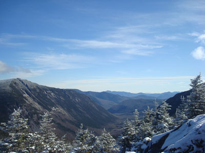
Looking down Crawford Notch from the Mt. Avalon summit

A gray jay near the Mt. Avalon summit
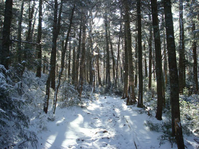
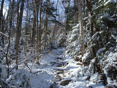
The Avalon Trail to Mt. Field
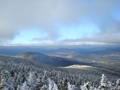
Looking northwest from the Mt. Field view point

The Willey Range Trail

Looking at Mt. Webster from the Mt. Willey eastern view point

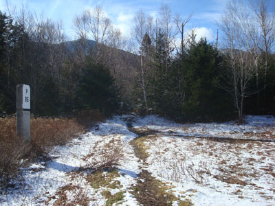
Directions to trailhead: Take Route 302 west from Bartlett, NH. There is a parking area on the left side of the road at the top of the pass. Continue down the road on foot to the rail station - the Avalon Trail trailhead is across the tracks.
Back to Mt. Avalon Profile
Back to Mt. Field Profile
Back to Mt. Willey Profile
|