Home
States
Colorado
Connecticut
Maine
Massachusetts
New Hampshire
New York
Rhode Island
Utah
Vermont
View All
Lists
NE 4,000 Footers
NE 100 Highest
NH 4,000 Footers
NH 100 Highest
NH 52 With A View
NH Belknap Range
NH Ossipee 10
Links
Trail Conditions
Trip Log
Sunrises
Sunsets
About
|
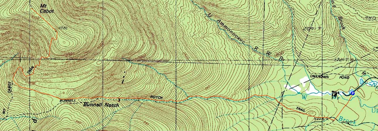
Mt. Cabot
Berlin, NH, Kilkenny, NH
Trailheads, measurements, times, distances, and maps are all approximate and relative to the hike(s) as shown below.
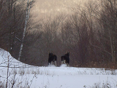
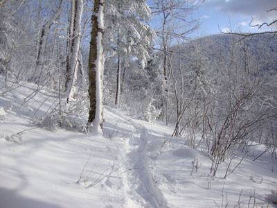
Following two moose up the Bunnell Notch Trail
Route: York Pond Trail, Bunnell Notch Trail, Kilkenny Ridge Trail, (Mt. Cabot), Kilkenny Ridge Trail, Bunnell Notch Trail, York Pond Trail
Three days after a midweek snowstorm, I knew the odds of having broken trail were at a minimum. Nonetheless, I was thinking perhaps the upper portion of the trail to Mt. Cabot would be broken out - either from the fish hatchery side or the Mt. Cabot Trail side. Arriving at the trailhead a little while after sunrise (due to poor road conditions), I quickly found out that the hatchery side was indeed untouched.
The trail breaking along the flats wasn't overly challenging - decent powder conditions without wind drifts or a crust. Reaching the first height of land, I ran into two moose - who quickly took off upon seeing me.
Once on the actual trail portion of the Bunnell Notch Trail, trail breaking became a bit more challenging, due to increased snow depth, pitch, and a decent number of blowdowns. At one point, I looked up to my right and saw two moose hanging out up the embankment (not the same moose I had seen a few miles earlier). Thinking it was neat to have seen a total of four moose on the trails already, I saw a third head pop up - quite a convention going on up there! Though tempted to get a closer look, I knew I still had plenty of trail breaking ahead of me.
The moment of truth was reaching the Mt. Cabot Trail junction. Unfortunately, no one had been up it - thus, I was breaking all the way to the summit. Past Bunnell Rock, things became increasingly challenging due to higher winds and somewhat deep drifts. Beyond the cabin, the trail was difficult to follow (as always seems to be the case with snow on the ground) - however, the terrain is pretty straight forward.
After reaching the summit, I headed over to the blowdown patch viewpoint, prior to descending and doing a bunch of trail maintenance. Just beyond the Mt. Cabot Trail junction, while dragging a cut up tree off the trail, I saw what looked to be two large rocks. Not the case! Rather, it was moose number 6 of the day - a bull with a rack taking a nap (though he did awake as I worked my way closer to get a better look).
After that final moose encounter, it was a long, slow descent, as there was plenty of blowdown removal to be had. What optimistically was supposed to be a morning hike ended up turning into a full day.
| Hike Ratings |
|
Getting To Trailhead: |
Easy |
| Destination: |
Mt. Cabot |
|
Length: |
Moderate |
|
Steepness: |
Moderate |
|
Navigation: |
Easy |
|
Views: |
Excellent |
|
Crowds: |
Minimal |
|
| Hike Stats |
|
Date Hiked: |
Saturday, December 12, 2009 |
| Hike Commenced: |
7:43 AM |
| Parking Elevation: |
1,670' |
| Destination: |
Mt. Cabot |
| Ascent Commenced: |
7:43 AM |
| Summit Reached: |
11:28 AM |
| Time Elapsed: |
03:45 |
| Trailhead Elevation: |
1,670' |
| Summit Elevation: |
4,170' |
| Distance: |
4.8 miles |
| Vertical Gain: |
2,780' |
|
|
| Hike Ended: |
3:12 PM |
| Hike Time Elapsed: |
07:29 |
| Hike Distance: |
9.6 miles |
| Hike Vertical Gain: |
3,060' |
|
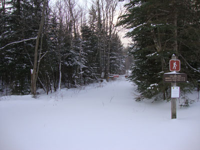
The York Pond Trail trailhead
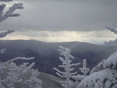
Mt. Waumbek and Mt. Starr King as seen from near the summit of Mt. Cabot
The Kilkenny Ridge Trail
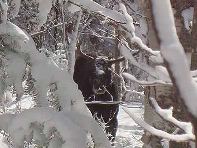
You never know who's watching you

Directions to trailhead: Take Route 16 to Berlin, then take Route 110 west. York Pond Road will eventually be on the left. Continue through the Fish Hatchery (do be aware that the gates are only open during the day, usually 8 AM - 4 PM). The York Pond Trail trailhead and small parking area will eventually be on the left, shortly after passing the Unknown Pond Trail parking area on the right.
Back to Mt. Cabot Profile
|