Home
States
Colorado
Connecticut
Maine
Massachusetts
New Hampshire
New York
Rhode Island
Utah
Vermont
View All
Lists
NE 4,000 Footers
NE 100 Highest
NH 4,000 Footers
NH 100 Highest
NH 52 With A View
NH Belknap Range
NH Ossipee 10
Links
Trail Conditions
Trip Log
Sunrises
Sunsets
About
|
Mt. Cardigan
Orange, NH
Trailheads, measurements, times, distances, and maps are all approximate and relative to the hike(s) as shown below.

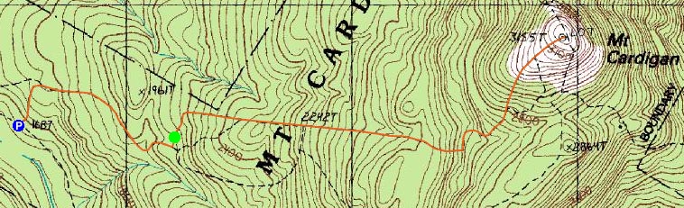
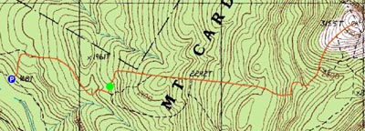
West Ridge Trail
Route: Cardigan Mountain Road, West Ridge Trail, Cardigan Mountain Road
All week I had been reading weather forecasts calling for rain on Thursday. Driving through New Hampshire, I was hoping I'd be able to go hiking, however with rain and clouds, it didn't seem worth it. However, waking up Thursday morning, I saw a clear sky which held well into the afternoon.
Mt. Cardigan is quite a sight from the roads approaching it - the rock summit is visible for miles. Upon arriving at the Burnt Hill Road - Cardigan Mountain Road intersection, I saw that the summit road wasn't plowed. Fortunately, there was a plowed out area across from the gate, allowing for maybe half a dozen to a dozen vehicles. I was the only one.
The road itself is fairly gradual. The West Ridge Trail starts off with a moderately steep section, then becoming gradual until dropping into a small valley and then ascending up the actual mountain.
The hike up the mountain is in filled with evergreens until passing the Appalachian Club sign. From there, things become increasingly cleared out, as the last portion of the hike is above treeline.
The stairs to the lookout tower were open (the cab was closed), however due to the wind (I could barely stand at the summit), I decided that the views were good enough from the ground. Though an oncoming storm limited visibility, views to the south were still nice, with Ragged Mountain and Mt. Kearsarge visible. Mt. Sunapee was just barely visible (my guess is that on a normal day, this is probably easily seen).
The last section of trail, from the treeline to the summit, was very slushly. As a result, foot deep slush postholes were quite common.
This is definitely a nice hike - one of the more enjoyable 3,000 footers I've climbed.
| Hike Ratings |
|
Getting To Trailhead: |
Moderate |
| Destination: |
Mt. Cardigan |
|
Length: |
Moderate |
|
Steepness: |
Moderate |
|
Navigation: |
Easy |
|
Views: |
Excellent |
|
Crowds: |
Minimal |
|
| Hike Stats |
|
Date Hiked: |
Thursday, March 22, 2007 |
| Hike Commenced: |
1:20 PM |
| Parking Elevation: |
1,662' |
| Destination: |
Mt. Cardigan |
| Ascent Commenced: |
1:37 PM at West Ridge Trail trailhead |
| Summit Reached: |
2:27 PM |
| Time Elapsed: |
00:50 |
| Trailhead Elevation: |
1,760' |
| Summit Elevation: |
3,155' |
| Vertical Gain: |
1,430' |
|
|
| Hike Ended: |
3:43 PM |
| Hike Time Elapsed: |
02:23 |
| Hike Vertical Gain: |
1,603' |
|

Trailhead at the Mt. Cardigan State Park parking lot

Looking south from the Mt. Cardigan summit at Ragged Mountain and Mt. Kearsarge

Directions to trailhead: Take Burnt Hill Road up to the green Cardigan Mtn post next to the access road gate. If access road is closed, park across the road from the gate; otherwise, there is parking at the picnic area.
Back to Mt. Cardigan Profile
|