Home
States
Colorado
Connecticut
Maine
Massachusetts
New Hampshire
New York
Rhode Island
Utah
Vermont
View All
Lists
NE 4,000 Footers
NE 100 Highest
NH 4,000 Footers
NH 100 Highest
NH 52 With A View
NH Belknap Range
NH Ossipee 10
Links
Trail Conditions
Trip Log
Sunrises
Sunsets
About
|
Mt. Cardigan, Orange Mountain
Orange, NH, Alexandria, NH
Trailheads, measurements, times, distances, and maps are all approximate and relative to the hike(s) as shown below.

Looking up the Holt Trail
Route: Holt Trail, Clark Trail, South Ridge Trail, Skyland Trail, Vistamont Trail, Woodland Trail
Fantastic weather for Cardigan - blue skies, temperatures in the 60s, a slight breeze, long reaching views, and no biting bugs.
Holt Trail below Grand Junction was generally dry with a few minor areas of mud/running water from recent rain. Middle portion of Holt Trail had similar conditions. Ledge scrambles on Holt Trail were wet and a bit slippery.
Also some slippery ledge on the ridge between Cardigan and Orange, as well as a few significant but short muddy areas. Scramble ledge below Orange on Vistamont was also very wet and slippery.
Some areas of muck on the lower Clark/Woodland Trails, but otherwise not too bad.
| Hike Ratings |
|
Getting To Trailhead: |
Easy |
| Destination: |
Mt. Cardigan |
|
Length: |
Moderate |
|
Steepness: |
Very Difficult |
|
Navigation: |
Moderate |
|
Views: |
Excellent |
|
Crowds: |
Heavy |
| Destination: |
Orange Mountain |
|
Length: |
Moderate |
|
Steepness: |
Difficult |
|
Navigation: |
Easy |
|
Views: |
Excellent |
|
Crowds: |
Minimal |
|
| Hike Stats |
|
Date Hiked: |
Sunday, May 18, 2014 |
| Parking Elevation: |
1,365' |
| Destination: |
Mt. Cardigan |
| Time Elapsed: |
00:58 |
| Trailhead Elevation: |
1,380' |
| Summit Elevation: |
3,155' |
| Distance: |
2.2 miles |
| Vertical Gain: |
1,850' |
| Destination: |
Orange Mountain |
| Time Elapsed: |
00:50 |
| Trailhead Elevation: |
3,155' |
| Summit Elevation: |
2,684' |
| Vertical Gain: |
404' |
|
|
| Hike Time Elapsed: |
3:13 |
| Hike Vertical Gain: |
2,354' |
|

The Manning Trail trailhead near the AMC facility

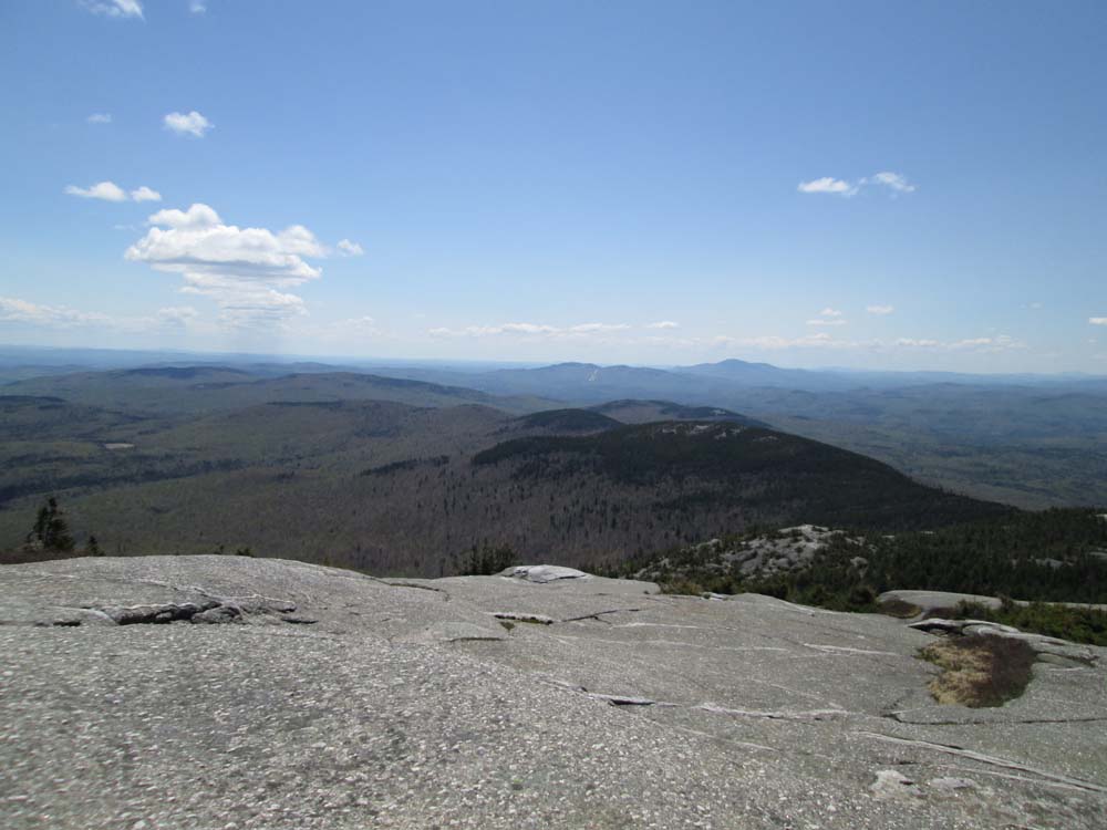
Looking at Orange, Ragged, and Kearsarge from Mt. Cardigan

The Skyland Trail between the peaks

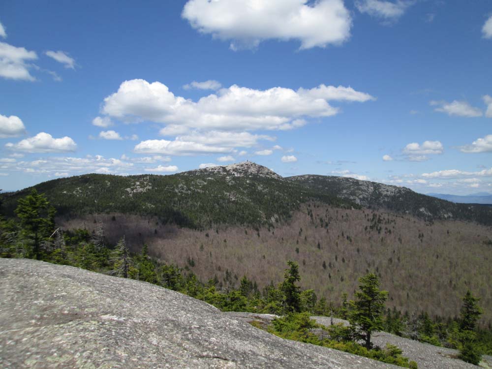
Looking at Cardigan from Orange Mountain

Trout lily along the Vistamont Trail
Directions to trailhead: From Bristol, take Route 3A North briefly, then take a left onto Bristol Hill Road. Eventually bear left onto Plummer Hill Road, then take a left onto Thissell Road, then take a right onto Town Pond Road. Town Pond Road eventually joins Mt. Cardigan Road. Mt. Cardigan Road becomes Shem Valley Road at a sharp turn - go straight on it. Parking is located across from the AMC facility. One can also find the AMC Lodge with more ease from Alexandria by following the AMC Lodge signs.
Back to Mt. Cardigan Profile
Back to Orange Mountain Profile
|