Home
States
Colorado
Connecticut
Maine
Massachusetts
New Hampshire
New York
Rhode Island
Utah
Vermont
View All
Lists
NE 4,000 Footers
NE 100 Highest
NH 4,000 Footers
NH 100 Highest
NH 52 With A View
NH Belknap Range
NH Ossipee 10
Links
Trail Conditions
Trip Log
Sunrises
Sunsets
About
|
Mt. Deception
Carroll, NH, Low and Burbanks Grant, NH
Trailheads, measurements, times, distances, and maps are all approximate and relative to the hike(s) as shown below.
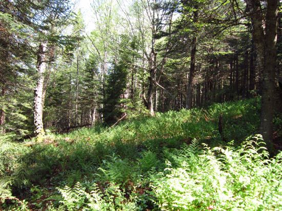
Open woods on the western slope of Mt. Deception
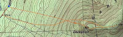
Route: Bushwhack
Starting from the back of camp site 7 off Cherry Mountain Road, we climbed at moderate grades through generally open woods, going a bit south of east.
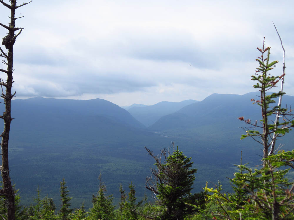
Nearing the cone of the west peak of Deception, we hit steeper terrain and some mixed woods with some blowdown. From the west peak, we had views toward the Presidentials (in the clouds), Crawford Notch, and Bretton Woods.
We then dropped a bit to the north side, to avoid some spruce, then pushed back to the ridge, picking up the long-abandoned Deception Trail in places (some blowdown forced us to the north in a few places).
We didn't find any open views from near the recognized highpoint and, due to nasty black flies, we didn't linger for long. For the descent, we attempted to go around the west peak, but in hindsight found the woods and terrain to slow us down. We headed a bit more south for the descent down to Cherry Mountain Road and found it to be less optimal than the ascent, as we dropped into some brooks and had to walk a few minutes back up the road.
| Hike Ratings |
|
Getting To Trailhead: |
Easy |
| Destination: |
Mt. Deception |
|
Length: |
Moderate |
|
Steepness: |
Difficult |
|
Navigation: |
Difficult |
|
Views: |
Minimal |
|
Crowds: |
Minimal |
|
| Hike Stats |
|
Date Hiked: |
Saturday, May 26, 2012 |
| Parking Elevation: |
1,920' |
| Destination: |
Mt. Deception |
| Time Elapsed: |
02:29 |
| Trailhead Elevation: |
1,920' |
| Summit Elevation: |
3,671' |
| Vertical Gain: |
1,891' |
|
|
| Hike Time Elapsed: |
04:42 |
| Hike Vertical Gain: |
1,941' |
|
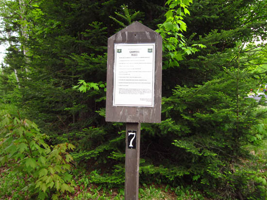
Camp site 7 on Cherry Mountain Road

Crawford Notch as seen from the western subpeak of Mt. Deception

Directions to trailhead: Take US 302 East from Twin Mountain, then take a left onto Cherry Mountain Road. Camp Site 7 will eventually be on the right.
Back to Mt. Deception Profile
|