Home
States
Colorado
Connecticut
Maine
Massachusetts
New Hampshire
New York
Rhode Island
Utah
Vermont
View All
Lists
NE 4,000 Footers
NE 100 Highest
NH 4,000 Footers
NH 100 Highest
NH 52 With A View
NH Belknap Range
NH Ossipee 10
Links
Trail Conditions
Trip Log
Sunrises
Sunsets
About
|
Mt. Eisenhower
Bean's Grant, NH, Chandler's Purchase, NH, Sargent's Purchase, NH
Trailheads, measurements, times, distances, and maps are all approximate and relative to the hike(s) as shown below.

Looking up the Edmands Path
Route: Edmands Path, Eisenhower Loop, (Mt. Eisenhower), Eisenhower Loop, Edmands Path
Below treeline, trail was mostly dry with just a little bit of mud near one of the water crossings. Around treeline on the northwest side of the peak, there was a lot of wet/slippery rock, but nowhere else (not in the woods just below that, or above). Odd.
Beautiful hobblebush leaf colors along the first mile or so of trail. Not much to see in the canopy, and it appears a lot of the trees are going to shades of brown, rather than vivid colors. Looks like a lot of the upper Dry River leaves have already fallen.
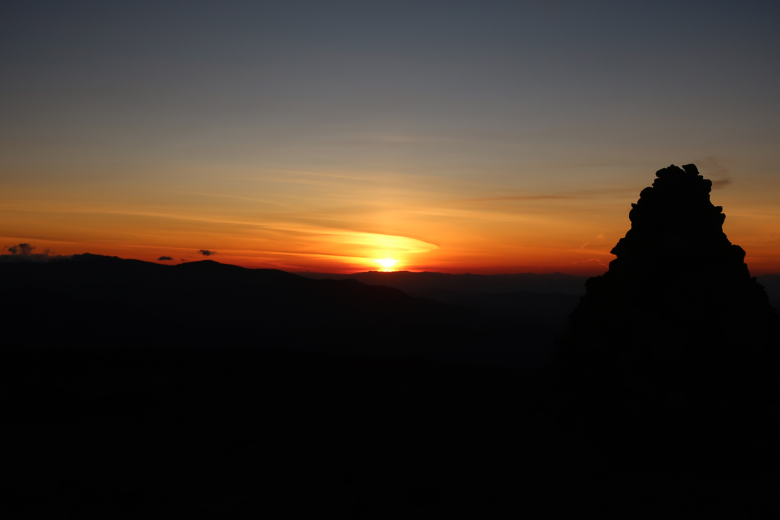
Rare mild October night in the Presis for a sunset. Minimal winds and temperatures were warm enough that I didn't need to put on gloves. Not many nights like this left before winter!
| Hike Ratings |
|
Getting To Trailhead: |
Easy |
| Destination: |
Mt. Eisenhower |
|
Length: |
Moderate |
|
Steepness: |
Moderate |
|
Navigation: |
Easy |
|
Views: |
Excellent |
|
Crowds: |
Minimal |
|
| Hike Stats |
|
Date Hiked: |
Tuesday, October 3, 2017 |
| Parking Elevation: |
1,975' |
| Destination: |
Mt. Eisenhower |
| Time Elapsed: |
01:14 |
| Trailhead Elevation: |
1,980' |
| Summit Elevation: |
4,780' |
| Distance: |
3.3 miles |
| Vertical Gain: |
2,860' |
|
|
| Hike Time Elapsed: |
02:42 |
| Hike Distance: |
6.6 miles |
| Hike Vertical Gain: |
2,925' |
|

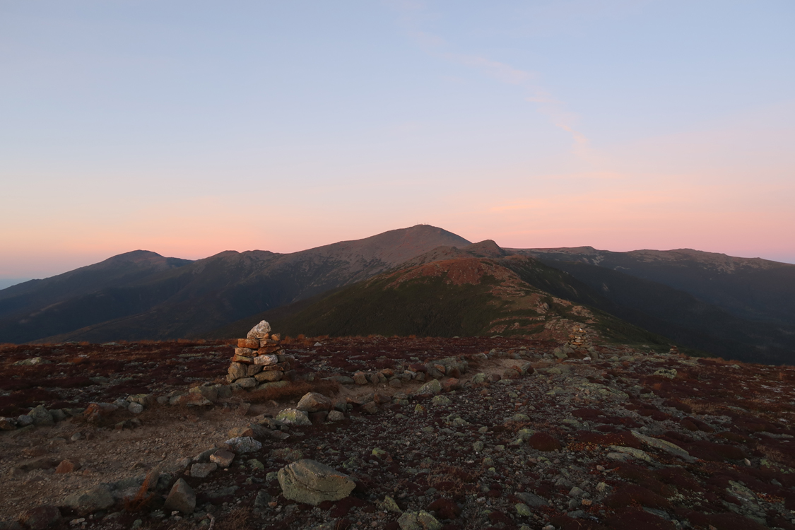
Looking north from Mt. Eisenhower

The sunset as seen from Mt. Eisenhower
Directions to trailhead: Take Route 302 West from Bartlett into Carroll. Just after Saco Lake, take a right onto Mt. Clinton Road. Take this road for a few minutes. The Edmand Path trailhead and small WMNF fee parking area will be on the right.
Back to Mt. Eisenhower Profile
|