Home
States
Colorado
Connecticut
Maine
Massachusetts
New Hampshire
New York
Rhode Island
Utah
Vermont
View All
Lists
NE 4,000 Footers
NE 100 Highest
NH 4,000 Footers
NH 100 Highest
NH 52 With A View
NH Belknap Range
NH Ossipee 10
Links
Trail Conditions
Trip Log
Sunrises
Sunsets
About
|
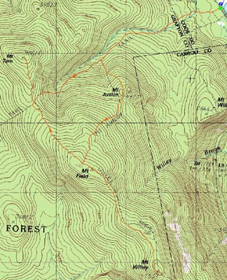
Mt. Field, Mt. Willey, Mt. Tom
Carroll, NH, Bethlehem, NH
Trailheads, measurements, times, distances, and maps are all approximate and relative to the hike(s) as shown below.
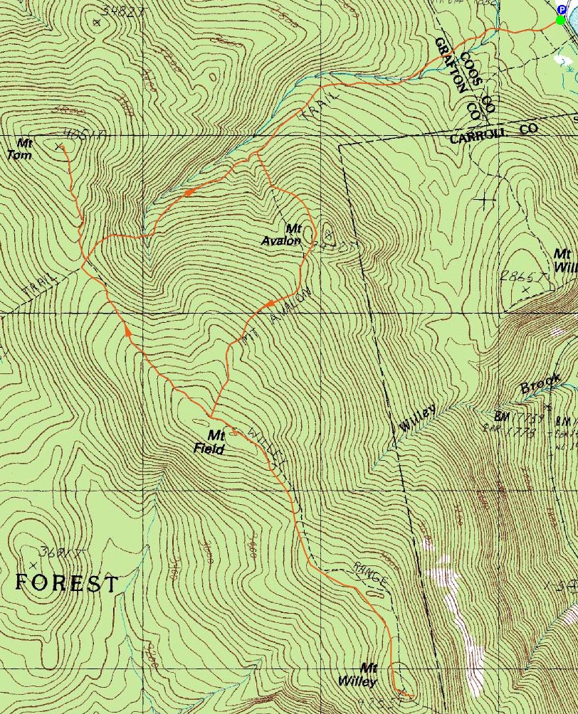
Looking up the Avalon Trail on the way to Mt. Field
Route: Avalon Trail, (spur trail to summit), (Mt. Avalon), (spur trail from summit), Avalon Trail, Willey Range Trail, (Mt. Field), Willey Range Trail, (Mt. Willey), Willey Range Trail, (Mt. Field), Willey Range Trail, A-Z Trail, Mt. Tom Spur Trail, (Mt. Tom), Mt. Tom Spur Trail, A-Z Trail, Avalon Trail
Even though the weather forecast was looking pretty poor, I was determined to get out and get some exercise, having spent the previous day indoors.
Arriving at the railroad depot, I could see there was no one out and about. Though the gloomy weather made it tempting to turn around and call it a day, I nonetheless strapped my snowshoes onto my pack and headed up the Avalon Trail.
The first water crossing was a bit tricky but nonetheless doable. As I crossed, however, pieces of it were crumbling. From there, I put on my snowshoes in effort to keep the monorail in tact.
The second water crossings was a bit more tricky - some of the rocks were submerged, so I was forced to let my boots get wet. Above here, I rode the monorail up the Avalon Trail, skipping Mt. Avalon since there were no views to be had.
Finally reaching the summit of Mt. Field, I snapped a few photos of the loitering grey jays. I didn't feel like loitering, however, so I continued on my way to Mt. Willey. The trail was a bit hard to follow in places (the packed portion appears to deviate from the proper trail), and the monorail was rather unpleasant in others (built up on spruce and thus crumbling even when wearing snowshoes).
With no views from Willey, I turned around and headed across to Mt. Tom. Once again, no views.
As I started to descend, I could see the fog was lifting a bit. While the upper water crossings on the A-Z Trail were still bridged, the Avalon Trail crossings were once again tricky.
Back at the trailhead, I could see that the fog had lifted tremendously and that the summits of Mt. Field were now in and out of the clouds. While it would have been nice to have had some views, I was nonetheless glad to be done, warm, and dry.
| Hike Ratings |
|
Getting To Trailhead: |
Easy |
| Destination: |
Mt. Field |
|
Length: |
Moderate |
|
Steepness: |
Difficult |
|
Navigation: |
Easy |
|
Views: |
Moderate due to weather |
|
Crowds: |
Minimal |
| Destination: |
Mt. Willey |
|
Length: |
Moderate |
|
Steepness: |
Difficult |
|
Navigation: |
Moderate |
|
Views: |
Minimal due to weather |
|
Crowds: |
Minimal |
| Destination: |
Mt. Field |
|
Length: |
Moderate |
|
Steepness: |
Difficult |
|
Navigation: |
Easy |
|
Views: |
Minimal due to weather |
|
Crowds: |
Minimal |
| Destination: |
Mt. Tom |
|
Length: |
Moderate |
|
Steepness: |
Difficult |
|
Navigation: |
Easy |
|
Views: |
Minimal due to weather |
|
Crowds: |
Minimal |
|
| Hike Stats |
|
Date Hiked: |
Saturday, April 4, 2009 |
| Hike Commenced: |
9:10 AM |
| Parking Elevation: |
1,900' |
| Destination: |
Mt. Field |
| Ascent Commenced: |
9:11 AM |
| Summit Reached: |
10:46 AM |
| Time Elapsed: |
01:35 |
| Trailhead Elevation: |
1,900' |
| Summit Elevation: |
4,340' |
| Distance: |
2.8 miles |
| Vertical Gain: |
2,542' |
| Destination: |
Mt. Willey |
| Ascent Commenced: |
10:47 AM |
| Summit Reached: |
11:32 AM |
| Time Elapsed: |
00:45 |
| Trailhead Elevation: |
4,340' |
| Summit Elevation: |
4,285' |
| Distance: |
1.4 miles |
| Vertical Gain: |
465' |
| Destination: |
Mt. Field |
| Ascent Commenced: |
11:34 AM |
| Summit Reached: |
12:17 PM |
| Time Elapsed: |
00:43 |
| Trailhead Elevation: |
4,285' |
| Summit Elevation: |
4,340' |
| Distance: |
1.4 miles |
| Vertical Gain: |
520' |
| Destination: |
Mt. Tom |
| Ascent Commenced: |
12:17 PM |
| Summit Reached: |
12:55 PM |
| Time Elapsed: |
00:38 |
| Trailhead Elevation: |
4,340' |
| Summit Elevation: |
4,051' |
| Distance: |
1.5 miles |
| Vertical Gain: |
411' |
|
|
| Hike Ended: |
2:22 PM |
| Hike Time Elapsed: |
05:12 |
| Hike Distance: |
9.8 miles |
| Hike Vertical Gain: |
3,978' |
|
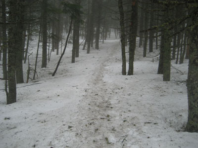
The Avalon Trail trailhead next to the train station

Greyjays hanging out at the summit of Mt. Field

The Willey Range Trail to Mt. Willey

Looking at fog from one of the Mt. Willey viewpoints

The Mt. Tom Spur Trail

Looking into the clouds from the Mt. Tom summit

Directions to trailhead: Take Route 302 west from Bartlett, NH. In the winter and early spring there is parking next to the railroad station. Trailhead is across the tracks.
Back to Mt. Field Profile
Back to Mt. Willey Profile
Back to Mt. Tom Profile
|