Home
States
Colorado
Connecticut
Maine
Massachusetts
New Hampshire
New York
Rhode Island
Utah
Vermont
View All
Lists
NE 4,000 Footers
NE 100 Highest
NH 4,000 Footers
NH 100 Highest
NH 52 With A View
NH Belknap Range
NH Ossipee 10
Links
Trail Conditions
Trip Log
Sunrises
Sunsets
About
|
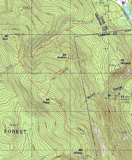
Mt. Field, Mt. Willey, Mt. Tom
Carroll, NH, Bethlehem, NH
Trailheads, measurements, times, distances, and maps are all approximate and relative to the hike(s) as shown below.
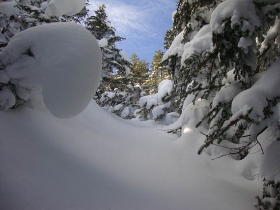
Looking up the Avalon Trail
Route: Avalon Trail, Willey Range Trail, (Mt. Field), Willey Range Trail, (Mt. Willey), Willey Range Trail, (Mt. Field), Willey Range Trail, A-Z Trail, Mt. Tom Spur Trail, (Mt. Tom), Mt. Tom Spur Trail, A-Z Trail, Avalon Trail
After having been literally grounded by the flu for most of the week, I decided to get out and get some fresh air. While my first choice had been to hike Whiteface-Passaconaway, I decided while sitting in the Ferncroft parking lot that that hike wouldn't be happening. Thus, I headed north for something a bit more tame.
Starting on the Avalon Trail, I made decent time through the flats. Shortly after the second water crossing, I realized I'd be breaking some trail - not something I was looking forward to. Starting up the steeps on the Avalon Trail, I considered turning around, but decided to just take my time and see how far I'd be able to go.
Eventually passing by Avalon, I continued up to Mt. Field. Reaching the summit, I had decent views of the Presidentials as overhead clouds started to build in.
With the majority of climbing behind me, I decided to continue to Mt. Willey, hoping others would catch up to me. No one did, and I ended up breaking trail all the way to that summit, from where I had decent, but overcast views.
Once back on Mt. Field, I opted to descend via the Willey Range Trail, making a decision about Mt. Tom on the way down. Unfortunately, this segment of the Willey Range Trail had seen very little traffic, requiring some quasi-trailbreaking.
Upon reaching the Mt. Tom Spur, I decided to head up to the summit. I reached the summit just in time for a snowstorm to drop down, seemingly out of nowhere.
The descent went fairly smoothly as the snow started to ramp up a bit.
| Hike Ratings |
|
Getting To Trailhead: |
Easy |
| Destination: |
Mt. Field |
|
Length: |
Moderate |
|
Steepness: |
Difficult |
|
Navigation: |
Moderate |
|
Views: |
Excellent |
|
Crowds: |
Heavy |
| Destination: |
Mt. Willey |
|
Length: |
Moderate |
|
Steepness: |
Difficult |
|
Navigation: |
Difficult |
|
Views: |
Excellent |
|
Crowds: |
Minimal |
| Destination: |
Mt. Field |
|
Length: |
Moderate |
|
Steepness: |
Difficult |
|
Navigation: |
Easy |
|
Views: |
Excellent |
|
Crowds: |
Minimal |
| Destination: |
Mt. Tom |
|
Length: |
Moderate |
|
Steepness: |
Difficult |
|
Navigation: |
Moderate |
|
Views: |
Excellent |
|
Crowds: |
Heavy |
|
| Hike Stats |
|
Date Hiked: |
Saturday, February 5, 2011 |
| Hike Commenced: |
9:53 AM |
| Parking Elevation: |
1,900' |
| Destination: |
Mt. Field |
| Ascent Commenced: |
9:55 AM |
| Summit Reached: |
12:37 PM |
| Time Elapsed: |
02:42 |
| Trailhead Elevation: |
1,900' |
| Summit Elevation: |
4,340' |
| Distance: |
2.8 miles |
| Vertical Gain: |
2,542' |
| Destination: |
Mt. Willey |
| Ascent Commenced: |
12:40 PM |
| Summit Reached: |
1:46 PM |
| Time Elapsed: |
01:06 |
| Trailhead Elevation: |
4,340' |
| Summit Elevation: |
4,285' |
| Distance: |
1.4 miles |
| Vertical Gain: |
465' |
| Destination: |
Mt. Field |
| Ascent Commenced: |
1:51 PM |
| Summit Reached: |
2:44 PM |
| Time Elapsed: |
00:53 |
| Trailhead Elevation: |
4,285' |
| Summit Elevation: |
4,340' |
| Distance: |
1.4 miles |
| Vertical Gain: |
520' |
| Destination: |
Mt. Tom |
| Ascent Commenced: |
2:44 PM |
| Summit Reached: |
3:32 PM |
| Time Elapsed: |
00:48 |
| Trailhead Elevation: |
4,340' |
| Summit Elevation: |
4,051' |
| Distance: |
1.5 miles |
| Vertical Gain: |
411' |
|
|
| Hike Ended: |
4:36 PM |
| Hike Time Elapsed: |
06:43 |
| Hike Distance: |
9.8 miles |
| Hike Vertical Gain: |
3,978' |
|
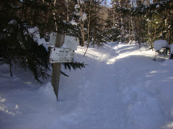
The Avalon Trail trailhead next to the train station
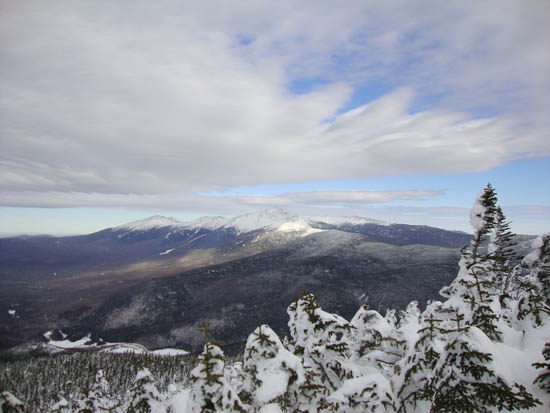
The Presidentials as seen from the Mt. Field viewpoint

The Willey Range Trail to Mt. Willey

Looking at the Bonds and Twins from one of the Mt. Willey viewpoints

The Willey Range Trail

A pine marten at the Mt. Tom Spur junction

Looking at Carrigain Notch from Mt. Tom as a snowstorm moves in

Directions to trailhead: Take Route 302 west from Bartlett, NH. In the winter, there is plowed parking available at the Highland Center. Trailhead is across the tracks, next to the Crawford Depot.
Back to Mt. Field Profile
Back to Mt. Willey Profile
Back to Mt. Tom Profile
|


