Home
States
Colorado
Connecticut
Maine
Massachusetts
New Hampshire
New York
Rhode Island
Utah
Vermont
View All
Lists
NE 4,000 Footers
NE 100 Highest
NH 4,000 Footers
NH 100 Highest
NH 52 With A View
NH Belknap Range
NH Ossipee 10
Links
Trail Conditions
Trip Log
Sunrises
Sunsets
About
|
Mt. Garfield
Bethlehem, NH, Franconia, NH
Trailheads, measurements, times, distances, and maps are all approximate and relative to the hike(s) as shown below.
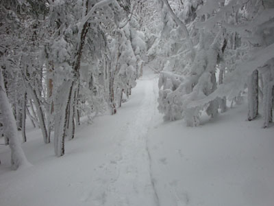
Looking up the Garfield Trail
Route: Gale River Road, Garfield Trail, Garfield Ridge Trail, (Mt. Garfield), Garfield Ridge Trail, Garfield Trail, Gale River Road
After a bunch of days in a row on the trails, and immediately after a Bonds traverse, I was looking for something a bit more tame. With poor weather approaching, Garfield seemed to fit the description.
The small lot at the end of Gale River Road was plowed, however the road itself was gated. The first bridge had been repaired, however the second and third were still out - fortunately the water crossings were frozen over.
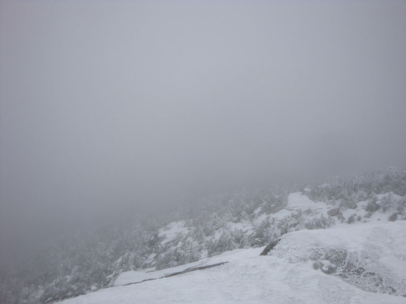
The Garfield Trail was hit pretty hard by blowdowns from the windy weather a few weeks earlier. Reaching the windy summit, we had very little visibility - however, it wasn't raining or snowing, so we were content.
We took our time on the descent, cleaning up as many of the blowdowns as possible. Reaching the parking lot, we were fortunate to beat out the storm.
| Hike Ratings |
|
Getting To Trailhead: |
Difficult |
| Destination: |
Mt. Garfield |
|
Length: |
Difficult |
|
Steepness: |
Difficult |
|
Navigation: |
Easy |
|
Views: |
Minimal (due to weather) |
|
Crowds: |
Minimal |
|
| Hike Stats |
|
Date Hiked: |
Saturday, December 26, 2009 |
| Hike Commenced: |
8:09 AM |
| Parking Elevation: |
1,320' |
| Destination: |
Mt. Garfield |
| Ascent Commenced: |
8:42 AM |
| Summit Reached: |
10:54 AM |
| Time Elapsed: |
02:12 |
| Trailhead Elevation: |
1,535' |
| Summit Elevation: |
4,500' |
| Distance: |
5 miles |
| Vertical Gain: |
3,055' |
|
|
| Hike Ended: |
1:16 PM |
| Hike Time Elapsed: |
05:07 |
| Hike Vertical Gain: |
3,402' |
|
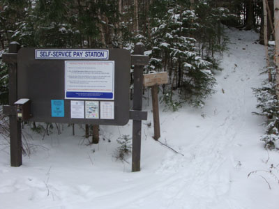
The Garfield Trail trailhead
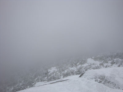
Looking into the clouds from the Mt. Garfield summit
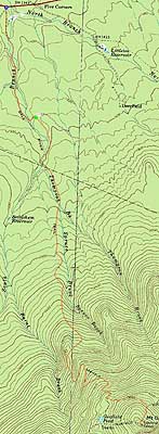

Directions to trailhead: Take US 3 South from US 302. In early winter 2009-10, the parking area at the end of Gale River Road (the South-West branch, on the left shortly after Five Corners and Trudeau Road) was plowed. The Garfield Trail is 1.2 miles up Gale River Road, on the right shortly after the forth bridge.
Back to Mt. Garfield Profile
|