Home
States
Colorado
Connecticut
Maine
Massachusetts
New Hampshire
New York
Rhode Island
Utah
Vermont
View All
Lists
NE 4,000 Footers
NE 100 Highest
NH 4,000 Footers
NH 100 Highest
NH 52 With A View
NH Belknap Range
NH Ossipee 10
Links
Trail Conditions
Trip Log
Sunrises
Sunsets
About
|
Mt. Garfield
Bethlehem, NH, Franconia, NH
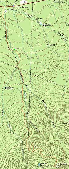
Trailheads, measurements, times, distances, and maps are all approximate and relative to the hike(s) as shown below.
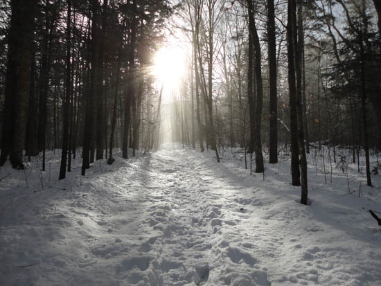
Looking up the Garfield Trail
Route: Gale River Road, Garfield Trail, Garfield Ridge Trail, (Mt. Garfield), Garfield Ridge Trail, Garfield Trail, Gale River Road
With morning rain and dropping temperatures, we decided to stay in the trees and head to Mt. Garfield.
Starting a little while after the rain stopped, we headed down the closed Gale River Road on foot, finding the two out of the three washed out bridges had been replaced. The only remaining one under construction had a large wooden beam adjacent to it for crossing.
Once on the Garfield Trail, the going was a bit slow, as the previously packed trail still resulted in sinking snowshoes due to the warm, moist weather.
Though the last steep portion of the ascent tends to ice up, there was enough snow to make it fairly smooth sailing. Reaching the summit, we had clearing views of the Franconias, Bonds, and Twins.
After a lunch break out of the wind, we headed back down the trail, still sinking on our previously packed footbed. The lower water crossings, which had been snowbridged on the ascent, were quickly crumbling in the warm weather.
| Hike Ratings |
|
Getting To Trailhead: |
Difficult |
| Destination: |
Mt. Garfield |
|
Length: |
Difficult |
|
Steepness: |
Difficult |
|
Navigation: |
Easy |
|
Views: |
Excellent |
|
Crowds: |
Minimal |
|
| Hike Stats |
|
Date Hiked: |
Sunday, January 2, 2011 |
| Hike Commenced: |
9:01 AM |
| Parking Elevation: |
1,320' |
| Destination: |
Mt. Garfield |
| Ascent Commenced: |
9:44 AM |
| Summit Reached: |
12:42 PM |
| Time Elapsed: |
02:58 |
| Trailhead Elevation: |
1,535' |
| Summit Elevation: |
4,500' |
| Distance: |
5 miles |
| Vertical Gain: |
3,055' |
|
|
| Hike Ended: |
3:20 PM |
| Hike Time Elapsed: |
06:19 |
| Hike Vertical Gain: |
3,462' |
|
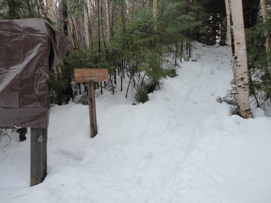
The Garfield Trail trailhead
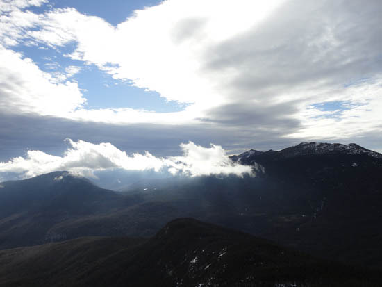
Owl's Head and the Franconia Ridge as seen from Mt. Garfield

Directions to trailhead: Take US 3 South from US 302. In winter 2010-11, one could park (on the right heading southbound) at the Trudeau Road-US 3 junction, then walk southbound on US 3, taking a left onto Gale River Road. The Garfield Trail is 1.2 miles up Gale River Road, on the right shortly after the forth bridge.
Back to Mt. Garfield Profile
|


