Home
States
Colorado
Connecticut
Maine
Massachusetts
New Hampshire
New York
Rhode Island
Utah
Vermont
View All
Lists
NE 4,000 Footers
NE 100 Highest
NH 4,000 Footers
NH 100 Highest
NH 52 With A View
NH Belknap Range
NH Ossipee 10
Links
Trail Conditions
Trip Log
Sunrises
Sunsets
About
|
Mt. Garfield
Bethlehem, NH, Franconia, NH
Trailheads, measurements, times, distances, and maps are all approximate and relative to the hike(s) as shown below.
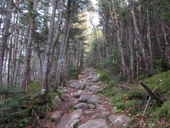
Looking up the Garfield Trail
Route: Garfield Trail, Garfield Ridge Trail, (Mt. Garfield), Garfield Ridge Trail, Garfield
Brisk after work sunset hike.
| Hike Ratings |
|
Getting To Trailhead: |
Easy |
| Destination: |
Mt. Garfield |
|
Length: |
Moderate |
|
Steepness: |
Difficult |
|
Navigation: |
Easy |
|
Views: |
Excellent |
|
Crowds: |
Minimal |
|
| Hike Stats |
|
Date Hiked: |
Wednesday, September 14, 2011 |
| Parking Elevation: |
1,540' |
| Destination: |
Mt. Garfield |
| Time Elapsed: |
01:41 |
| Trailhead Elevation: |
1,535' |
| Summit Elevation: |
4,500' |
| Distance: |
5 miles |
| Vertical Gain: |
3,055' |
|
|
| Hike Time Elapsed: |
04:29 |
| Hike Vertical Gain: |
3,150' |
|
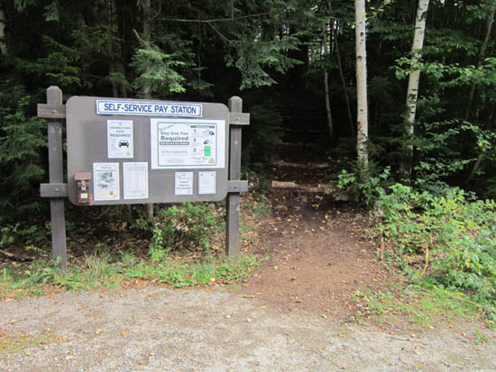
The Garfield Trail trailhead
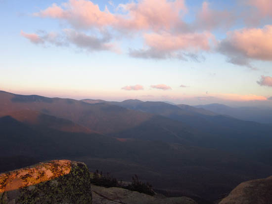
Looking at the Bonds and Owl's Head from Mt. Garfield

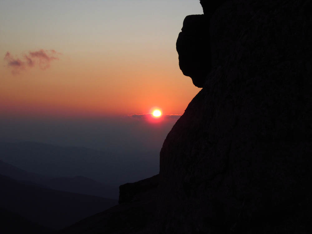
The sunset on Mt. Garfield
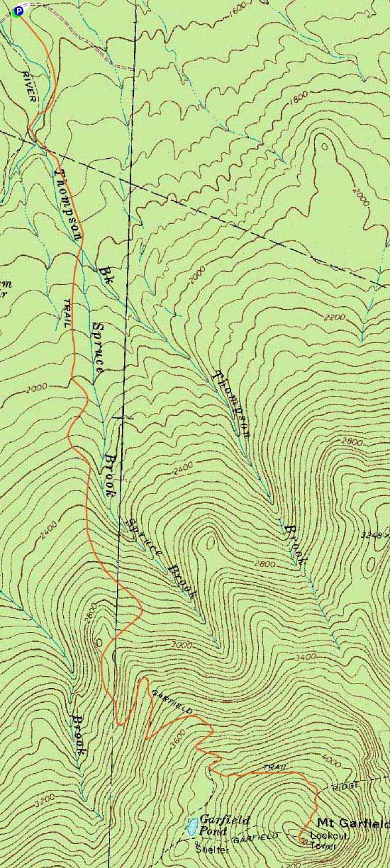

Directions to trailhead: Take Route 3 South from US 302. Due to bridges being out on the west end of Gale River Road, take a left onto Gale River Road at the Five Corners junction. Bear left at the first fork, then take a right at the second fork, passing the Gale River Trail parking area. A few minutes later, the Garfield Trail WMNF fee hiker parking area is on the left, just before the Garfield Trail trailhead.
Back to Mt. Garfield Profile
|