Home
States
Colorado
Connecticut
Maine
Massachusetts
New Hampshire
New York
Rhode Island
Utah
Vermont
View All
Lists
NE 4,000 Footers
NE 100 Highest
NH 4,000 Footers
NH 100 Highest
NH 52 With A View
NH Belknap Range
NH Ossipee 10
Links
Trail Conditions
Trip Log
Sunrises
Sunsets
About
|
Mt. Hale
Bethlehem, NH, Franconia, NH
Trailheads, measurements, times, distances, and maps are all approximate and relative to the hike(s) as shown below.
Looking down the Firewarden's Trail
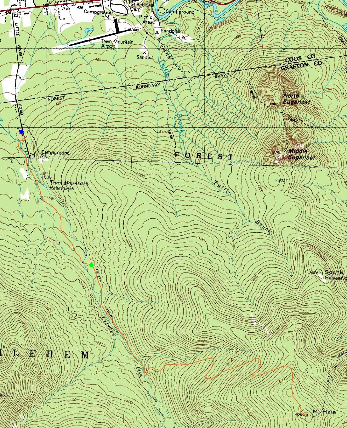
Route: Little River Road, Corridor 11S, Corridor 11 Bypass, herd path, Haystack Road, North Twin Trail, herd path, Firewarden's Trail, (Mt. Hale), Firewarden's Trail, herd path, North Twin Trail, Haystack Road, herd path, Corridor 11 Bypass, Corridor 11N, Little River Road
While an iffy weather forecast, Mt. Hale seemed to be a nice target. While I had hiked it four previous times, I was really looking forward to this particular trip - a great group had been assembled to go up an officially abandoned trail.
After paying our parking fee at the 7 Dwarfs Motel, we soon were snowshoeing up the snowmobile trails. After checking out the abandoned school bus near the abandoned bridge, we took an abandoned herd path to a seasonally abandoned Haystack Road, soon reaching the seasonally abandoned North Twin parking lot.
From here, we headed up the North Twin Trail, bearing left at the first water crossing and staying on the eastern shore of the Little River. A few minutes thereafter, we took a sharp left up perhaps a 10 vertical foot embankment, then continued turning left onto the more noticable Firewarden's Trail trailbed.
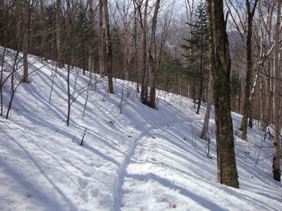
While the weather still wasn't great - cloudy with snow and some wind - the ascent was still quite pleasant, as the trail worked its way up through a massive birch glade. Nearing the top of the ridge, the trail dipped into some spruce, soon reaching a false summit, dropping down a bit, then emerging at the top of Mt. Hale.
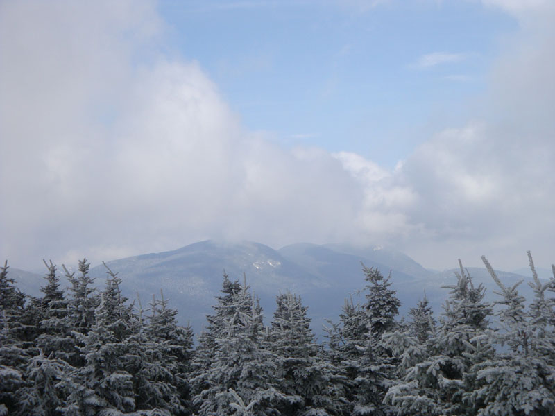
A massive tower built out of blocks of snow provided the potential for great views - however, we were in a cloud. As we loitered for awhile, we could see some brief flashes of sun - then, almost instantly, the clouds lifted a bit. Hustling to the top of the snow tower, we were treated to views of North Twin, Zealand, Carrigain, and the Tom-Field-Willey Range. While it was tempting to loiter a bit longer, it was still a bit windy and cold, so we commenced our retreat.
As we reached the birch glade, we started getting consistent blue sky and sun - this, coupled with frosted birch branches, made for great scenery. By the time we reached the North Twin Trail, it was a a beautiful spring day. What a nice alternative to the Hale Brook Trail!
| Hike Ratings |
|
Getting To Trailhead: |
Difficult |
| Destination: |
Mt. Hale |
|
Length: |
Moderate |
|
Steepness: |
Difficult |
|
Navigation: |
Moderate |
|
Views: |
Excellent |
|
Crowds: |
Minimal |
|
| Hike Stats |
|
Date Hiked: |
Sunday, March 8, 2009 |
| Hike Commenced: |
9:35 AM |
| Parking Elevation: |
1,560' |
| Destination: |
Mt. Hale |
| Ascent Commenced: |
10:29 AM |
| Summit Reached: |
12:54 PM |
| Time Elapsed: |
02:25 |
| Trailhead Elevation: |
1,800' |
| Summit Elevation: |
4,054' |
| Vertical Gain: |
2,324' |
|
|
| Hike Ended: |
4:33 PM |
| Hike Time Elapsed: |
06:58 |
| Hike Vertical Gain: |
2,674' |
|
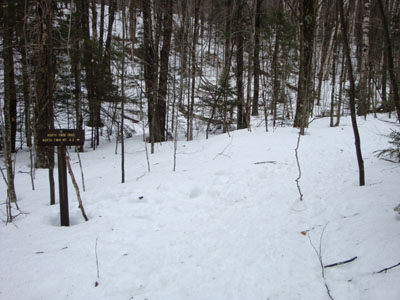
The North Twin Trail trailhead at the end of Haystack Road

Looking at the Tom-Field-Willey Range from the top of the snowtower on Mt. Hale
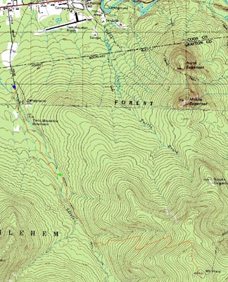

Directions to trailhead: In winter, from Route 302, take Route 3 South into Twin Mountain. Take a left onto Little River Road. About a mile down the road, the 7 Dwarfs Motel will be on the right. The parking fee is 6 dollars and it is asked that dogs be on leash while on the premises. Once parked, walk a hundred or so feet further up Little River Road, then take a right onto an access road marked with two boulders. Cross the bridge, then take an immediate left onto the 11 Corridor Bypass. Continue on this trail, bearing left toward an abandoned bridge. A herd path starts near the end of this bridge (does not cross the bridge) and leads to the bridge (go over this bridge when you reach it) just before the summer North Twin parking area. The North Twin Trail trailhead is at the back of the parking area.
Back to Mt. Hale Profile
|