Home
States
Colorado
Connecticut
Maine
Massachusetts
New Hampshire
New York
Rhode Island
Utah
Vermont
View All
Lists
NE 4,000 Footers
NE 100 Highest
NH 4,000 Footers
NH 100 Highest
NH 52 With A View
NH Belknap Range
NH Ossipee 10
Links
Trail Conditions
Trip Log
Sunrises
Sunsets
About
|
Mt. Hale
Bethlehem, NH
Trailheads, measurements, times, distances, and maps are all approximate and relative to the hike(s) as shown below.
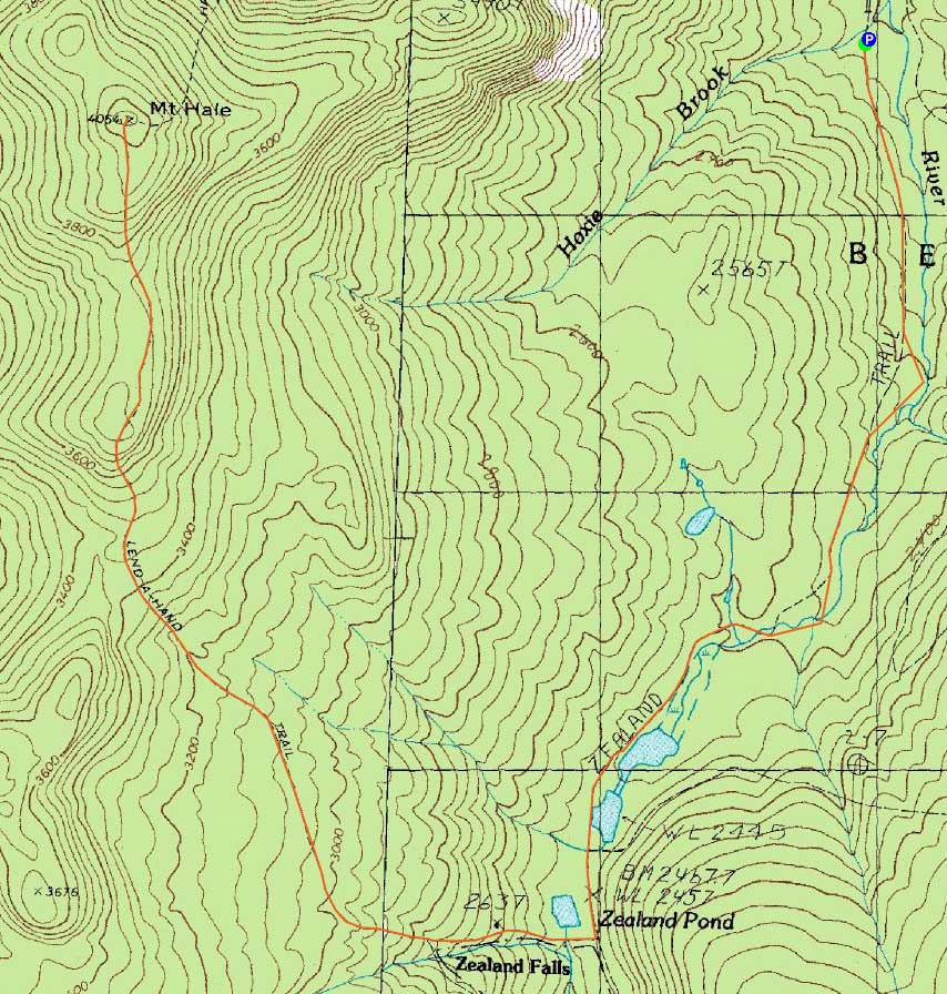
The Zealand Trail
Route: Zealand Trail, Twinway, Lend-A-Hand Trail, (Mt. Hale), Lend-A-Hand Trail, Twinway, Zealand Trail
With a decent, but windy, day forecasted below treeline, I decided to take advantage of Zealand Road still being open and head up the Lend-A-Hand Trail.
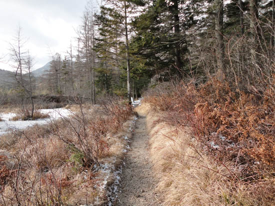
The Zealand Trail was covered in a dusting of snow and the rocks at water crossings covered in ice. The steeps on the way to the hut, as well as on the Lend-A-Hand Trail were icy as well, requiring the use of light traction. The Lend-A-Hand Trail itself was less than pleasant on this day, as much of it was covered in puddles and running water with a breakable ice crust on top. Add half an inch of snow on top, and it was hard to figure out what you'd be stepping into.
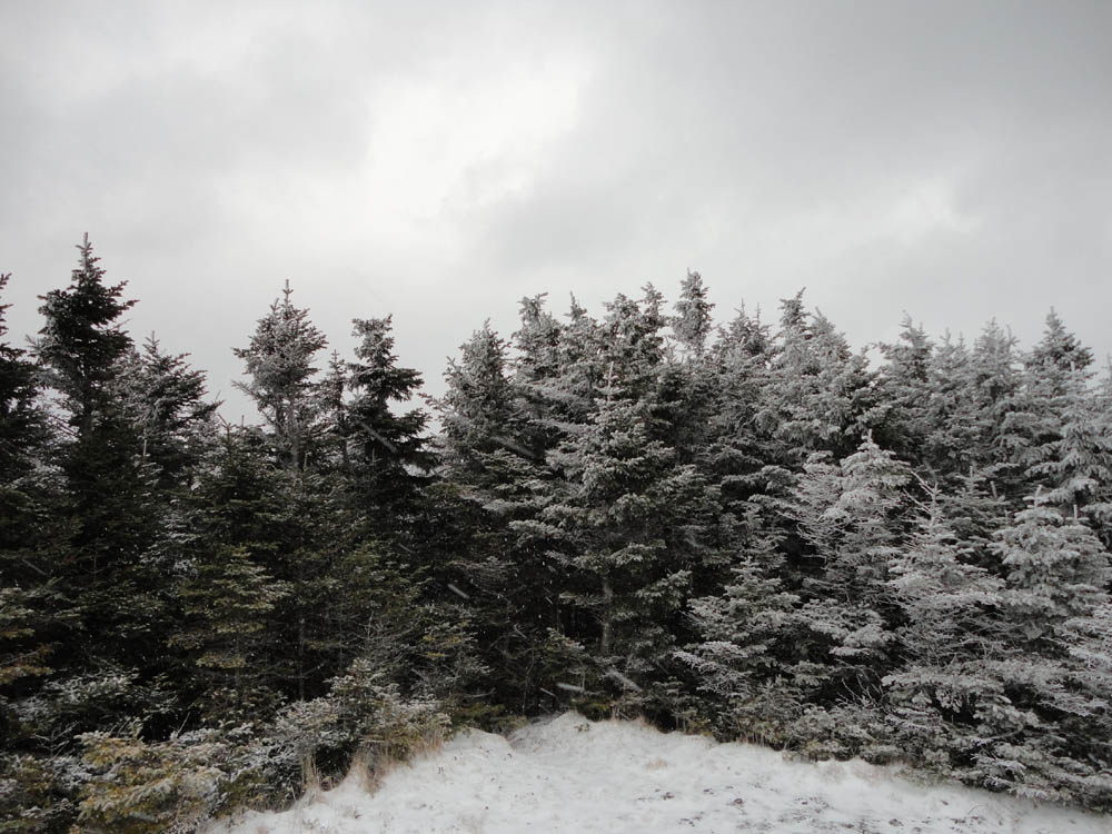
After a few brief steep sections and a few false heights of land, I eventually reached the summit of Hale in the middle of a light snow squall. With that, the normally mediocre at best views were zilch, resulting in a very short stay on the summit.
Upon reaching an open, marshy area where the Lend-A-Hand Trail first clears a ridge, I weighed going to South Hale. Though originally my objective for the day (the cliffs especially), it seemed less than desirable in dropping temperatures, limited visibility, and increasing winds. Thusly, I decided to keep descending and instead settled for a break at the Zealand hut.
Upon reaching the Zealand Trail below the hut, the clouds and snow started to move out, resulting in a nice, partly sunny afternoon with decreasing winds.
| Hike Ratings |
|
Getting To Trailhead: |
Easy |
| Destination: |
Mt. Hale |
|
Length: |
Moderate |
|
Steepness: |
Difficult |
|
Navigation: |
Easy |
|
Views: |
Minimal (due to weather) |
|
Crowds: |
Minimal |
|
| Hike Stats |
|
Date Hiked: |
Saturday, November 20, 2010 |
| Hike Commenced: |
8:44 AM |
| Parking Elevation: |
2,000' |
| Destination: |
Mt. Hale |
| Ascent Commenced: |
8:45 AM |
| Summit Reached: |
11:22 AM |
| Time Elapsed: |
02:37 |
| Trailhead Elevation: |
2,000' |
| Summit Elevation: |
4,054' |
| Distance: |
5.6 miles |
| Vertical Gain: |
2,224' |
|
|
| Hike Ended: |
2:20 PM |
| Hike Time Elapsed: |
05:36 |
| Hike Distance: |
11.2 miles |
| Hike Vertical Gain: |
2,394' |
|
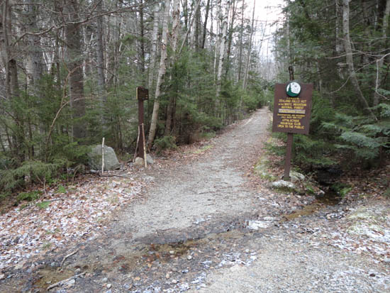
The Zealand Trail trailhead at the end of Zealand Road
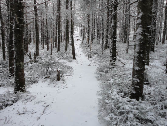
The upper Lend-A-Hand Trail
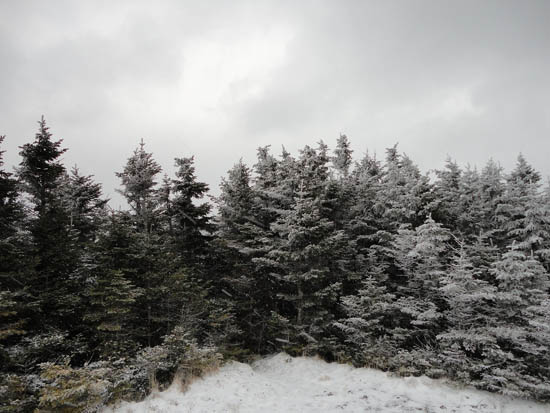
A lack of views from the Mt. Hale summit
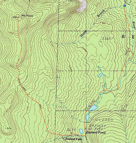

Directions to trailhead: Take US 302 west from Bartlett past Bretton Woods Ski Area. A few minutes after, take a left onto Zealand Road. The Zealand WMNF fee parking area and Zealand Trail trailhead are located at the end of the road.
Back to Mt. Hale Profile
|