Home
States
Colorado
Connecticut
Maine
Massachusetts
New Hampshire
New York
Rhode Island
Utah
Vermont
View All
Lists
NE 4,000 Footers
NE 100 Highest
NH 4,000 Footers
NH 100 Highest
NH 52 With A View
NH Belknap Range
NH Ossipee 10
Links
Trail Conditions
Trip Log
Sunrises
Sunsets
About
|
Mt. Hale
Bethlehem, NH, Franconia, NH
Trailheads, measurements, times, distances, and maps are all approximate and relative to the hike(s) as shown below.
Looking up the Firewarden's Trail
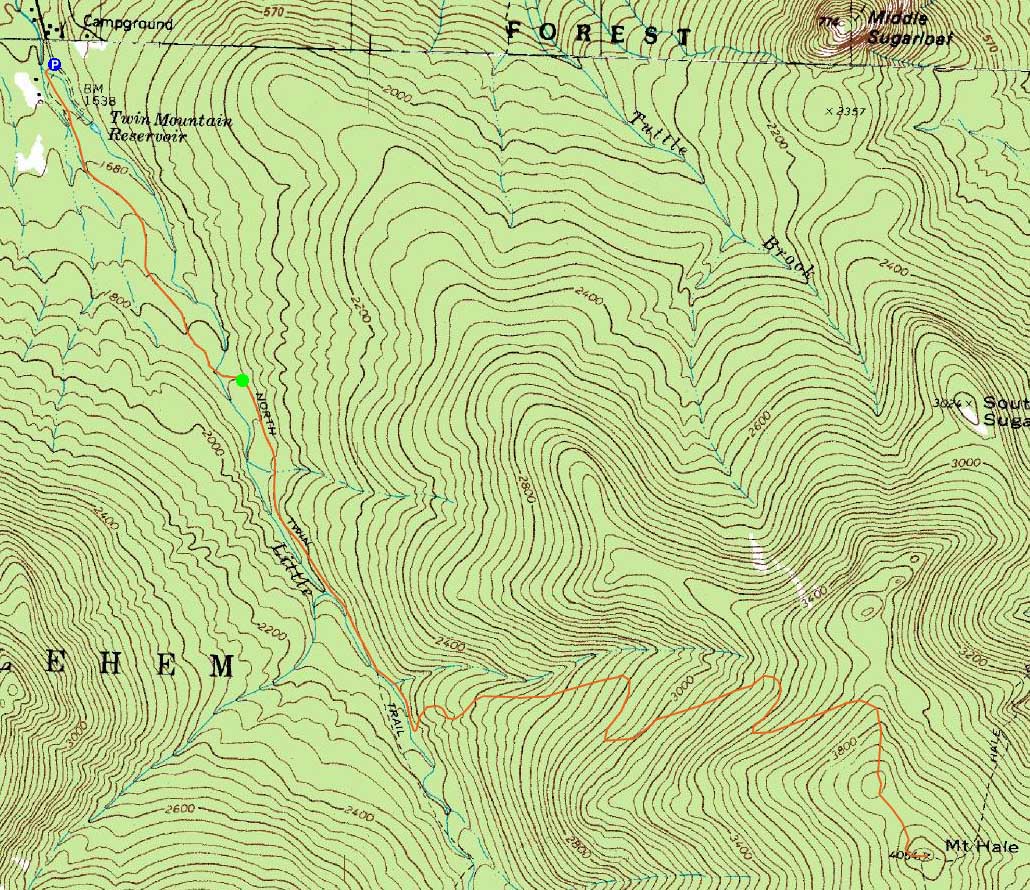
Route: Herd path, Haystack Road, North Twin Trail, herd path, Firewarden's Trail, (Mt. Hale), Firewarden's Trail, herd path, North Twin Trail, Haystack Road, herd path
With poor road conditions and mediocre weather, we decided to head up to Mt. Hale for the first full day of winter.
Starting at the end of Little River Road, we snowshoed across the snowmobile bridge, then took an immediate left onto the herd path to the North Twin Trail trailhead.
Once on the North Twin Trail, we made decent progress up to the herd path (at otherwise the first water crossing), following it over a smaller brook crossing and then to the unmarked Firewarden's Trail trailhead.
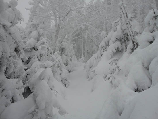
Previously dealing with 3-4" of new snow on old ski tracks, we had proper light trail breaking on the Firewarden's Trail as we worked our way up the switchbacks. Powder depths ranged from 4-12" on top of a frozen granular base.
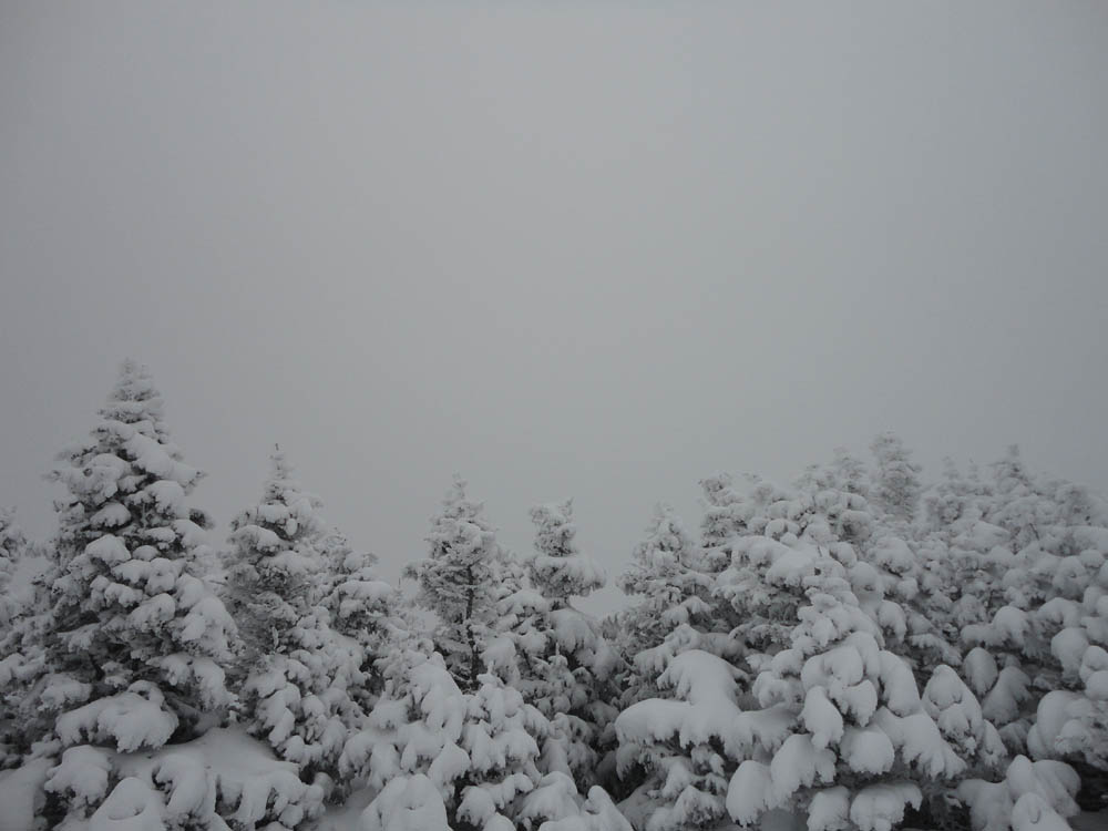
Eventually reaching the summit, there were no views to be had, due in part to the light snow flurries.
For the descent, we followed our tracks back out, making much better time on packed trail.
| Hike Ratings |
|
Getting To Trailhead: |
Difficult |
| Destination: |
Mt. Hale |
|
Length: |
Moderate |
|
Steepness: |
Difficult |
|
Navigation: |
Difficult |
|
Views: |
Minimal (due to weather) |
|
Crowds: |
Minimal |
|
| Hike Stats |
|
Date Hiked: |
Wednesday, December 22, 2010 |
| Hike Commenced: |
9:05 AM |
| Parking Elevation: |
1,620' |
| Destination: |
Mt. Hale |
| Ascent Commenced: |
9:37 AM |
| Summit Reached: |
12:40 PM |
| Time Elapsed: |
03:03 |
| Trailhead Elevation: |
1,800' |
| Summit Elevation: |
4,054' |
| Vertical Gain: |
2,324' |
|
|
| Hike Ended: |
2:50 PM |
| Hike Time Elapsed: |
05:15 |
| Hike Vertical Gain: |
2,604' |
|
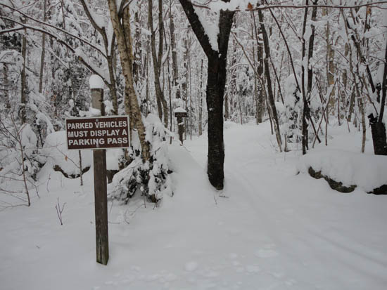
The North Twin Trail trailhead at the end of Haystack Road
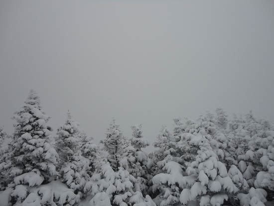
A lack of views from the Mt. Hale summit
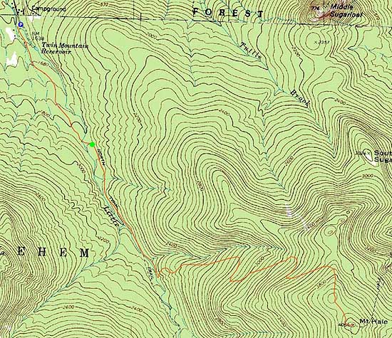

Directions to trailhead: In winter, from Route 302, take Route 3 South into Twin Mountain. Take a left onto Little River Road. As of winter 2009-2010, the end of the road had room for limited parking (no parking signs removed - 7 Dwarfs Motel offers alternative fee parking in winter), and the snowmobile bridge across the Little River had been rebuilt and reopened. After crossing this bridge, take an immediate sharp left turn onto a skier path, which then leads to Haystack Road, near the North Twin Trail trailhead.
Back to Mt. Hale Profile
|