Home
States
Colorado
Connecticut
Maine
Massachusetts
New Hampshire
New York
Rhode Island
Utah
Vermont
View All
Lists
NE 4,000 Footers
NE 100 Highest
NH 4,000 Footers
NH 100 Highest
NH 52 With A View
NH Belknap Range
NH Ossipee 10
Links
Trail Conditions
Trip Log
Sunrises
Sunsets
About
|
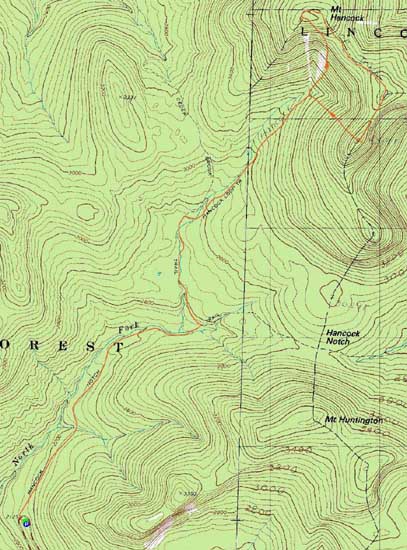
Mt. Hancock (North Peak), Mt. Hancock (South Peak)
Lincoln, NH, Livermore, NH
Trailheads, measurements, times, distances, and maps are all approximate and relative to the hike(s) as shown below.
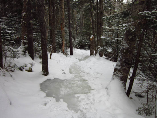
Looking up the Hancock Loop Trail
Route: Hancock Notch Trail, Cedar Brook Trail, Hancock Loop Trail, (Mt. Hancock North Peak), Hancock Loop Trail, (Mt. Hancock South Peak), Hancock Loop Trail, Cedar Brook Trail, Hancock Notch Trail
With minimal snowpack, I was able to bareboot most of the hike (except for the descent down the icy mountain). An inch or so at the base, upwards of a foot on the ridge.
| Hike Ratings |
|
Getting To Trailhead: |
Easy |
| Destination: |
Mt. Hancock (North Peak) |
|
Length: |
Moderate |
|
Steepness: |
Very Difficult |
|
Navigation: |
Easy |
|
Views: |
Excellent |
|
Crowds: |
Heavy |
| Destination: |
Mt. Hancock (South Peak) |
|
Length: |
Moderate |
|
Steepness: |
Difficult |
|
Navigation: |
Moderate |
|
Views: |
Excellent |
|
Crowds: |
Heavy |
|
| Hike Stats |
|
Date Hiked: |
Saturday, January 7, 2012 |
| Parking Elevation: |
2,140' |
| Destination: |
Mt. Hancock (North Peak) |
| Time Elapsed: |
01:54 |
| Trailhead Elevation: |
2,140' |
| Summit Elevation: |
4,420' |
| Vertical Gain: |
2,470' |
| Destination: |
Mt. Hancock (South Peak) |
| Trailhead Elevation: |
4,420' |
| Summit Elevation: |
4,319' |
| Distance: |
1.4 miles |
| Vertical Gain: |
534' |
|
|
| Hike Vertical Gain: |
3,154' |
|
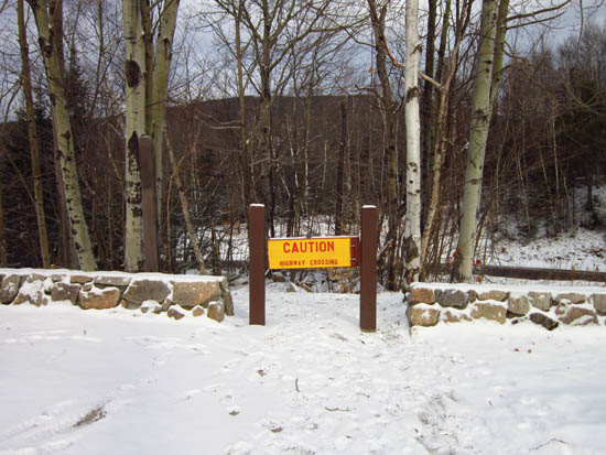
The Hancock Notch Trail trailhead
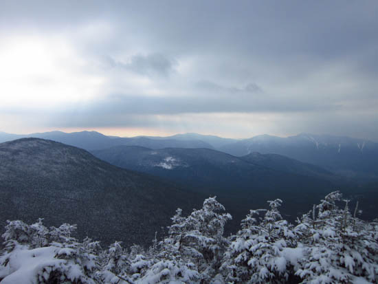
The Osceolas and Sandwich Range as seen from North Hancock
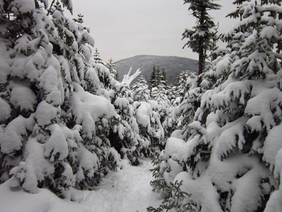
The Hancock Loop Trail between the peaks

Looking at the Arrow Slide from near the summit of South Hancock

Directions to trailhead: Take Route 112 west from Route 16. After going over the pass, continue down hill a bit. The Hancock WMNF fee parking area will be on the left, just before a hairpin turn.
Back to Mt. Hancock (North Peak) Profile
Back to Mt. Hancock (South Peak) Profile
|


