Home
States
Colorado
Connecticut
Maine
Massachusetts
New Hampshire
New York
Rhode Island
Utah
Vermont
View All
Lists
NE 4,000 Footers
NE 100 Highest
NH 4,000 Footers
NH 100 Highest
NH 52 With A View
NH Belknap Range
NH Ossipee 10
Links
Trail Conditions
Trip Log
Sunrises
Sunsets
About
|
Mt. Hancock (North Peak), Mt. Hancock (South Peak)
Lincoln, NH, Livermore, NH
Trailheads, measurements, times, distances, and maps are all approximate and relative to the hike(s) as shown below.

Looking up the Arrow Slide on the way to North Hancock
Route: Hancock Notch Trail, Cedar Brook Trail, Hancock Loop Trail, bushwhack, Arrow Slide, bushwhack, (Mt. Hancock North Peak), Hancock Loop Trail, (Mt. Hancock South Peak), Hancock Loop Trail, Cedar Brook Trail, Hancock Notch Trail
Hancock Notch Trail and Cedar Brook Trail were mostly dry. Lots of nice reds from hobblebush and maples.
Hancock Loop Trail had some running water on the initial ascent, otherwise fairly dry. Lots of unmitigated erosion prior to the split.
We then descended on the north leg of the loop to the low point (e.g. dry water crossing), climbed over the berm, then ascended the drainage into the Arrow Slide. The Arrow Slide was mostly dry, with occasional slippery slabs. Lots of loose material, in part due to everything being so dry. We favored the right side of the slide and went almost to the top, ducking into the woods a few dozen vertical feet short of the top. The entrance into the woods is thick, but things opened quite quickly, and we found going diagonally uphill to be the easiest going, hitting the trail a tenth or so below the summit.
Good views from both viewpoints, on account of the view clearing that has taken place in the past half decade or so. The trail between the peaks is dry.
The descent off South Hancock was rough, as the trail is in advanced stages of erosion. Entire trees are coming down due to being undermined, and old rock steps are collapsing. It's also very easy to send loose material falling downhill to unsuspecting hikers who have their backs to you. Trail is in dire need of major work.
Hot day, but nice blue skies. Slight breeze on the slide and on top of South Hancock.
| Hike Ratings |
|
Getting To Trailhead: |
Easy |
| Destination: |
Mt. Hancock (North Peak) |
|
Length: |
Moderate |
|
Steepness: |
Very Difficult |
|
Navigation: |
Easy |
|
Views: |
Excellent |
|
Crowds: |
Moderate |
| Destination: |
Mt. Hancock (South Peak) |
|
Length: |
Moderate |
|
Steepness: |
Difficult |
|
Navigation: |
Easy |
|
Views: |
Excellent |
|
Crowds: |
Heavy |
|
| Hike Stats |
|
Date Hiked: |
Sunday, September 24, 2017 |
| Parking Elevation: |
2,140' |
| Destination: |
Mt. Hancock (North Peak) |
| Time Elapsed: |
03:34 |
| Trailhead Elevation: |
2,140' |
| Summit Elevation: |
4,420' |
| Vertical Gain: |
2,490' |
| Destination: |
Mt. Hancock (South Peak) |
| Time Elapsed: |
00:35 |
| Trailhead Elevation: |
4,420' |
| Summit Elevation: |
4,319' |
| Distance: |
1.4 miles |
| Vertical Gain: |
534' |
|
|
| Hike Time Elapsed: |
06:46 |
| Hike Vertical Gain: |
3,184' |
|

The Hancock Notch Trail trailhead

Looking up the Arrow Slide near the top

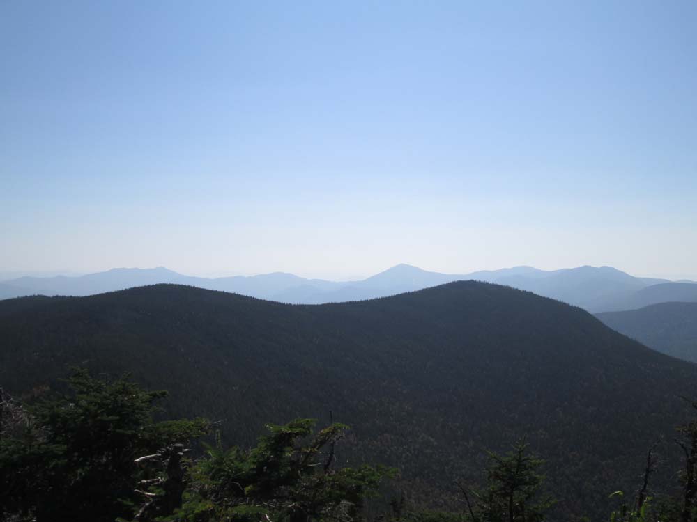
The Sandwich Range as seen from Mt. Hancock's North Peak viewpoint

The Hancock Loop Trail between the peaks

Looking at Mt. Carrigain from the viewpoint near Mt. Hancock's South Peak
Directions to trailhead: Take Route 112 west from Route 16. After going over the pass, continue down hill a bit. The Hancock WMNF fee parking area will be on the left, just before a hairpin turn.
Back to Mt. Hancock (North Peak) Profile
Back to Mt. Hancock (South Peak) Profile
|