Home
States
Colorado
Connecticut
Maine
Massachusetts
New Hampshire
New York
Rhode Island
Utah
Vermont
View All
Lists
NE 4,000 Footers
NE 100 Highest
NH 4,000 Footers
NH 100 Highest
NH 52 With A View
NH Belknap Range
NH Ossipee 10
Links
Trail Conditions
Trip Log
Sunrises
Sunsets
About
|
Mt. Isolation
Jackson, NH, Sargents Purchase, NH, Cutts Grant, NH
Trailheads, measurements, times, distances, and maps are all approximate and relative to the hike(s) as shown below.
The birch glades around the Engine Hill bushwhack
Route: Rocky Branch Trail, (Engine Hill bushwhack), Isolation Trail, (bushwhack), Davis Path, Isolation Spur, (Mt. Isolation), Isolation Spur, Davis Path, (bushwhack), Isolation Trail, (Engine Hill bushwhack), Rocky Branch Trail
Ironically, the only times I've ever turned back without attaining a 4,000 footer have been on the smallest peaks - once attempting Tecumseh due to a thunderstorm, and three times attempting Isolation (the first time in summer due to a knee injury, the second and third times in the winter). Having failed to ascend Isolation twice in one week due to weather and snow conditions, I was growing a bit impatient with the Rocky Branch Trail.
After a long Bonds traverse, I checked the weather forecast and realized I had a half day opening with freshly broken trail. Though tired and a bit sore, I decided I had to go for it. Arriving at the Rocky Branch parking lot, I was quite perturbed to discover that both of my MSR Lightning Ascent snowshoes had broken during the previous day's traverse - the rivets holding the crampon to the binding had failed on each shoe and one of the crampon plates had split. Since I wouldn't be dealing with ice or hardpack, I decided to take my chances and use my repair kit and duct tape if things worsened.
The Rocky Branch portion of the hike went slower than normal, as I was feeling the effects of minimal sleep. Nonetheless, I soon reached the height of land and could see where the Engine Hill bushwhack had been broken out. Though perhaps not as direct as it could be, it was still quite smooth sailing. Reaching the Isolation Trail, I soon saw where some tracks led across the Rocky Branch. Crossing the water, the tracks stopped. Cussing because I thought the group had turned back, I backtracked across the water and pondered whether or not to proceed, until I saw some tracks leading around some spruce. Great success!
The broken out trail continued up the north shore before crossing and reaching some flat ground. While I suspect it meandered from the what seems to be unmarked trail, it soon reached a ridge and I could see where it was turning to ascend to the Davis Path. I could also see where there was a more direct bushwhack broken out and followed that for a few short minutes, reaching the Davis Path without the extra vertical gain and loss.
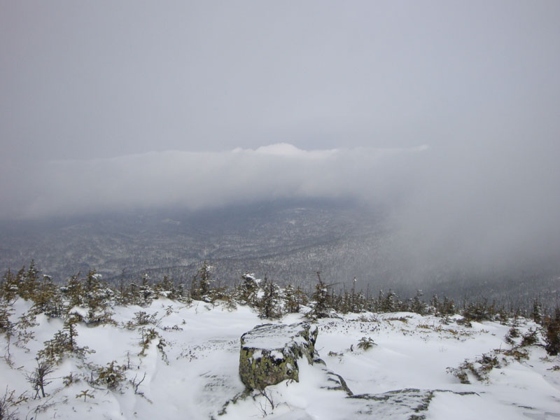
The Davis Path was pretty rough going - the branches were at chest level at best. A glorified spruce bushwhack really. Nonetheless, I could see Isolation in the distance and continued onward and upward. The hike was easy to moderate in terms of pitch up until the final ascent up the spur trail to the summit. Reaching the first cairn, I continued up to the second cairn and summit proper, just as some fog started to roll in from the southeast. The views were rather limited, but nonetheless I could still see into the valley to the west.
The descent was rather smooth sailing, though the ascent up the bushwhack and then up the Rocky Branch Trail was not particularly welcomed by my worn out body. Nonetheless, I reached the parking lot just as the incoming storm started to pick up.
| Hike Ratings |
|
Getting To Trailhead: |
Easy |
| Destination: |
Mt. Isolation |
|
Length: |
Difficult |
|
Steepness: |
Difficult |
|
Navigation: |
Difficult |
|
Views: |
Excellent |
|
Crowds: |
Minimal |
|
| Hike Stats |
|
Date Hiked: |
Sunday, February 22, 2009 |
| Hike Commenced: |
7:07 AM |
| Parking Elevation: |
1,260' |
| Destination: |
Mt. Isolation |
| Ascent Commenced: |
7:07 AM |
| Summit Reached: |
10:29 AM |
| Time Elapsed: |
03:22 |
| Trailhead Elevation: |
1,260' |
| Summit Elevation: |
4,004' |
| Vertical Gain: |
3,034' |
|
|
| Hike Ended: |
1:08 PM |
| Hike Time Elapsed: |
06:01 |
| Hike Vertical Gain: |
3,324' |
|

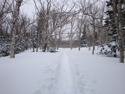
The Rocky Branch Trail trailhead

Looking down the Isolation Trail

Looking toward the Presidentials from near the Mt. Isolation summit


Directions to trailhead: Take Route 16 North from the Route 302-16 junction in Glen. A few minutes having passing Jackson and just before 16 starts to climb to Pinkham Notch, the Rocky Branch parking lot will be on the left. The Rocky Branch Trail trailhead is at the north side of the parking lot.
Back to Mt. Isolation Profile
|