Home
States
Colorado
Connecticut
Maine
Massachusetts
New Hampshire
New York
Rhode Island
Utah
Vermont
View All
Lists
NE 4,000 Footers
NE 100 Highest
NH 4,000 Footers
NH 100 Highest
NH 52 With A View
NH Belknap Range
NH Ossipee 10
Links
Trail Conditions
Trip Log
Sunrises
Sunsets
About
|
Mt. Isolation
Jackson, NH, Sargents Purchase, NH, Cutts Grant, NH
Trailheads, measurements, times, distances, and maps are all approximate and relative to the hike(s) as shown below.
The Rocky Branch Trail
Route: Rocky Branch Trail, (Engine Hill bushwhack), Isolation Trail, Davis Path, Isolation Spur, (Mt. Isolation), Isolation Spur, Davis Path, Isolation Trail, (Engine Hill bushwhack), Rocky Branch Trail
With some comp time saved up, I decided to head up and hike Mt. Isolation for the first time in fall. Leaving the trailhead, light snow was falling under partly sunny skies. By the time I reached the wilderness boundary, there was a fairly consistent dusting of snow on the ground.
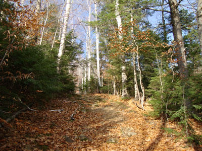
Not long after passing the height of land, I took a right and headed uphill into the woods, reaching the beautiful Engine Hill birch glade bushwhack after climbing a few dozen vertical feet. Since things were a little bit mucky down low, I climbed up further and followed the generally open woods for quite awhile, until finally dropping down a bit and reaching the Isolation Trail just before the third water crossing. I bypassed that and the subsquent re-crossing by following a somewhat steep herd path, and then was soon at the final water crossing, which proved to be a little bit tricky due to a decent water level and some ice on the rocks.
Though I had felt a few strong wind gusts on the Rocky Branch Trail, things were not overly bad as I reached the Davis Path. The short, steep spur path to the summit was a bit slippery due to the snow and a bit of ice, but I was able to nonetheless make it to the top without putting on traction.
The views from the chilly summit were decent - very strong to the east and south, however the Presidentials were in the clouds between Mt. Franklin and Boott Spur.
For the descent, I decided to start the bushwhack partway between the fifth and fourth water crossings on the Isolation Trail. While the terrain was a little bit rocky at first, the woods were still fairly open prior to reaching the birch glades. Once at the birch glades, I followed some herd paths (most likely moose paths) and eventually climbed up to a nice dwarf birch area. While it was tempting to continue to the highpoint of the peak, I wanted to get back before sunset. Unfortunately, I decided to take a beeline of sorts back to the trail and ended up in some steep sprucy areas with a few ledges (had I backtracked slightly before the beeline, I would have had much easier travelling). Nonetheless, I eventually made it back down to the Rocky Branch Trail, between the height of land and wilderness boundary, and then continued down to the parking lot.
| Hike Ratings |
|
Getting To Trailhead: |
Easy |
| Destination: |
Mt. Isolation |
|
Length: |
Difficult |
|
Steepness: |
Difficult |
|
Navigation: |
Difficult |
|
Views: |
Excellent |
|
Crowds: |
Minimal |
|
| Hike Stats |
|
Date Hiked: |
Wednesday, November 4, 2009 |
| Hike Commenced: |
7:58 AM |
| Parking Elevation: |
1,260' |
| Destination: |
Mt. Isolation |
| Ascent Commenced: |
7:58 AM |
| Summit Reached: |
11:23 PM |
| Time Elapsed: |
03:25 |
| Trailhead Elevation: |
1,260' |
| Summit Elevation: |
4,004' |
| Vertical Gain: |
3,039' |
|
|
| Hike Ended: |
2:59 PM |
| Hike Time Elapsed: |
07:01 |
| Hike Vertical Gain: |
3,334' |
|
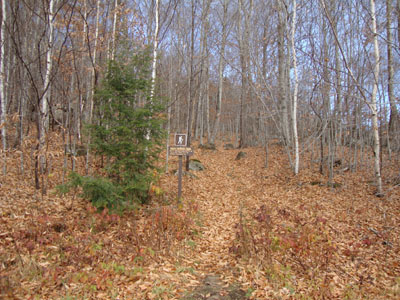
The Rocky Branch Trail trailhead
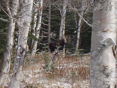
You never know who is watching you!
The vast birch glades of the so-called Engine Hill bushwhack
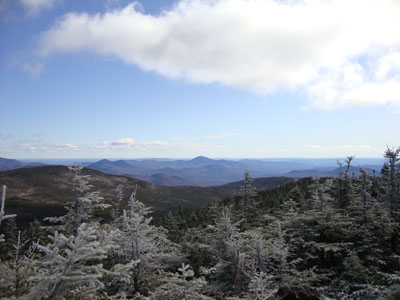
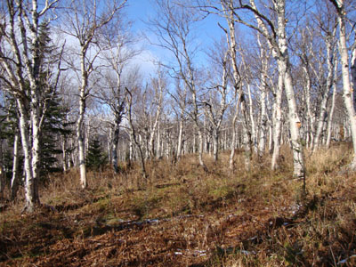
Looking Kearsarge North Mountain from Mt. Isolation
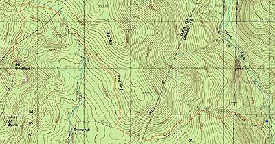

Directions to trailhead: Take Route 16 North from the Route 302-16 junction in Glen. A few minutes having passing Jackson and just before 16 starts to climb to Pinkham Notch, the Rocky Branch parking lot will be on the left. The Rocky Branch Trail trailhead is at the north side of the parking lot.
Back to Mt. Isolation Profile
|


