Home
States
Colorado
Connecticut
Maine
Massachusetts
New Hampshire
New York
Rhode Island
Utah
Vermont
View All
Lists
NE 4,000 Footers
NE 100 Highest
NH 4,000 Footers
NH 100 Highest
NH 52 With A View
NH Belknap Range
NH Ossipee 10
Links
Trail Conditions
Trip Log
Sunrises
Sunsets
About
|
Mt. Isolation
Jackson, NH, Sargents Purchase, NH, Cutts Grant, NH
Trailheads, measurements, times, distances, and maps are all approximate and relative to the hike(s) as shown below.
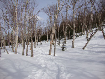
The birch glades around the Engine Hill bushwhack
Route: Rocky Branch Trail, (Engine Hill bushwhack), Isolation Trail, (bushwhack), Davis Path, Isolation Spur, (Mt. Isolation), Isolation Spur, Davis Path, (bushwhack), (Mt. Isolation Southeast Peak), (bushwhack), Davis Path, (bushwhack), Isolation Trail, (Engine Hill bushwhack), Rocky Branch Trail
With a rain storm approaching, I opted to hike Mt. Isolation in the last bit of decent weather.
Still a bit fatigued by hiking the Bonds two days earlier, I was in no hurry for this ascent. Fortunately, the entire route had been broken out, though the Engine Hill bushwhack was broken out a bit lower than I prefer. The water crossing was nicely snowbridged, and the upper portion of the Isolation Trail route, though off course, was fairly easy to climb.
The Davis Path was a bit tight, thanks to the deep snow depths. Reaching the summit, the views were still quite strong - while the south was clouding over, there was still some blueish tint to the north, and the Presidentials were in the clear.
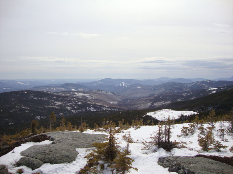
With plenty of time remaining, I decided to go exploring. For a few years, I have been looking at a rocky crag to the southeast of Isolation, visible from the Route 16 corridor, as well as the Engine Hill area. Returning to the Davis Path, I headed south for awhile, soon leaving the trail. After passing over the top of a spruce field, I climbed briefly up to a ridge, then pushed east, popping out on top of the rocky crag.
From this alpine zone, there were 270+ degree views, ranging from Mt. Isolation proper, Mt. Washington, Kearsarge North, and the Sandwich Range.
While it was tempting to bushwhack down from this peak, I opted to return via my tracks.
| Hike Ratings |
|
Getting To Trailhead: |
Easy |
| Destination: |
Mt. Isolation |
|
Length: |
Difficult |
|
Steepness: |
Difficult |
|
Navigation: |
Difficult |
|
Views: |
Excellent |
|
Crowds: |
Moderate |
|
| Hike Stats |
|
Date Hiked: |
Saturday, March 13, 2010 |
| Hike Commenced: |
7:25 AM |
| Parking Elevation: |
1,260' |
| Destination: |
Mt. Isolation |
| Ascent Commenced: |
7:25 AM |
| Summit Reached: |
10:57 AM |
| Time Elapsed: |
03:32 |
| Trailhead Elevation: |
1,260' |
| Summit Elevation: |
4,004' |
| Vertical Gain: |
3,054' |
|
|
| Hike Ended: |
2:22 PM |
| Hike Time Elapsed: |
06:57 |
| Hike Vertical Gain: |
3,544' |
|
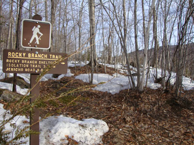
The Rocky Branch Trail trailhead
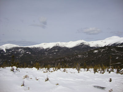
Looking the Southern Presidentials from Mt. Isolation
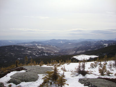
Looking down the Rocky Branch Valley from a ledgy crag southeast of Mt. Isolation

Directions to trailhead: Take Route 16 North from the Route 302-16 junction in Glen. A few minutes having passing Jackson and just before 16 starts to climb to Pinkham Notch, the Rocky Branch parking lot will be on the left. The Rocky Branch Trail trailhead is at the north side of the parking lot.
Back to Mt. Isolation Profile
|