Home
States
Colorado
Connecticut
Maine
Massachusetts
New Hampshire
New York
Rhode Island
Utah
Vermont
View All
Lists
NE 4,000 Footers
NE 100 Highest
NH 4,000 Footers
NH 100 Highest
NH 52 With A View
NH Belknap Range
NH Ossipee 10
Links
Trail Conditions
Trip Log
Sunrises
Sunsets
About
|
Mt. Israel
Sandwich, NH
Trailheads, measurements, times, distances, and maps are all approximate and relative to the hike(s) as shown below.
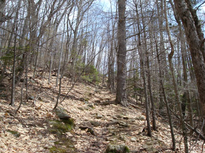
Looking up the Wentworth Trail
Route: Wentworth Trail
The forecast was for a mostly sunny day. Since there had been snow up north, I decided to stay local and take advantage of the good weather.
Arriving at the trailhead, I was a bit perturbed to see solid clouds moving overhead - mostly sunny, huh?
The first portion of the trail was a bit wet from the recent rainfall, however the balance of the ascent was somewhat dry. Upon clearing the top of the ascent and heading into the flatter portions of the trail, there were pockets of snow, pooled water, and ice. As I was crossing through this portion of the trail, it started snowing!
The views from the summit, despite the clouds, were still strong - the Sandwich Dome, Mt. Whiteface, and Mt. Passaconaway were all white.
The descent wasn't really noteworthy - though I was able to clean up a few blowdowns.
| Hike Ratings |
|
Getting To Trailhead: |
Easy |
| Destination: |
Mt. Israel |
|
Length: |
Moderate |
|
Steepness: |
Moderate |
|
Navigation: |
Easy |
|
Views: |
Excellent |
|
Crowds: |
Minimal |
|
| Hike Stats |
|
Date Hiked: |
Wednesday, April 30, 2008 |
| Hike Commenced: |
11:39 AM |
| Parking Elevation: |
940' |
| Destination: |
Mt. Israel |
| Ascent Commenced: |
11:40 AM |
| Summit Reached: |
12:43 PM |
| Time Elapsed: |
01:03 |
| Trailhead Elevation: |
950' |
| Summit Elevation: |
2,630' |
| Distance: |
2.1 miles |
| Vertical Gain: |
1,780' |
|
|
| Hike Ended: |
1:59 PM |
| Hike Time Elapsed: |
02:20 |
| Hike Distance: |
4.2 miles |
| Hike Vertical Gain: |
1,890' |
|
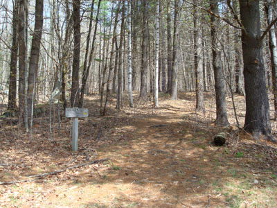
Wentworth Trail trailhead at the Mead Base Camp
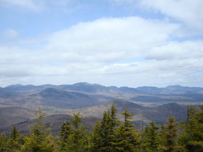
Looking north-northeast at Mt. Tripyramid, Flat Mountain, and Mt. Whiteface from the Mt. Israel summit
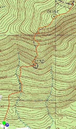

Directions to trailhead: Take Route 109 into Center Sandwich. Route 113 will enter on your right and bear left shortly thereafter. Go straight onto Grove Street instead, bear left onto Diamond Ledge Road. Parking at the Mead Camp.
Back to Mt. Israel Profile
|

