Home
States
Colorado
Connecticut
Maine
Massachusetts
New Hampshire
New York
Rhode Island
Utah
Vermont
View All
Lists
NE 4,000 Footers
NE 100 Highest
NH 4,000 Footers
NH 100 Highest
NH 52 With A View
NH Belknap Range
NH Ossipee 10
Links
Trail Conditions
Trip Log
Sunrises
Sunsets
About
|
Mt. Jefferson
Thompson and Meserve's Purchase, NH
Trailheads, measurements, times, distances, and maps are all approximate and relative to the hike(s) as shown below.
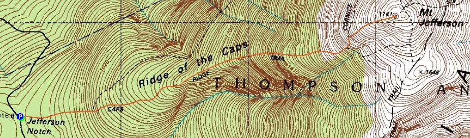
The Caps Ridge Trail
Route: Caps Ridge Trail
I had been waiting for some time for a good opportunity to hike up Mt. Jefferson to see the sunset. Knowing that Jefferson Notch Road won't be open much longer if winter continues to make its presence known, I decided to roll the dice and give it a go with a potentially decent forecast - winds were to be mild, skies mostly sunny, and the summits free of clouds.
It didn't quite work out that way, though. The mostly sunny day was mostly cloudy pretty much beginning to end, and the higher summits were covered with clouds for much of it. Nonetheless, it looked like the cearly was going north to south, so it seemed like I had an opening.
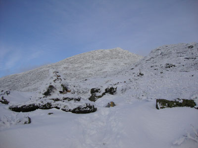
The Caps Ridge Trail was covered with snow (and some ice) immediately. First Microspikes hike of the fall. As I worked my way through the woods portion of the trail, I could see the clouds lifting - not a bad sign. In addition, the winds were very mild.
Reaching treeline, the scrambles were a bit tricky - snow and black ice worked into the ledges. Nonetheless, with some creative footwork, I was able to get up and over the Caps.
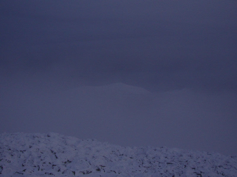
The talus slopes were quite vexing, as the holes were seemingly filled in with snow. In addition, the cairns and blazes were obscured by rime. Nearing the summit, I noticed the wind direction had changed - and was suddenly ushering in fog from the east. Fortunately, I had been wiping cairns on the ascent, to make the descent easier to follow.
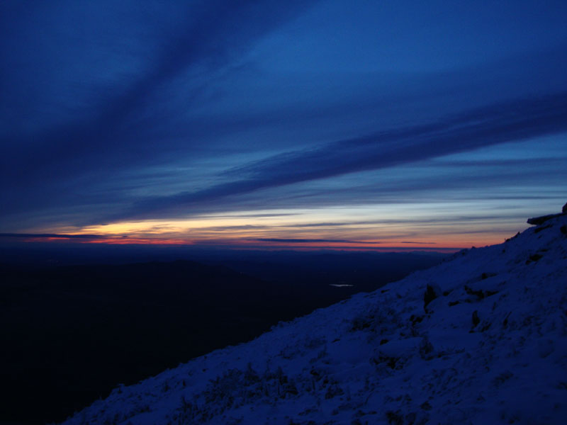
I didn't end up having much in way of views from the summit due to the new fog, though Washington was poking through the undercast. Thus, I decided to descend a bit to see a quasi-sunset display (the sun had set into a bank of clouds, but just to the north of it was clear).
This didn't go well, though. A few hundred feet from the summit, I slipped into one of the covered traprock holes and ended up landing on my knee (on a sharp rock) with all of my weight. After a loud yell, I kept on moving, knowing that no good would come out of standing still and assessing the pain. As I worked my way down the trap rock field, I could feel the swelling increase, as well as a red spot on the knee portion of my pants.
The colors on the horizon were pretty neat - reds and oranges with other colors up high. In addition, the lights throughout the valley were quite a sight. Finally making it over the Caps and dropping into the woods, the adrenaline wore off, revealing quite a bit of pain. Nonetheless, I was able to make it back to the parking lot in one piece, albeit quite sore.
| Hike Ratings |
|
Getting To Trailhead: |
Easy |
| Destination: |
Mt. Jefferson |
|
Length: |
Moderate |
|
Steepness: |
Very Difficult |
|
Navigation: |
Difficult |
|
Views: |
Excellent |
|
Crowds: |
Minimal |
|
| Hike Stats |
|
Date Hiked: |
Thursday, October 15, 2009 |
| Hike Commenced: |
3:58 PM |
| Parking Elevation: |
3,009' |
| Destination: |
Mt. Jefferson |
| Ascent Commenced: |
3:58 PM |
| Summit Reached: |
5:47 PM |
| Time Elapsed: |
01:49 |
| Trailhead Elevation: |
3,009' |
| Summit Elevation: |
5,712' |
| Distance: |
2.5 miles |
| Vertical Gain: |
2,768' |
|
|
| Hike Ended: |
7:45 PM |
| Hike Time Elapsed: |
03:47 |
| Hike Distance: |
5 miles |
| Hike Vertical Gain: |
2,833' |
|
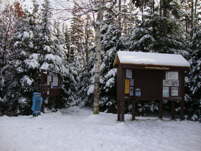
Caps Ridge Trail trailhead at Jefferson Notch
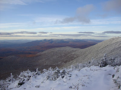
The Pliny Range, as seen from the Caps Ridge Trail
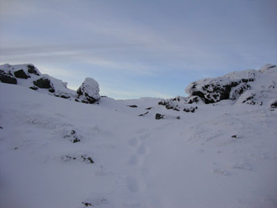
The Caps Ridge Trail
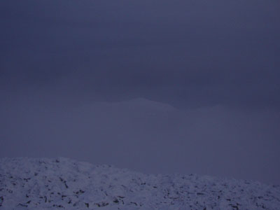
Looking at Mt. Washington from Mt. Jefferson
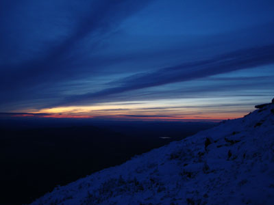
Sunset colors as seen from near the summit Mt. Jefferson
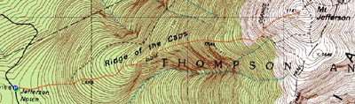

Directions to trailhead: Take Route 302 West from Bartlett into Carroll. Just after Saco Lake, take a right onto Mt. Clinton Road. Cross over Base Road and continue on Jefferson Notch Road. At the high point of the road, the WMNF fee parking lot will be on the right. The Caps Ridge Trail trailhead is at the back of the parking lot.
Back to Mt. Jefferson Profile
|