Home
States
Colorado
Connecticut
Maine
Massachusetts
New Hampshire
New York
Rhode Island
Utah
Vermont
View All
Lists
NE 4,000 Footers
NE 100 Highest
NH 4,000 Footers
NH 100 Highest
NH 52 With A View
NH Belknap Range
NH Ossipee 10
Links
Trail Conditions
Trip Log
Sunrises
Sunsets
About
|
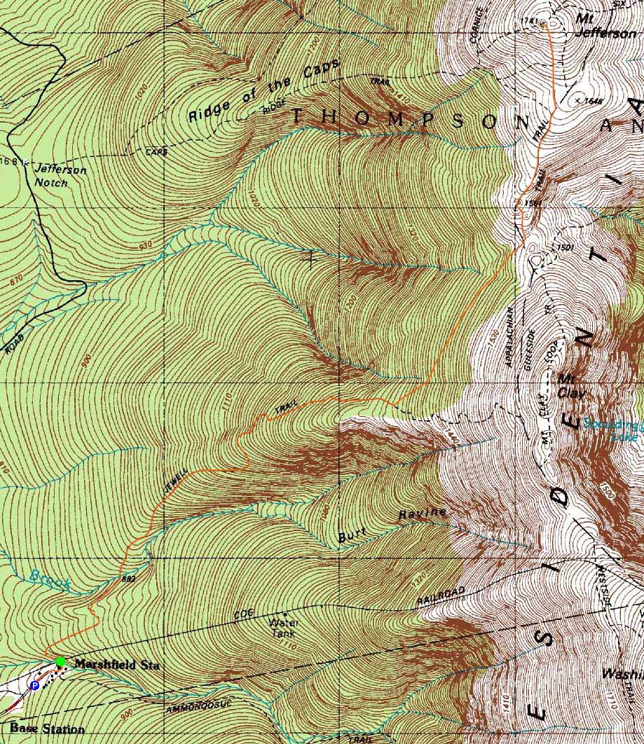
Mt. Jefferson
Thompson and Meserve's Purchase, NH
Trailheads, measurements, times, distances, and maps are all approximate and relative to the hike(s) as shown below.

Cutting across snowfields below Gulfside on the way to Mt. Jefferson
Route: Jewell Trail, snowfields (Mt. Jefferson), snowfields, Jewell Trail
Last minute plan, cold start, but warmer as the day went. Despite having very little snow at the base, there was enough to cut across snowfields above treeline without risking damage to vegetation.
| Hike Ratings |
|
Getting To Trailhead: |
Easy |
| Destination: |
Mt. Jefferson |
|
Length: |
Moderate |
|
Steepness: |
Difficult |
|
Navigation: |
Moderate |
|
Views: |
Excellent |
|
Crowds: |
Moderate |
|
| Hike Stats |
|
Date Hiked: |
Sunday, January 22, 2012 |
| Parking Elevation: |
2,650' |
| Destination: |
Mt. Jefferson |
| Time Elapsed: |
03:00 |
| Trailhead Elevation: |
2,710' |
| Summit Elevation: |
5,712' |
| Vertical Gain: |
3,152 |
|
|
| Hike Time Elapsed: |
05:57 |
| Hike Vertical Gain: |
3,382' |
|

The new (2011) Jewell Trail trailhead near the Marshfield Base Station

Looking back at Clay and Washington on Gulfside

Looking at Carter Dome from Mt. Jefferson


Directions to trailhead: To get to the Cog Base Station in winter, take 302 West from Crawford Notch, then take a right onto Base Station Road. In winter 2012, there was plowed parking available below the Cog Base Station. Looking up the mountain from the parking lot, the spur trail to the Jewell Trail begins above the base station building, above the first Cog track bridge crossing, to the left at the top of an embankment.
Back to Mt. Jefferson Profile
|