Home
States
Colorado
Connecticut
Maine
Massachusetts
New Hampshire
New York
Rhode Island
Utah
Vermont
View All
Lists
NE 4,000 Footers
NE 100 Highest
NH 4,000 Footers
NH 100 Highest
NH 52 With A View
NH Belknap Range
NH Ossipee 10
Links
Trail Conditions
Trip Log
Sunrises
Sunsets
About
|
Mt. Mack, Mt. Klem
Gilmanton, NH, Gilford, NH
Trailheads, measurements, times, distances, and maps are all approximate and relative to the hike(s) as shown below.

Looking up Orange Trail on the Mack Ridge
Route: Red/Blue Trail, Orange Trail, Red/Orange Trail, (Mt. Mack), Red Trail, herd path, (Mt. Klem), herd path, Red Trail, Round Pond Road, Red/Blue Trail
Trails were mostly dry and in good shape. Other than on the roadwalks, we saw very few people on the trails. A nice, quiet area, whereas I suspect nearby peaks like Mt. Major were probably mobbed.
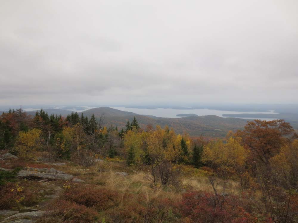
Overcast skies never cleared and views remained hazy, but no rain. Nice foliage colors throughout the hike.
| Hike Ratings |
|
Getting To Trailhead: |
Easy |
| Destination: |
Mt. Mack |
|
Length: |
Moderate |
|
Steepness: |
Difficult |
|
Navigation: |
Moderate |
|
Views: |
Excellent |
|
Crowds: |
Heavy |
| Destination: |
Mt. Klem |
|
Length: |
Moderate |
|
Steepness: |
Difficult |
|
Navigation: |
Moderate |
|
Views: |
Excellent |
|
Crowds: |
Minimal |
|
| Hike Stats |
|
Date Hiked: |
Sunday, October 13, 2013 |
| Parking Elevation: |
740' |
| Destination: |
Mt. Mack |
| Time Elapsed: |
02:00 |
| Trailhead Elevation: |
740' |
| Summit Elevation: |
1,945' |
| Distance: |
3.2 miles |
| Vertical Gain: |
1,365' |
| Destination: |
Mt. Klem |
| Time Elapsed: |
00:17 |
| Trailhead Elevation: |
1,945' |
| Summit Elevation: |
2,001' |
| Distance: |
0.8 mile |
| Vertical Gain: |
266' |
|
|
| Hike Time Elapsed: |
04:20 |
| Hike Vertical Gain: |
1,741' |
|

The Red-Blue Trail trailhead at Camp Bell

Looking at Piper and Belknap from near the Mt. Mack summit

The trail between Mt. Mack and Mt. Klem

Looking at Lake Winnipesaukee near the Mt. Klem summit

Round Pond
Directions to trailhead: From Route 107, take Route 140 east into Gilmanton. Take a left onto Crystal Lake Road, bearing left to stay on it (when Mountain Road goes straight). After passing Crystal Lake, the road turns into Guinea Ridge Road. Take a right next to some cabins onto Manning Lake Road (this is inaccurately labelled as Camp Leo Road and Moulton Road on some maps...the current road sign says Manning Lake Road). There is a small parking area on the left just before reaching the area with the camp buildings. The Red-Blue Trail starts at the bridge just beyond the main building, in the form of a dirt road. When camp is in session, visitors should sign in at the main building.
Back to Mt. Mack Profile
Back to Mt. Klem Profile
|