Home
States
Colorado
Connecticut
Maine
Massachusetts
New Hampshire
New York
Rhode Island
Utah
Vermont
View All
Lists
NE 4,000 Footers
NE 100 Highest
NH 4,000 Footers
NH 100 Highest
NH 52 With A View
NH Belknap Range
NH Ossipee 10
Links
Trail Conditions
Trip Log
Sunrises
Sunsets
About
|
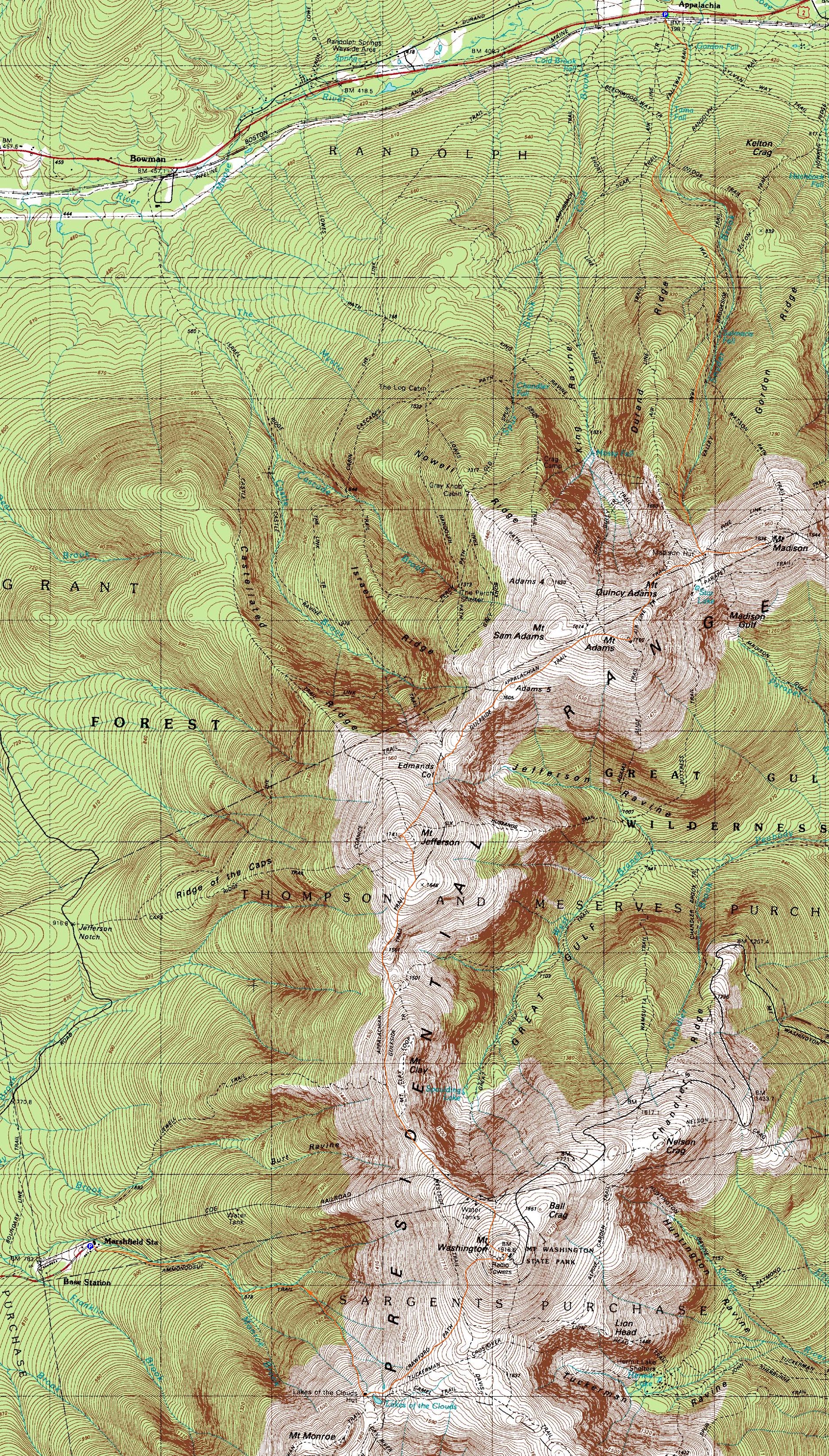
Mt. Madison, Mt. Adams, Mt. Jefferson, Mt. Washington
Bean's Grant, NH, Chandler's Purchase, NH
Trailheads, measurements, times, distances, and maps are all approximate and relative to the hike(s) as shown below.
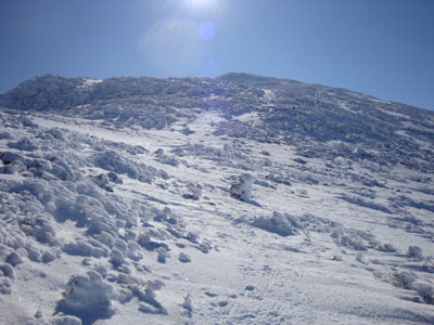
Looking up the Osgood Trail on the way to Mt. Madison
Route: Valley Way, Osgood Trail, (Mt. Madison), Osgood Trail, Gulfside Trail, Air Line Trail, (Mt. Adams), Lowe's Path, Israel Ridge Trail, Gulfside Trail, Jefferson Loop, (Mt. Jefferson), Jefferson Loop, Gulfside Trail, (Mt. Washington), Crawford Path, Ammonoosuc Ravine Trail
Finally, after waiting for weeks to get Presidential weather, the forecast looked good. After spotting a car at the base of the Cog Railroad, we headed up to Appalachia.
Having been down Valley Way a few times but never up it, I found the upper portions to drag on. While the trail was barebootable, I settled for snowshoes, as I didn't want to have to carry them on my pack.
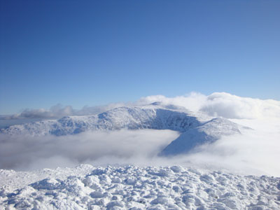
Climbing through some clouds, I arrived at the hut in an awesome undercast. After dropping my snowshoes, we worked our way up to Mt. Madison. Microspikes were adequate enough to make it up the Osgood Trail. The views were stunning - a puffy undercast as far as the eye could see to the north, with Adams and Washington peaking out from the west and southwest.
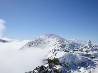
Back at the hut, I decided to just wear a tee shirt for the next part of the hike, as I was burning up in the tropical February weather - it must have been close to 30 degrees! The ascent up Adams dragged on a bit, as it was my fourth day in a row of 4,000 footer-calibre hiking. Fortunately, due to the snow, the traprock field that is the upper Air Line was pretty smooth sailing. The views from the top of Adams were fantastic - undercast still in effect, blue sky overhead.
Our next stop was Jefferson. As we descended toward Edmands Col, we dipped into the clouds for a bit - a brief, chilly, and snowy reminder that it was still February! As we climbed to Jefferson, we were basically making our way up an open snowfield. Though we were using Microspikes, one would have certainly needed crampons to safely descend.
Jefferon's views were even more impressive than the previous two peaks - undercast as far as the eye could see to the west and north, a bowl of clouds in the gulf, and the Franconia Ridge sticking up in the distance. Short sleeve shirt weather with blue skies and no winds. Amazing.
Since we were running behind schedule, we had to try and pick up the pace a bit for the next leg of the journey. Dripping into the col between Jefferson and Clay, we were once again in snow clouds with somewhat poor visibility. As we started to ascend again, however, we pulled back into the clear. Once again, amazing views. While none of the terrain was particularly steep, it was nonetheless a bit of a slog to get up to Mt. Washington. Just prior to the summit, a bank of clouds lift and quickly approached and overtook us. Time to add winter layers!
Arriving at the summit, we were socked in to the west, but there were still some views toward the northeast. After a few short minutes, we headed toward the Crawford Path.
As we reached the Crawford Path, the sun was starting to set into the clouds - an absolutely amazing site with the undercast. As we descended, the horizon started to light up - for a few minutes, the western side of the mountain turned pink. Dropping down toward the hut, we were treated to an amazing display of orange, with a few more higher peaks sneaking above the clouds to the southwest.
While I was hoping to make it over to Monroe for the tail end of the sunset, we hit a nasty sidehill on the Crawford Path. While we could slowly make our way across it with Microspikes and an ice axe, we decided to take the time to switch over to crampons, as to reduce the chances of sliding to our demise. This took awhile, as we had no nearby flat place to comfortable sit or put down our packs.
Finally on our way, we heard a thunderous noise coming from near the hut. As we approached, we realized it was water - an ice dam had likely broken at one of the Lakes of Clouds. As such, the we were now faced with dozens of feet of water crossings - not something we had expected! After taking a few minutes to search for the best place to cross, we finally hopped across a wider, more shallow area.
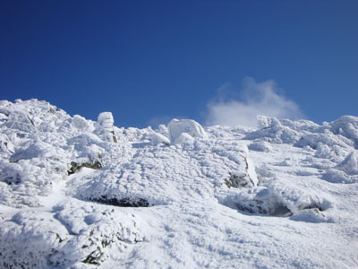
The front of the hut was dramatically drifted - the snow led in a consistent grade all the way to the pitch of the roof!
On the Ammonoosuc Ravine Trail below the hut, we stumbled into more water problems - water was gurggling up onto the trail for a few hundred feet, forcing us to find a way around it. Below there, we took our time descending over glissaded trail in our crampons, finally reaching the flats after a few thousand vertical feet. Once there, I eagerly took off my crampons. It was along process, however, as the water situation had frozen them to my boot.
The flats seemed to drag on forever - though forever was a relative term, as we were happy to be able to shave off a fraction of a mile by heading to the Cog Base Station, as opposed to the normal summertime parking lot. Once there, the views in the distance were quite neat, with the profile of Bretton Woods lit up.
Easily the most scenic day I've ever had in the Presidentials.
| Hike Ratings |
|
Getting To Trailhead: |
Easy |
| Destination: |
Mt. Madison |
|
Length: |
Moderate |
|
Steepness: |
Difficult |
|
Navigation: |
Moderate |
|
Views: |
Excellent |
|
Crowds: |
Moderate |
| Destination: |
Mt. Adams |
|
Length: |
Moderate |
|
Steepness: |
Difficult |
|
Navigation: |
Moderate |
|
Views: |
Excellent |
|
Crowds: |
Moderate |
| Destination: |
Mt. Jefferson |
|
Length: |
Difficult |
|
Steepness: |
Very Difficult |
|
Navigation: |
Moderate |
|
Views: |
Excellent |
|
Crowds: |
Minimal |
| Destination: |
Mt. Washington |
|
Length: |
Very Difficult |
|
Steepness: |
Difficult |
|
Navigation: |
Moderate |
|
Views: |
Excellent |
|
Crowds: |
Moderate |
|
| Hike Stats |
|
Date Hiked: |
Monday, February 16, 2009 |
| Hike Commenced: |
8:52 AM |
| Parking Elevation: |
1,311' |
| Destination: |
Mt. Madison |
| Ascent Commenced: |
8:52 AM |
| Summit Reached: |
11:58 AM |
| Time Elapsed: |
03:06 |
| Trailhead Elevation: |
1,311' |
| Summit Elevation: |
5,367' |
| Vertical Gain: |
4,186' |
| Destination: |
Mt. Adams |
| Ascent Commenced: |
12:03 PM |
| Summit Reached: |
1:29 PM |
| Time Elapsed: |
01:26 |
| Trailhead Elevation: |
5,367' |
| Summit Elevation: |
5,774' |
| Vertical Gain: |
989' |
| Destination: |
Mt. Jefferson |
| Ascent Commenced: |
1:35 PM |
| Summit Reached: |
2:59 PM |
| Time Elapsed: |
01:24 |
| Trailhead Elevation: |
5,774' |
| Summit Elevation: |
5,712' |
| Vertical Gain: |
889' |
| Destination: |
Mt. Washington |
| Ascent Commenced: |
3:02 PM |
| Summit Reached: |
4:53 PM |
| Time Elapsed: |
01:51 |
| Trailhead Elevation: |
5,712' |
| Summit Elevation: |
6,288' |
| Vertical Gain: |
1,498' |
|
|
| Hike Ended: |
7:29 PM |
| Hike Time Elapsed: |
10:37 |
| Hike Vertical Gain: |
7,562' |
|
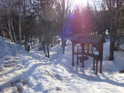
Valley Way Trail trailhead at Appalachia
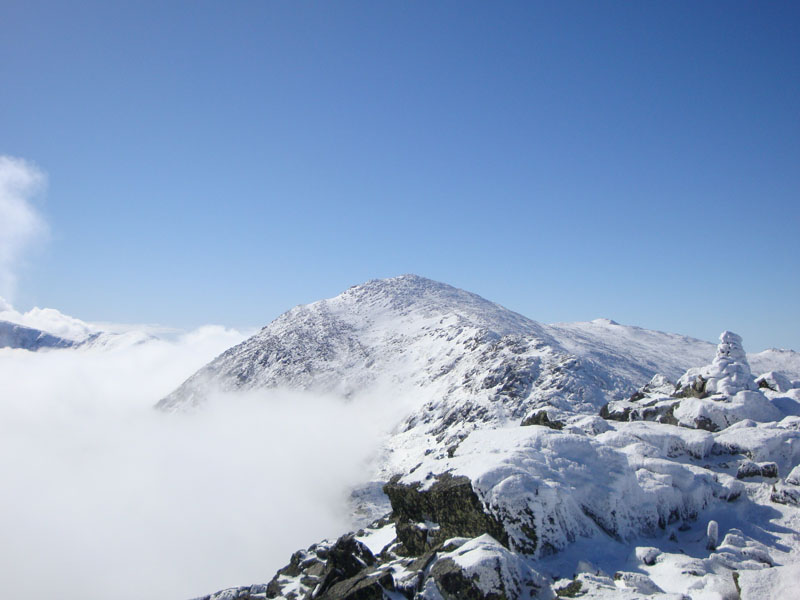
Looking at Mt. Adams from Mt. Madison
Looking up the the Air Line Trail on the way to Mt. Adams

Looking northwest at the undercast from Mt. Adams
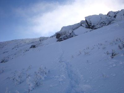
Looking up the Gulfside Trail on the way to Mt. Jefferson
Looking at Mt. Washington from Mt. Jefferson

Looking up the Gulfside Trail on the way to Mt. Washington

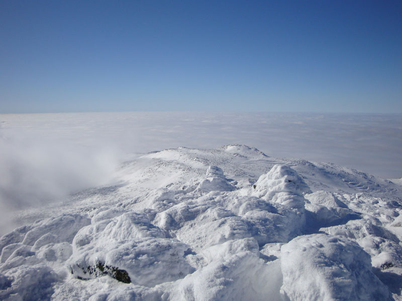
Looking at the Northern Presidentials from Mt. Washington

The sunset as seen from near the summit of Mt. Washington

Heading down the Crawford Path from Mt. Washington

The sunset as seen from near the summit of Mt. Washington

Directions to trailhead: To get to the Cog Base Station in winter, take 302 West from Crawford Notch, then take a right onto Base Station Road. In winter 2008-09, there was plowed parking available at the Cog Base Station. To get to Appalachia from there, return to 302, then take US 3 North to 115, then US 2 East to the Appalachia parking lot and trailhead.
Back to Mt. Madison Profile
Back to Mt. Adams Profile
Back to Mt. Jefferson Profile
Back to Mt. Washington Profile
|