Home
States
Colorado
Connecticut
Maine
Massachusetts
New Hampshire
New York
Rhode Island
Utah
Vermont
View All
Lists
NE 4,000 Footers
NE 100 Highest
NH 4,000 Footers
NH 100 Highest
NH 52 With A View
NH Belknap Range
NH Ossipee 10
Links
Trail Conditions
Trip Log
Sunrises
Sunsets
About
|
Mt. Major
Alton, NH
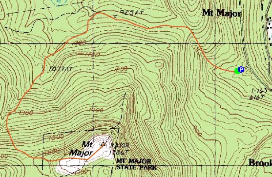
Trailheads, measurements, times, distances, and maps are all approximate and relative to the hike(s) as shown below.

Looking down the Major/Straightback Link Trail on the way to the Mt. Major summit
Route: Mt. Major Trail, Brook Trail, Major/Straightback Link, (Mt. Major), Major/Straightback Link, Brook Trail, Mt. Major Trail
Daylight was a bit limited, but I was determined to get a hike in. Fortunately, the Mt. Major parking lot is well plowed.
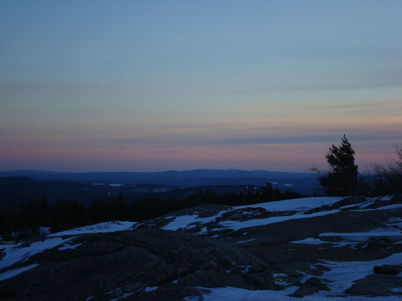
The Mt. Major Main Trail was decently packed for snowshoeing. I continued onto the Brook Trail, which is flat to moderate in pitch before arriving at the Straightback/Major Link intersection. From here, I had to break trail up to the ledges. Again, the trail is flat to moderate in pitch. The setting sun provided some great colors.
I had the summit to myself for the sunset. Not overly cold.
The descent didn't require me to turn on my headlamp, as the light from the half moon provided all I needed.
| Hike Ratings |
|
Getting To Trailhead: |
Easy |
| Destination: |
Mt. Major |
|
Length: |
Moderate |
|
Steepness: |
Moderate |
|
Navigation: |
Easy |
|
Views: |
Excellent |
|
Crowds: |
Minimal |
|
| Hike Stats |
|
Date Hiked: |
Tuesday, December 18, 2007 |
| Hike Commenced: |
2:56 PM |
| Parking Elevation: |
585' |
| Destination: |
Mt. Major |
| Ascent Commenced: |
2:57 PM |
| Summit Reached: |
4:04 PM |
| Time Elapsed: |
01:07 |
| Trailhead Elevation: |
600' |
| Summit Elevation: |
1,786' |
| Distance: |
2.4 miles |
| Vertical Gain: |
1,271' |
|
|
| Hike Ended: |
5:23 PM |
| Hike Time Elapsed: |
02:27 |
| Hike Distance: |
4.8 miles |
| Hike Vertical Gain: |
1,361' |
|

The Mt. Major Trail trailhead at the back of the Route 11 parking lot

Looking south from the Mt. Major summit

The sunset over Straightback Mountain as seen from the Mt. Major summit


Directions to trailhead: Take Route 11 West (north in reality) from Alton Bay. Parking lot and trailhead are on the left after the blasted out section of Route 11.
Back to Mt. Major Profile
|