Home
States
Colorado
Connecticut
Maine
Massachusetts
New Hampshire
New York
Rhode Island
Utah
Vermont
View All
Lists
NE 4,000 Footers
NE 100 Highest
NH 4,000 Footers
NH 100 Highest
NH 52 With A View
NH Belknap Range
NH Ossipee 10
Links
Trail Conditions
Trip Log
Sunrises
Sunsets
About
|
Mt. Major
Alton, NH
Trailheads, measurements, times, distances, and maps are all approximate and relative to the hike(s) as shown below.

Looking up the Beeline Trail
Route: Boulder Loop, Beeline Trail, Mt. Major Trail, (Mt. Major), Brook Trail
Probably 20-30" of powder throughout, with some larger drifts, as well as some exposed ledge and blue ice.
Beeline Trail (near beginning of Boulder Loop) had been booted, but wasn't packed out. Snowshoes needed for it.
The ledges on the Blue Mt. Major Main Trail were icy, but I was able to get up them with my Flex Alps snowshoes. Main Trail wasn't broken out initially, but a group descended it with snowshoes, so it's probably well packed now.
Brook Trail had a good snowshoe track on it. Some folks were booting as well, but it seemed a little marginal still. Boulder Loop was also tracked out and some folks were able to boot it with light traction.
I wore snowshoes roundtrip and found them to be ideal. A few areas were a little bony due to lack of base underneath the powder.
| Hike Ratings |
|
Getting To Trailhead: |
Easy |
| Destination: |
Mt. Major |
|
Length: |
Moderate |
|
Steepness: |
Difficult |
|
Navigation: |
Moderate |
|
Views: |
Excellent |
|
Crowds: |
Moderate |
|
| Hike Stats |
|
Date Hiked: |
Sunday, February 10, 2013 |
| Parking Elevation: |
590' |
| Destination: |
Mt. Major |
| Time Elapsed: |
00:52 |
| Trailhead Elevation: |
600' |
| Summit Elevation: |
1,786' |
| Vertical Gain: |
1,196' |
|
|
| Hike Time Elapsed: |
01:59 |
| Hike Vertical Gain: |
1,291' |
|

The Boulder Loop Trail trailhead at the back of the Route 11 parking lot

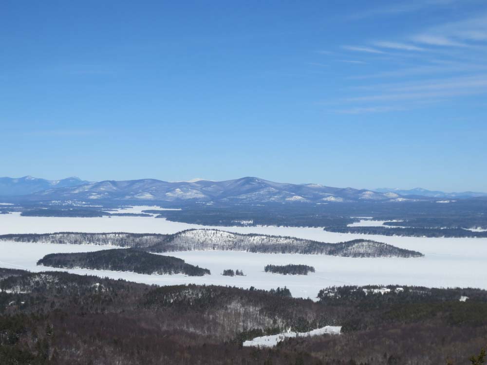
Looking at the Ossipees and Mt. Washington from Mt. Major

Snow drifts near the summit


Directions to trailhead: Take Route 11 West (north in reality) from Alton Bay. Parking lot and trailhead are on the left after the blasted out section of Route 11.
Back to Mt. Major Profile
|