Home
States
Colorado
Connecticut
Maine
Massachusetts
New Hampshire
New York
Rhode Island
Utah
Vermont
View All
Lists
NE 4,000 Footers
NE 100 Highest
NH 4,000 Footers
NH 100 Highest
NH 52 With A View
NH Belknap Range
NH Ossipee 10
Links
Trail Conditions
Trip Log
Sunrises
Sunsets
About
|
Mt. Major
Alton, NH
Trailheads, measurements, times, distances, and maps are all approximate and relative to the hike(s) as shown below.
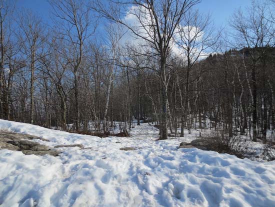
Looking up the Mt. Major Trail
Route: Mt. Major Trail, (Mt. Major), Mt. Major Trail
Initial portion of the trail was mostly snow free with some minor mud. Approaching the Mt. Major/Brook Trail junction, snowpack commences. Enough bareboot traffic has passed through that snowshoes will not be needed for Mt. Major Trail unless we get more snow. The ledges are a bit icy, though they could be navigated with care without traction in warm temperatures. Traction of some sort would be absolutely necessary in the early morning hours.
| Hike Ratings |
|
Getting To Trailhead: |
Easy |
| Destination: |
Mt. Major |
|
Length: |
Moderate |
|
Steepness: |
Difficult |
|
Navigation: |
Easy |
|
Views: |
Excellent |
|
Crowds: |
Moderate |
|
| Hike Stats |
|
Date Hiked: |
Friday, April 5, 2013 |
| Parking Elevation: |
585' |
| Destination: |
Mt. Major |
| Time Elapsed: |
00:44 |
| Trailhead Elevation: |
600' |
| Summit Elevation: |
1,786' |
| Distance: |
1.75 miles |
| Vertical Gain: |
1,211' |
|
|
| Hike Time Elapsed: |
01:39 |
| Hike Distance: |
3.5 miles |
| Hike Vertical Gain: |
1,276 |
|
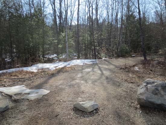
The Mt. Major Trail trailhead at the back of the Route 11 parking lot
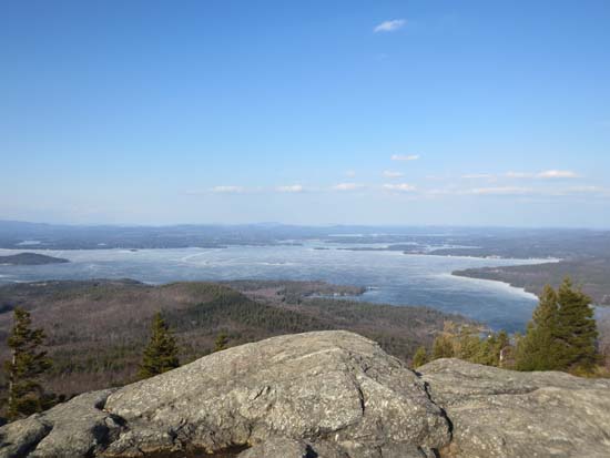
Looking toward Wolfeboro from Mt. Major
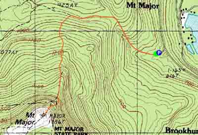

Directions to trailhead: Take Route 11 West (north in reality) from Alton Bay. Parking lot and trailhead are on the left after the blasted out section of Route 11.
Back to Mt. Major Profile
|

