Home
States
Colorado
Connecticut
Maine
Massachusetts
New Hampshire
New York
Rhode Island
Utah
Vermont
View All
Lists
NE 4,000 Footers
NE 100 Highest
NH 4,000 Footers
NH 100 Highest
NH 52 With A View
NH Belknap Range
NH Ossipee 10
Links
Trail Conditions
Trip Log
Sunrises
Sunsets
About
|
Mt. Martha
Carroll, NH
Trailheads, measurements, times, distances, and maps are all approximate and relative to the hike(s) as shown below.

Looking up the Cherry Mountain Trail
Route: Cherry Mountain Trail, Mt. Martha Spur Trail, (Mt. Martha), Mt. Martha Spur Trail, Cherry Mountain Trail
Not too much snow via this route. I wore snowshoes roundtrip, but if I were to do this one again tomorrow, I'd boot it, perhaps with light traction. Might be a nice snowshoe if we get some snow on Wednesday.
1-3" of snowpack down low (1-2" of powder, an inch or two of crud underneath), increasing to a little over half a foot on the snowmobile packed spur trail to the summit. Also observed snowmobile tracks on Martha's Mile. They turned back after a few hundred feet.
| Hike Ratings |
|
Getting To Trailhead: |
Easy |
| Destination: |
Mt. Martha |
|
Length: |
Moderate |
|
Steepness: |
Moderate |
|
Navigation: |
Easy |
|
Views: |
Excellent |
|
Crowds: |
Minimal |
|
| Hike Stats |
|
Date Hiked: |
Tuesday, February 3, 2014 |
| Parking Elevation: |
1,660' |
| Destination: |
Mt. Martha |
| Time Elapsed: |
00:54 |
| Trailhead Elevation: |
1,660' |
| Summit Elevation: |
3,573' |
| Distance: |
1.9 miles |
| Vertical Gain: |
1,933' |
|
|
| Hike Time Elapsed: |
01:53 |
| Hike Distance: |
3.8 miles |
| Hike Vertical Gain: |
1,953' |
|

The Cherry Mountain Trail trailhead

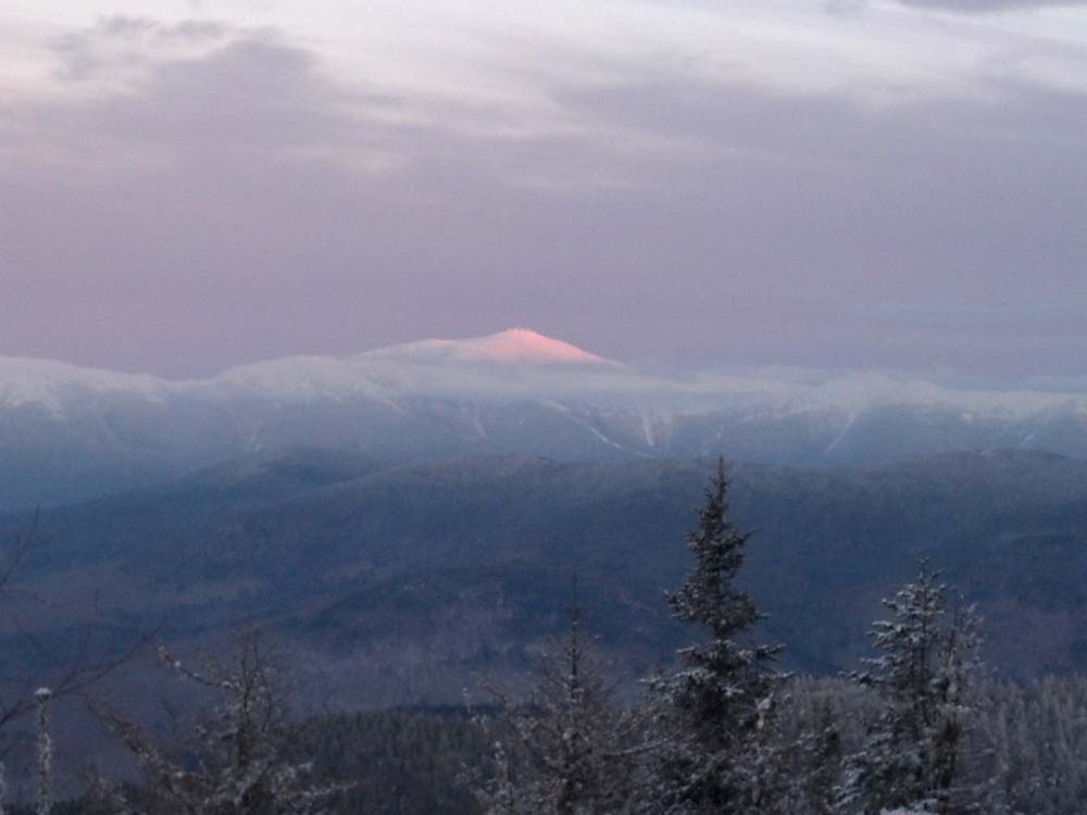
Looking at Mt. Washington from Mt. Martha

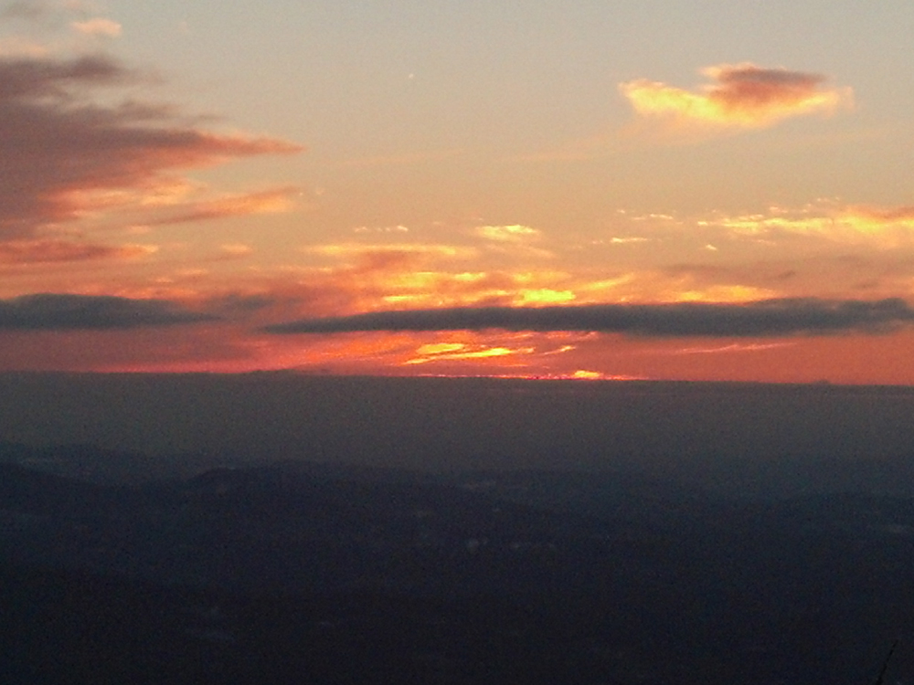
The sunset from Mt. Martha


Directions to trailhead: Take Route 302 west to Route 3 North, then take a right onto Route 115. The Cherry Mountain Trail trailhead and parking area will be on the right, immediately after passing Lennon Road on the left.
Back to Mt. Martha Profile
|