Home
States
Colorado
Connecticut
Maine
Massachusetts
New Hampshire
New York
Rhode Island
Utah
Vermont
View All
Lists
NE 4,000 Footers
NE 100 Highest
NH 4,000 Footers
NH 100 Highest
NH 52 With A View
NH Belknap Range
NH Ossipee 10
Links
Trail Conditions
Trip Log
Sunrises
Sunsets
About
|
Mt. Monroe
Chandler's Purchase, NH, Sargent's Purchase, NH
Trailheads, measurements, times, distances, and maps are all approximate and relative to the hike(s) as shown below.
Looking up the Ammonoosuc Ravine Trail
Route: Ammonoosuc Ravine Trail, Mount Monroe Loop, (Mt. Monroe), Mount Monroe Loop, Ammonoosuc Ravine Trail
After days of poor weather, I finally saw an opportunity to get out and hike with at least some blue sky.
As I headed up 302, the Presidentials were under cloudy skies. Fortunately, as I cleared the notch, I could see some openings in the clouds to the west. As I arrived at the parking lot on Base Road, a little bit of sunshine was visible.
The first part of the Ammonoosuc Ravine Trail was fairly gradual, with a few dips here and there. Fortunately, despite there being a few minor brook crossings, bugs weren't much of a problem.
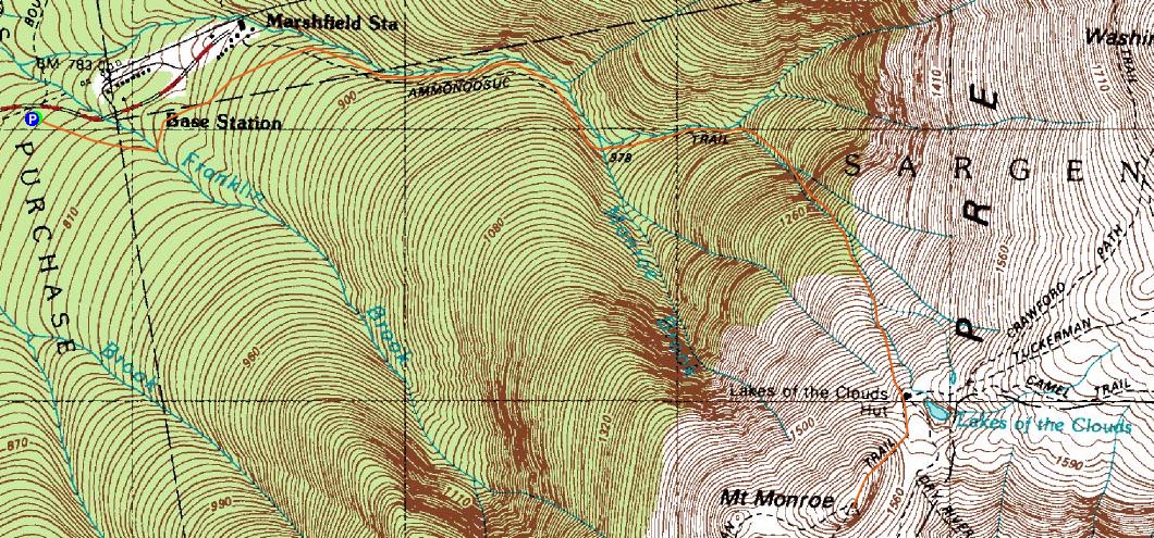
After passing the junction with the spur trail to the Cog base area, the trail followed along the river, not getting overly steep. After a fairly tame crossing at the Gem Pool, the trail steepened right away, remaining steep until some water crossings further uphill. Those water crossings were neat, as they were near cascades.
Soon, I was able to see Mt. Washington and other rocky areas ahead. The Lakes of Clouds Hut suddenly appeared straight ahead, signalling that I was getting close to my destination.
As I started up the Mount Monroe Loop Trail, I had to stop multiple times to let dozens of hikers by - busy day!
The views from the top of Mt. Monroe, though not as good as they could be due to the cloud cover and slight haze, were still nonetheless great. At one point, rock hopping with my camera out, I tripped and instantly scraped my knee and cut open my elbow. Doh.
On my way down, I decided to stop in the hut for awhile and have a quasi-late-lunch. The views from the main room are great.
The descent was fairly quiet - I took some time to check out various cascades that I had missed on the way up. One particularly neat one was a few minutes above the Gem Pool, off a spur trail marked with a small sign.
Back at the parking lot, I was tempted to head over and do a quick hike up Mt. Willard, but instead instinct prevailed and I called it a day with only my minor bruises and scrapes.
| Hike Ratings |
|
Getting To Trailhead: |
Easy |
| Destination: |
Mt. Monroe |
|
Length: |
Moderate |
|
Steepness: |
Difficult |
|
Navigation: |
Easy |
|
Views: |
Excellent |
|
Crowds: |
Heavy |
|
| Hike Stats |
|
Date Hiked: |
Wednesday, June 25, 2008 |
| Hike Commenced: |
12:30 PM |
| Parking Elevation: |
2,500' |
| Destination: |
Mt. Monroe |
| Ascent Commenced: |
12:32 PM |
| Summit Reached: |
2:19 PM |
| Time Elapsed: |
01:47 |
| Trailhead Elevation: |
2,500' |
| Summit Elevation: |
5,372' |
| Distance: |
3.5 miles |
| Vertical Gain: |
2,972' |
|
|
| Hike Ended: |
4:44 PM |
| Hike Time Elapsed: |
04:14 |
| Hike Distance: |
7 miles |
| Hike Vertical Gain: |
3,102' |
|

The Ammonoonusc Ravine Trail trailhead at the edge of the parking area
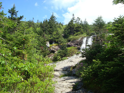
The Gem Pool
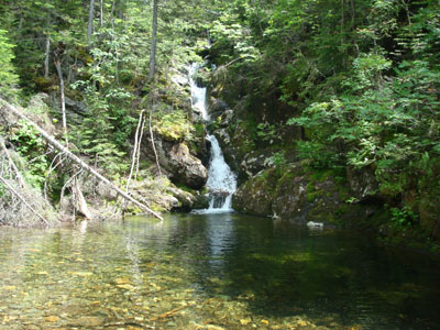
Looking at Mt. Washington from the Mt. Monroe summit
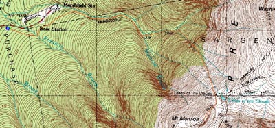

Directions to trailhead: Take Route 302 West from Bartlett up to Crawford Notch. Take a right onto Clinton Road. Follow the road to Base Road (stop sign). Take a right, then take a right a few minutes thereafter into the hiker parking area. The trailhead is on the eastern side of the parking lot.
Back to Mt. Monroe Profile
|