Home
States
Colorado
Connecticut
Maine
Massachusetts
New Hampshire
New York
Rhode Island
Utah
Vermont
View All
Lists
NE 4,000 Footers
NE 100 Highest
NH 4,000 Footers
NH 100 Highest
NH 52 With A View
NH Belknap Range
NH Ossipee 10
Links
Trail Conditions
Trip Log
Sunrises
Sunsets
About
|
Mt. Monroe, Mt. Washington, Mt. Reagan
Chandler's Purchase, NH, Sargent's Purchase, NH, Thompson and Meserve's Purchase, NH
Trailheads, measurements, times, distances, and maps are all approximate and relative to the hike(s) as shown below.
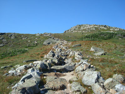
Looking up the Monroe Loop Trail
Route: Ammonoosuc Ravine Trail, Mount Monroe Loop, (Mt. Monroe), Mount Monroe Loop, Crawford Path, (Mt. Washington), Crawford Path, Gulfside Trail, Clay Loop, (Mt. Reagan), rock scramble, Gulfside Trail, Jewell Trail
Finally, after literally months of mostly junk weather, a nice extended period of weather had finally arrived - and with it, another opportunity to hike Mt. Washington.
Starting a bit later than the first time I had hiked Mt. Washington, I had a somewhat crowded Ammonoosuc Ravine Trail to contend with - a few folks ascending and a decent amount more descending, likely from the hut.
While the flats down low were a bit wet and muddy, the actual ascent was fairly dry. After passing a somewhat busy hut, I quickly headed up to Monroe, having the summit to myself. There were beautiful views in all directions - I especially enjoyed the morning fog hovering over the valleys to the west.
The main attraction was still yet to come - and I wanted to get there as early as possible, as I didn't want to deal with large clouds. The Crawford Path from the hut to the summit of Mt. Washington was surprisingly tame, as compared to the similar stretch of the Tuckerman Ravine Trail. There weren't any overly steep sections and much of the footing was decent, as compared to the boulderfield qualities of the Tuckerman Ravine Trail. The views along the way were great too - though, there was also some traffic to contend with.
Arriving at a somewhat busy summit, I walked over the highpoint (while the photo taking groups rotated), took in some views from the nearby deck, then headed inside for a beverage and a snack. Though the crowds can be a bit annoying, having easy access to a cafeteria is great!
After spending a bunch of time hanging out at the summit, I headed back to the Crawford Path, then to the Gulfside Trail. While I had originally planned to head directly down the Jewell Trail, I decided to take a detour and check out Mt. Reagan (while it's still known as Mt. Clay). I especially enjoyed the section of trail between the lower peak and the summit of Mt. Reagan, as it passed through a flat alpine meadow.
The views from Mt. Reagan were excellent - a nice, quiet place right next to a ravine, sort of like Mt. Franklin. Not wanting to backtrack, I decided to do a rock-whack down to the Gulfside Trail.
After ascending a bit to the trail junction, I headed down the Jewell Trail. While it was nice that a decent portion of it was above treeline, the rocky terrain wasn't too much fun. Though steeper, the Ammonoosuc Ravine Trail in my opinion is a nicer way to descend. I found the Jewell Trail to drag on and on without many redeeming qualities.
Altogether though, what a nice day to hike the Presidentials. Days like these will be remembered during the long, cold winters.
| Hike Ratings |
|
Getting To Trailhead: |
Easy |
| Destination: |
Mt. Monroe |
|
Length: |
Moderate |
|
Steepness: |
Difficult |
|
Navigation: |
Easy |
|
Views: |
Excellent |
|
Crowds: |
Heavy |
| Destination: |
Mt. Washington |
|
Length: |
Difficult |
|
Steepness: |
Difficult |
|
Navigation: |
Easy |
|
Views: |
Excellent |
|
Crowds: |
Heavy |
| Destination: |
Mt. Reagan |
|
Length: |
Difficult |
|
Steepness: |
Difficult |
|
Navigation: |
Easy |
|
Views: |
Excellent |
|
Crowds: |
Moderate |
|
| Hike Stats |
|
Date Hiked: |
Friday, August 22, 2008 |
| Hike Commenced: |
7:10 AM |
| Parking Elevation: |
2,500' |
| Destination: |
Mt. Monroe |
| Ascent Commenced: |
7:10 AM |
| Summit Reached: |
8:54 AM |
| Time Elapsed: |
01:44 |
| Trailhead Elevation: |
2,500' |
| Summit Elevation: |
5,372' |
| Distance: |
3.5 miles |
| Vertical Gain: |
2,972' |
| Destination: |
Mt. Washington |
| Ascent Commenced: |
8:58 AM |
| Summit Reached: |
9:56 AM |
| Time Elapsed: |
00:58 |
| Trailhead Elevation: |
5,372' |
| Summit Elevation: |
6,288' |
| Vertical Gain: |
1,301' |
| Destination: |
Mt. Reagan |
| Ascent Commenced: |
11:01 AM |
| Summit Reached: |
12:01 PM |
| Time Elapsed: |
01:00 |
| Trailhead Elevation: |
6,288' |
| Summit Elevation: |
5,533' |
| Vertical Gain: |
273' |
|
|
| Hike Ended: |
2:39 PM |
| Hike Time Elapsed: |
07:29 |
| Hike Vertical Gain: |
4,746' |
|
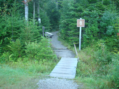
The Ammonoonusc Ravine Trail trailhead at the edge of the parking area
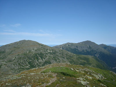
Looking at Mt. Tom, the Twin Range, and in the distance, the Franconia Ridge from the summit of Mt. Monroe

Looking down the Crawford Path at Mt. Monroe

The upper Lake of Clouds

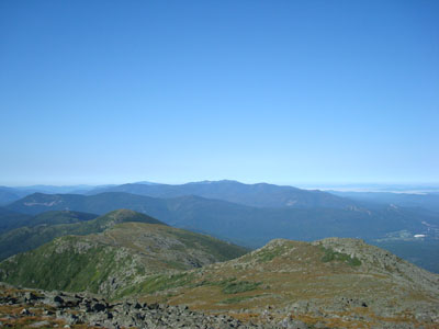
Looking at the southern Presidentials from near the Mt. Washington summit
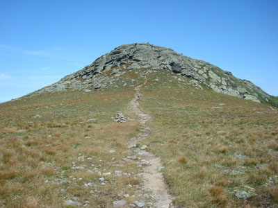
Looking up the Clay Loop Trail near the summit of Mt. Reagan
Looking at the northern Presidentials from the summit of Mt. Reagan
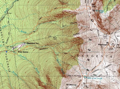

Directions to trailhead: Take Route 302 West from Bartlett up to Crawford Notch. Take a right onto Clinton Road. Follow the road to Base Road (stop sign). Take a right, then take a right a few minutes thereafter into the hiker parking area. The trailhead is on the eastern side of the parking lot.
Back to Mt. Monroe Profile
Back to Mt. Washington Profile
Back to Mt. Reagan Profile
|


