Home
States
Colorado
Connecticut
Maine
Massachusetts
New Hampshire
New York
Rhode Island
Utah
Vermont
View All
Lists
NE 4,000 Footers
NE 100 Highest
NH 4,000 Footers
NH 100 Highest
NH 52 With A View
NH Belknap Range
NH Ossipee 10
Links
Trail Conditions
Trip Log
Sunrises
Sunsets
About
|
Mt. Moosilauke
Benton, NH
Trailheads, measurements, times, distances, and maps are all approximate and relative to the hike(s) as shown below.
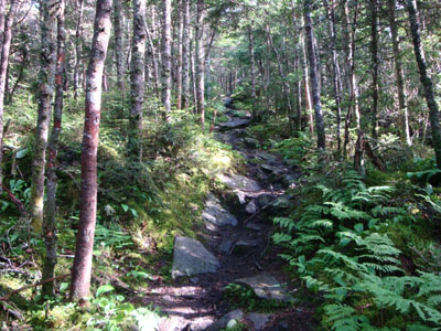
Looking up the Benton Trail
Route: Benton Trail
Eager to try a new approach to Mt. Moosilauke, I decided to give the Benton Trail a try.
After eventually finding a way across the tricking water crossing, I worked my way up the intially gradual Benton Trail. With the exception of a few short, steeper areas, the trail was fairly gradual. It was, however, one of those trails that seemed to go on forever - false hope with the sight of the horizon ahead quite a few times.
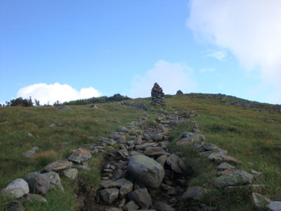
While the peak was in the clouds when I started the hike, some fog lifted by the time I reached treeline, allowing for decent views in multiple directions.
| Hike Ratings |
|
Getting To Trailhead: |
Easy |
| Destination: |
Mt. Moosilauke |
|
Length: |
Moderate |
|
Steepness: |
Difficult |
|
Navigation: |
Easy |
|
Views: |
Excellent |
|
Crowds: |
Heavy |
|
| Hike Stats |
|
Date Hiked: |
Thursday, July 9, 2009 |
| Hike Commenced: |
3:54 PM |
| Parking Elevation: |
1,700' |
| Destination: |
Mt. Moosilauke |
| Ascent Commenced: |
3:54 PM |
| Summit Reached: |
5:40 PM |
| Time Elapsed: |
01:46 |
| Trailhead Elevation: |
1,700' |
| Summit Elevation: |
4,802' |
| Distance: |
3.6 miles |
| Vertical Gain: |
3,152' |
|
|
| Hike Ended: |
8:22 PM |
| Hike Time Elapsed: |
04:28 |
| Hike Vertical Gain: |
3,202' |
|
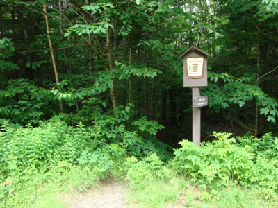
The Benton Trail trailhead
Looking up the Benton Trail on the way to the Mt. Moosilauke summit
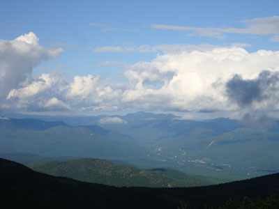
Looking over Lincoln at Mt. Carrigain from near the summit of Mt. Moosilauke
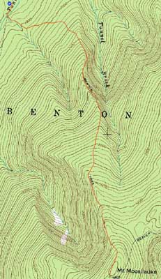

Directions to trailhead: Take Route 116 West from Kinsman Notch. Take a left onto Tunnel Brook Road. The Benton Trail trailhead and parking area will eventually be on the left.
Back to Mt. Moosilauke Profile
|


