Home
States
Colorado
Connecticut
Maine
Massachusetts
New Hampshire
New York
Rhode Island
Utah
Vermont
View All
Lists
NE 4,000 Footers
NE 100 Highest
NH 4,000 Footers
NH 100 Highest
NH 52 With A View
NH Belknap Range
NH Ossipee 10
Links
Trail Conditions
Trip Log
Sunrises
Sunsets
About
|
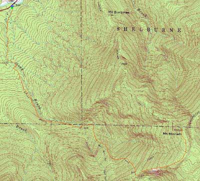
Mt. Moriah
Gorham, NH, Bean's Purchase, NH
Trailheads, measurements, times, distances, and maps are all approximate and relative to the hike(s) as shown below.
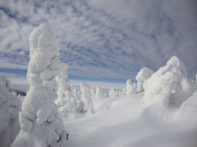
Looking up the Carter-Moriah Trail
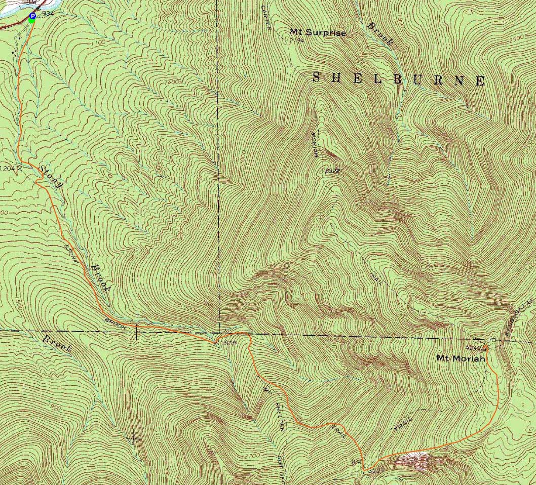
Route: Stony Brook Trail, Carter-Moriah Trail, (Mt. Moriah), Carter-Moriah Trail, Stony Brook Trail
After a long hike and drive the previous day, I was hoping for a tame morning. A fan of the Stony Brook Trail in winter conditions, I decided to head over to Moriah.
While the Stony Brook Trail started off nicely (and the largest crossing was snowbridged), I soon reached the straightaway and discovered unbroken trail. Had I known ahead of time, I probably would have opted for the Carter-Moriah Trail. Nonetheless, it was only a few inches of new snow, so I continued onward.
Once on the Carter Moriah Trail, things slowed dramatically. Not only was the snow deeper, but the trailfinding was difficult - there was a tremendous amount of blowdowns and leaners. Had I not learned this trail over the course of multiple previous hikes, it would have been impossible to follow.
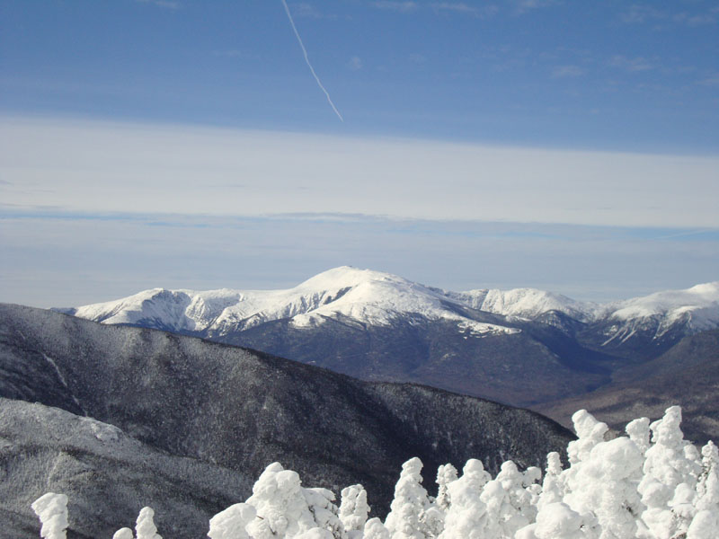
Finally reaching the summit, I had tremendous views in all directions, with the Presidentials particularly striking. Since I had further ambitions for the day, I didn't loiter for long.
Fearing the Carter Moriah Trail could be lost for the winter with the incoming rain storm (the spruce was already heavily loaded with ice and snow, so the additional weight of rain would likely topple the trees), I decided to do some maintenance, cutting out some particularly disorienting blowdowns. Back on the Stony Brook Trail, it was pretty smooth sailing to the parking lot.
| Hike Ratings |
|
Getting To Trailhead: |
Easy |
| Destination: |
Mt. Moriah |
|
Length: |
Moderate |
|
Steepness: |
Difficult |
|
Navigation: |
Difficult |
|
Views: |
Excellent |
|
Crowds: |
Minimal |
|
| Hike Stats |
|
Date Hiked: |
Sunday, January 24, 2010 |
| Hike Commenced: |
7:10 AM |
| Parking Elevation: |
930' |
| Destination: |
Mt. Moriah |
| Ascent Commenced: |
7:10 AM |
| Summit Reached: |
10:25 AM |
| Time Elapsed: |
03:15 |
| Trailhead Elevation: |
935' |
| Summit Elevation: |
4,049' |
| Distance: |
5 miles |
| Vertical Gain: |
3,329' |
|
|
| Hike Ended: |
12:57 PM |
| Hike Time Elapsed: |
05:47 |
| Hike Distance: |
10 miles |
| Hike Vertical Gain: |
3,549' |
|
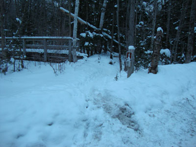
The Stony Brook Trail trailhead
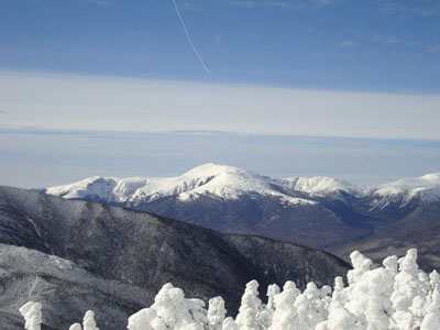
Looking at Mt. Washington from Mt. Moriah

Directions to trailhead: Take Route 16 North from Pinkham Notch. The Stony Brook parking area will be on the right, at the beginning of Mt. Carter Road. The Stony Brook Trail trailhead is a few dozen feet further up Mt. Carter Road, on the left.
Back to Mt. Moriah Profile
|