Home
States
Colorado
Connecticut
Maine
Massachusetts
New Hampshire
New York
Rhode Island
Utah
Vermont
View All
Lists
NE 4,000 Footers
NE 100 Highest
NH 4,000 Footers
NH 100 Highest
NH 52 With A View
NH Belknap Range
NH Ossipee 10
Links
Trail Conditions
Trip Log
Sunrises
Sunsets
About
|
Mt. Shannon
Gilmanton, NH
Trailheads, measurements, times, distances, and maps are all approximate and relative to the hike(s) as shown below.
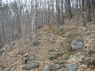
Looking up the Yellow Trail
Route: Yellow Trail
After doing a Gunstock-Belknap-Piper loop, I decided to check out one of the smaller peaks south of the main range.
I found finding the trailhead a bit difficult - the road names on Google Maps are indeed incorrect - Eileen Shore Way is not signed. I'd later find out my parking spot wasn't kosher, but I eventually followed the road from the Hidden Valley entrance to the Yellow Trail crossing of Camp Bell Road.
The trail started off with a decent pitch, prior to reaching the initial ridge. From there, it lollygagged a bit before climbing up to the summit proper.
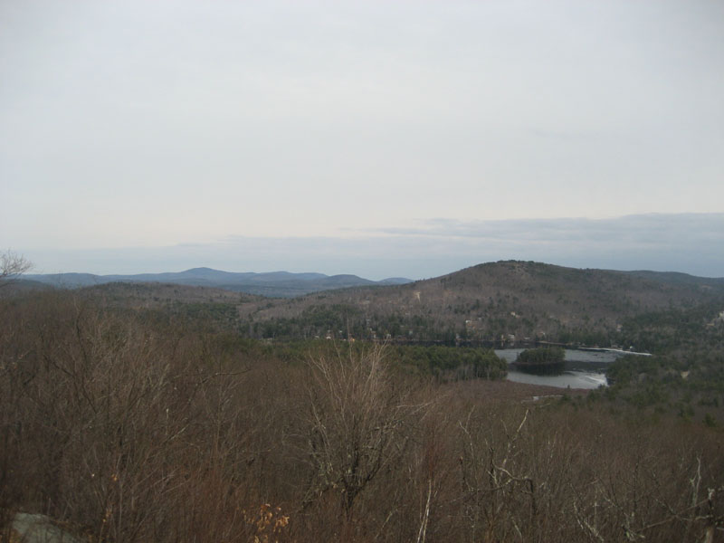
Though not spectacular, the views from the summit area were still quite nice - good ledge views to the east and southwest, along with a northern viewpoint.
Not a bad little peak - it could make an interesting combination hike with Goat Pasture Hill.
| Hike Ratings |
|
Getting To Trailhead: |
Difficult |
| Destination: |
Mt. Shannon |
|
Length: |
Easy |
|
Steepness: |
Moderate |
|
Navigation: |
Easy |
|
Views: |
Excellent |
|
Crowds: |
Minimal |
|
| Hike Stats |
|
Date Hiked: |
Saturday, April 11, 2009 |
| Hike Commenced: |
4:12 PM |
| Parking Elevation: |
800' |
| Destination: |
Mt. Shannon |
| Ascent Commenced: |
4:12 PM |
| Summit Reached: |
4:26 PM |
| Time Elapsed: |
00:14 |
| Trailhead Elevation: |
800' |
| Summit Elevation: |
1,265' |
| Vertical Gain: |
470' |
|
|
| Hike Ended: |
4:51 PM |
| Hike Time Elapsed: |
00:39 |
| Hike Vertical Gain: |
475' |
|
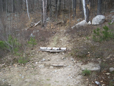
The Camp Bell Road Yellow Trail trailhead
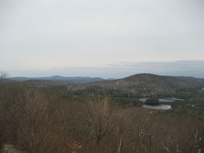
Looking east from Mt. Shannon
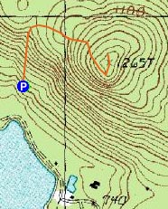

Directions to trailhead: From Route 107, take Route 140 east into Gilmanton. Take a left onto Crystal Lake Road, bearing left to stay on it (when Mountain Road goes straight). After passing Crystal Lake, the road turns into Guinea Ridge Road. Take a right onto Places Pond Road. The Hidden Valley Scout Reservation entrance will soon be on the left. Follow the directions on the kiosk at the entrance for checking in and parking. The Yellow Trail crosses Camp Bell Road north of Lake Eileen.
Back to Mt. Shannon Profile
|