Home
States
Colorado
Connecticut
Maine
Massachusetts
New Hampshire
New York
Rhode Island
Utah
Vermont
View All
Lists
NE 4,000 Footers
NE 100 Highest
NH 4,000 Footers
NH 100 Highest
NH 52 With A View
NH Belknap Range
NH Ossipee 10
Links
Trail Conditions
Trip Log
Sunrises
Sunsets
About
|
Northeast Cannon Ball, Cannon Mountain
Lincoln, NH, Franconia, NH
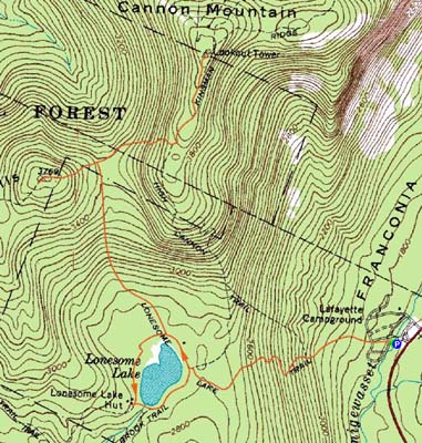
Trailheads, measurements, times, distances, and maps are all approximate and relative to the hike(s) as shown below.
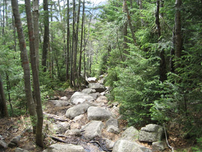
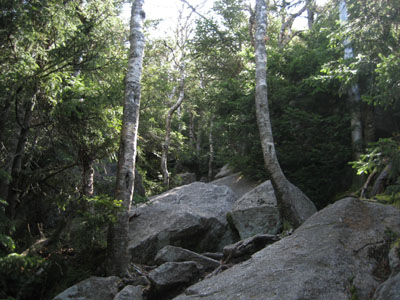
Looking down the Lonesome Lake Trail on the way to the Northeast Cannon Ball
Route: Lonesome Lake Trail, Kinsman Ridge Trail, (Northeast Cannon Ball), Kinsman Ridge Trail, (Cannon Mountain), Kinsman Ridge Trail, Lonesome Lake Trail, Around-Lonesome-Lake-Trail, (Lonesome Lake Hut), Cascade Brook Trail, Lonesome Lake Trail
Again trying to keep the mileage and vertical relatively low for purposes of letting my knee recover, I decided to head up to Northeast Cannonball and perhaps Cannon.
The first portion of the Lonesome Lake Trail was as I remembered it from two years earlier - not too steep, but not the best footing in the world. After passing through the bogwalks adjacent to the lake, the trail soon picked up in steepness (as well as rockiness), prior to levelling out and meeting the Kinsman Ridge Trail. At that junction, I dropped my pack and headed up the short but steep climb to the Northeast Cannon Ball. While I deemed a boulder in the scrub to be the highpoint, there were a few other possibilities just to the south. In terms of views, there was a halfway decent viewpoint just to the south of the height of land, as well as from a boulder adjacent to the potential highpoint.
Back at the col, I strapped on my pack and was soon dealing with the first measurable snow and ice of the day - fortunately I didn't need to put on any traction.
Though the trail was steep and rough (including some light scrambling), I did find it to be nicer than the other main trails to Cannon - perhaps because of the lack of highway sound, as much of this section is on the west side of the ridge.
The views from the summit tower were quite good, as some blue sky had been breaking through. It was also quite windy, though fortunately not cold.
Back at Lonesome Lake, I was feeling some discomfort in my knee, so I decided to head over to the hut and take a break for awhile. Though not yet at full service, the hut was nonetheless open for loitering.
Crowds were building as I descended the last portion of the Lonesome Lake Trail - it seems to be best to head up here early in the morning, prior to the masses hitting the trails!
| Hike Ratings |
|
Getting To Trailhead: |
Easy |
| Destination: |
Northeast Cannon Ball |
|
Length: |
Moderate |
|
Steepness: |
Difficult |
|
Navigation: |
Easy |
|
Views: |
Excellent |
|
Crowds: |
Moderate |
| Destination: |
Cannon Mountain |
|
Length: |
Moderate |
|
Steepness: |
Very Difficult |
|
Navigation: |
Easy |
|
Views: |
Excellent |
|
Crowds: |
Minimal |
|
| Hike Stats |
|
Date Hiked: |
Saturday, May 16, 2009 |
| Hike Commenced: |
8:35 AM |
| Parking Elevation: |
1,750' |
| Destination: |
Northeast Cannon Ball |
| Ascent Commenced: |
8:35 AM |
| Summit Reached: |
10:03 AM |
| Time Elapsed: |
01:28 |
| Trailhead Elevation: |
1,750' |
| Summit Elevation: |
3,769' |
| Distance: |
2.5 miles |
| Vertical Gain: |
2,084' |
| Destination: |
Cannon Mountain |
| Ascent Commenced: |
10:11 AM |
| Summit Reached: |
10:58 AM |
| Time Elapsed: |
00:47 |
| Trailhead Elevation: |
3,769' |
| Summit Elevation: |
4,100' |
| Vertical Gain: |
735' |
|
|
| Hike Ended: |
1:16 PM |
| Hike Time Elapsed: |
04:41 |
| Hike Vertical Gain: |
2,959' |
|
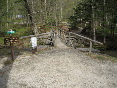
The Lonesome Lake Trail trailhead at the Lafayette Campground hiker parking lot
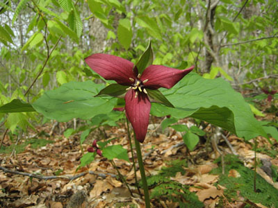
A trillium along the Lonesome Lake Trail
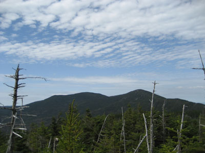
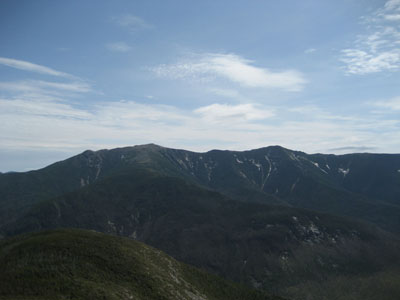
Looking at the Kinsmans from near the summit of North East Cannonball
Looking up the Kinsman Ridge Trail on the way to Cannon Mountain
Looking at the Franconia Ridge from the observation tower on Cannon Mountain
 ' '

Directions to trailhead: Take I-93 South to the Lafayette Place exit. The Lonesome Lake Trail starts on the foot bridge at the hiker parking lot.
Back to Northeast Cannon Ball Profile
Back to Cannon Mountain Profile
|


