Home
States
Colorado
Connecticut
Maine
Massachusetts
New Hampshire
New York
Rhode Island
Utah
Vermont
View All
Lists
NE 4,000 Footers
NE 100 Highest
NH 4,000 Footers
NH 100 Highest
NH 52 With A View
NH Belknap Range
NH Ossipee 10
Links
Trail Conditions
Trip Log
Sunrises
Sunsets
About
|
Northeast Cannon Ball
Lincoln, NH, Franconia, NH
Trailheads, measurements, times, distances, and maps are all approximate and relative to the hike(s) as shown below.

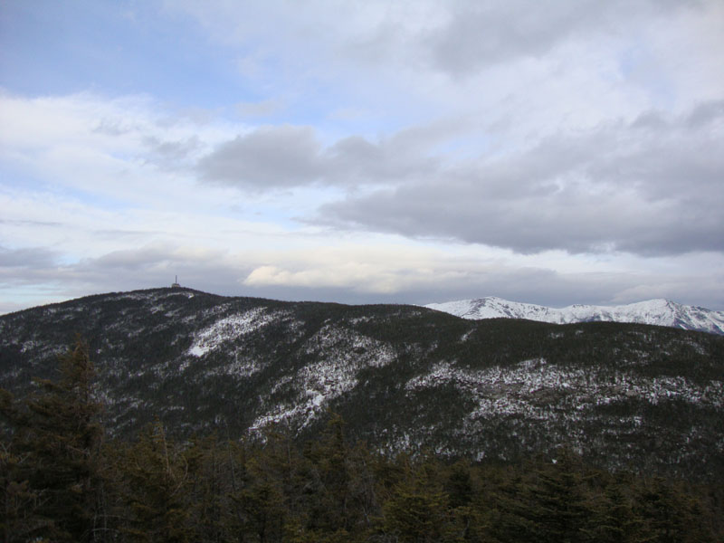
Looking down the Kinsman Ridge Trail on the way to the Northeast Cannonball
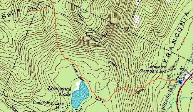
Route: Lonesome Lake Trail, Kinsman Ridge Trail, (Northeast Cannon Ball), Kinsman Ridge Trail, Lonesome Lake Trail
Curious to see if the snowpack had improved the views on Northeast Cannonball, I opted to head up to the Kinsman Ridge.
While there was virtually no snow left in Franconia Notch, the Lonesome Lake Trail still had on-trail snow, though of the monorail variety. Reaching the lake, I could see some blue sky - a welcome sight after watching the skies cloud over a few hours earlier.
Reaching the summit of Northeast Cannonball, the snow was too compromised for me to stand on top (thus sinking a foot or two), reducing my chance at stellar views. Nonetheless, the views were stronger than normal. Continuing over to the waterbar view, I could see well into the southern part of the state.
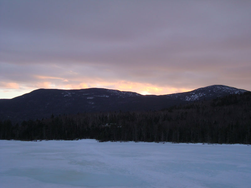
For the descent, I did some trail work, reaching the lake just before sunset. Sure enough, I had some slight colors while watching the display from the shore.
| Hike Ratings |
|
Getting To Trailhead: |
Easy |
| Destination: |
Northeast Cannon Ball |
|
Length: |
Moderate |
|
Steepness: |
Difficult |
|
Navigation: |
Easy |
|
Views: |
Excellent |
|
Crowds: |
Minimal |
|
| Hike Stats |
|
Date Hiked: |
Thursday, March 18, 2010 |
| Hike Commenced: |
4:24 PM |
| Parking Elevation: |
1,750' |
| Destination: |
Northeast Cannon Ball |
| Ascent Commenced: |
4:24 PM |
| Summit Reached: |
5:41 PM |
| Time Elapsed: |
01:17 |
| Trailhead Elevation: |
1,750' |
| Summit Elevation: |
3,769' |
| Distance: |
2.5 miles |
| Vertical Gain: |
2,084' |
|
|
| Hike Ended: |
7:17 PM |
| Hike Time Elapsed: |
02:53 |
| Hike Distance: |
5 mile |
| Hike Vertical Gain: |
2,159' |
|

The Lonesome Lake Trail trailhead at the Lafayette Campground hiker parking lot

Looking Cannon Mountain and the Franconia Ridge from Northeast Cannonball

The sunset as seen from Lonesome Lake
 ' '

Directions to trailhead: Take I-93 South to the Lafayette Place exit. The Lonesome Lake Trail starts on the foot bridge at the hiker parking lot.
Back to Northeast Cannon Ball Profile
|