Home
States
Colorado
Connecticut
Maine
Massachusetts
New Hampshire
New York
Rhode Island
Utah
Vermont
View All
Lists
NE 4,000 Footers
NE 100 Highest
NH 4,000 Footers
NH 100 Highest
NH 52 With A View
NH Belknap Range
NH Ossipee 10
Links
Trail Conditions
Trip Log
Sunrises
Sunsets
About
|
North Twin Mountain, South Twin Mountain
Bethlehem, NH, Franconia, NH
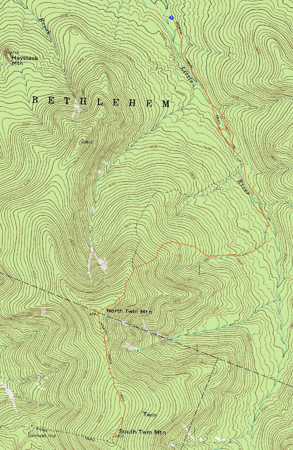
Trailheads, measurements, times, distances, and maps are all approximate and relative to the hike(s) as shown below.
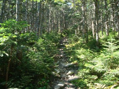
Looking up the North Twin Trail
Route: North Twin Trail, view spur path, (North Twin Mountain), view spur path, North Twin Spur, (South Twin Mountain), North Twin Spur, North Twin Trail, herd path, North Twin Trail
With a bit of a late start after a day of moving furniture, I decided to head up to the Twins, via the North Twin Trail. On the way there, I drove by Haystack Road, as there was no actual road sign for it. I realized my mistake as I drove by, and was soon on the dirt road, arriving at a somewhat full parking lot.
The first part of the North Twin Trail was like a hiking highway - flat, straight, good footing. Arriving at the first water crossing, I wasted about 10 minutes trying to first find a rock crossing, and then second build on. I came close, but decided to take off my shoes and wade the rest of the way. Dr. Watercrossing or: How I Learned to Stop Worrying and Love to Wade. My apologies to anyone drinking the Twin Mountain town water.
The trail was a little bit muddy, but still pretty easy going between the first and second crossings. The second and third crossings were easier to cross.
After the third water crossing, the trail started to steepen up a bit, crossing a few smaller streams thereafter. Not too long after, things steepened up a bit more, climbing up some loose dirt and then rocky sections.
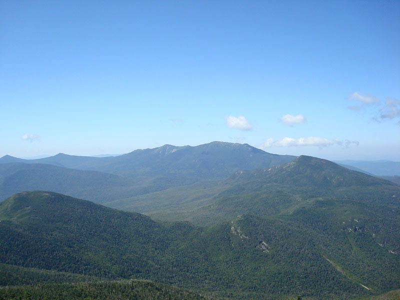
Soon, I emerged at a beautiful view ledge, surrounded by stunted evergreen growth. Beyond here, the trail was very narrow (and hard to find at first from the ledge), but nonetheless fairly gradual. After arriving at the North Twin Spur junction, I headed over to the near-summit viewpoint and had great views of the Pemi Wilderness.
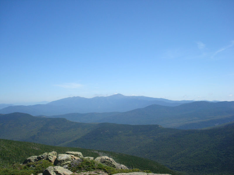
After cleaning out my shoes (some sand/pebbles in them from wading barefoot across the first water crossing), I headed over to South Twin, which also had great views. While I was tempted to eat lunch here, I decided to head back to the first viewpoint on North Twin, so that I'd have more than half of the hike over.
While eating lunch, a bee or something snuck under my foot and gave me a bit of a sting - must have been a Yankee fan.
On the way back down, I decided to avoid the lower two water crossings by following a fairly well worn herd path along the east shore.
| Hike Ratings |
|
Getting To Trailhead: |
Moderate |
| Destination: |
North Twin Mountain |
|
Length: |
Moderate |
|
Steepness: |
Difficult |
|
Navigation: |
Moderate |
|
Views: |
Excellent |
|
Crowds: |
Moderate |
| Destination: |
South Twin Mountain |
|
Length: |
Difficult |
|
Steepness: |
Difficult |
|
Navigation: |
Easy |
|
Views: |
Excellent |
|
Crowds: |
Moderate |
|
| Hike Stats |
|
Date Hiked: |
Sunday, August 24, 2008 |
| Hike Commenced: |
8:28 AM |
| Parking Elevation: |
1,795' |
| Destination: |
North Twin Mountain |
| Ascent Commenced: |
8:29 AM |
| Summit Reached: |
10:47 AM |
| Time Elapsed: |
02:18 |
| Trailhead Elevation: |
1,800' |
| Summit Elevation: |
4,761' |
| Distance: |
4.3 miles |
| Vertical Gain: |
3,111' |
| Destination: |
South Twin Mountain |
| Ascent Commenced: |
10:53 AM |
| Summit Reached: |
11:31 AM |
| Time Elapsed: |
00:38 |
| Trailhead Elevation: |
4,761' |
| Summit Elevation: |
4,902' |
| Distance: |
1.3 miles |
| Vertical Gain: |
461' |
|
|
| Hike Ended: |
2:57 PM |
| Hike Time Elapsed: |
06:29 |
| Hike Vertical Gain: |
4,048' |
|
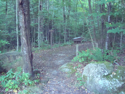
The North Twin Trail at the end of Haystack Road
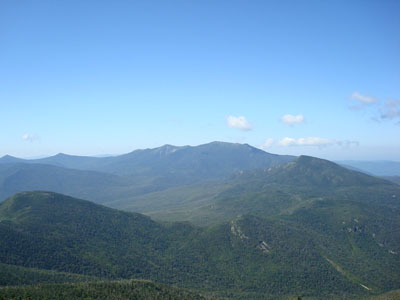
Looking at the Franconia Ridge from near the North Twin summit
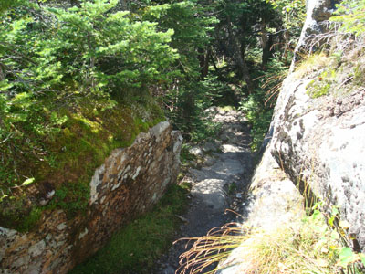
The North Twin Spur
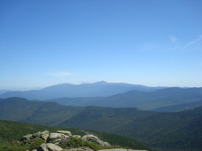
Looking at Mt. Washington from the South Twin summit
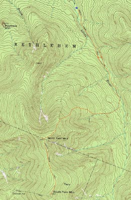

Directions to trailhead: From Route 302, take Route 3 South. Almost immediately after the Entering White Mountain National Forest, take a left onto Haystack Road. The WMNF fee parking area is at the end of the road, and the North Twin Trail trailhead is at the back of the lot.
Back to North Twin Mountain Profile
Back to South Twin Mountain Profile
|