Home
States
Colorado
Connecticut
Maine
Massachusetts
New Hampshire
New York
Rhode Island
Utah
Vermont
View All
Lists
NE 4,000 Footers
NE 100 Highest
NH 4,000 Footers
NH 100 Highest
NH 52 With A View
NH Belknap Range
NH Ossipee 10
Links
Trail Conditions
Trip Log
Sunrises
Sunsets
About
|
Oak Hill
Tuftonboro, NH
Trailheads, measurements, times, distances, and maps are all approximate and relative to the hike(s) as shown below.
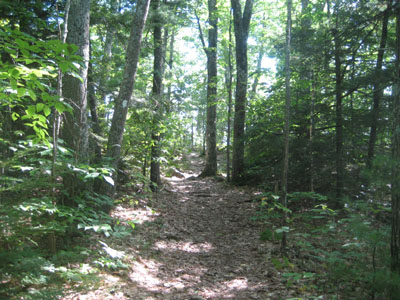
Looking up the trail to the Oak Hill ledges
Route: Unknown trail
While I had planned to take a subpar forecasted day off to rest my knee after five consecutive days of hiking, I decided to take a late lunch break and try the Oak Hill hike before the late afternoon clouds moved in.
Arriving at the trailhead, I parked on the side of the road and quickly set foot up the short, gradual trail.
Surprisingly, considering it was such a short hike, the views were tremendous. Particularly interesting was the large cross located on the ledges - perhaps religious camp services are conducted here.
I also ventured a bit further over to another set of ledges - careful, they're more slippery than a typical Washington politician!
| Hike Ratings |
|
Getting To Trailhead: |
Easy |
| Destination: |
Oak Hill |
|
Length: |
Easy |
|
Steepness: |
Easy |
|
Navigation: |
Easy |
|
Views: |
Excellent |
|
Crowds: |
Minimal |
|
| Hike Stats |
|
Date Hiked: |
Friday, August 29, 2008 |
| Hike Commenced: |
2:55 PM |
| Parking Elevation: |
1,000' |
| Destination: |
Oak Hill |
| Ascent Commenced: |
2:56 PM |
| Summit Reached: |
3:02 PM |
| Time Elapsed: |
00:06 |
| Trailhead Elevation: |
1,000' |
| Summit Elevation: |
1,180' |
| Vertical Gain: |
185' |
|
|
| Hike Ended: |
3:16 PM |
| Hike Time Elapsed: |
00:21 |
| Hike Vertical Gain: |
190' |
|
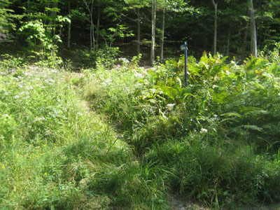
The trailhead to the trail to the Oak Hill ledges
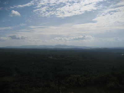
Looking at the Belknaps from the Oak Hill ledges as the clouds approach
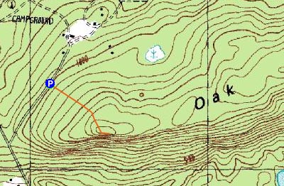

Directions to trailhead: Take 171 southeast from Route 25, past Castle in the Clouds. Take a left onto Canaan Road. Take a right onto Sentinel Lodge Road. Soon, utility lines will be to the left of the road. Just before the road starts to dip to the camp entrance, look for a blue sign on the right (facing downhill toward the camp) that says 'The Ledges'.
Back to Oak Hill Profile
|

