Home
States
Colorado
Connecticut
Maine
Massachusetts
New Hampshire
New York
Rhode Island
Utah
Vermont
View All
Lists
NE 4,000 Footers
NE 100 Highest
NH 4,000 Footers
NH 100 Highest
NH 52 With A View
NH Belknap Range
NH Ossipee 10
Links
Trail Conditions
Trip Log
Sunrises
Sunsets
About
|
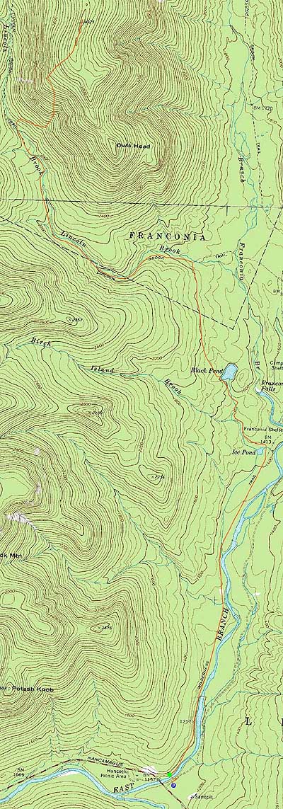
Owl's Head
Lincoln, NH, Franconia, NH
Trailheads, measurements, times, distances, and maps are all approximate and relative to the hike(s) as shown below.
The Lincoln Brook Trail
Route: Lincoln Woods Trail, Black Pond Trail, bushwhack, Lincoln Brook Trail, bushwhack, Owl's Head Path, (formerly recognized Owl's Head summit), bushwack, (Owl's Head), buswhack, Owl's Head Path, bushwhack, Lincoln Brook Trail, bushwhack, Black Pond Trail, Lincoln Woods Trail
Though the morning was looking to start off nicely weatherwise, the forecast was for cold temperatures and increasing clouds. Thus, despite the fresh snow, Owl's Head was on the radar.
Starting in sub-zero temperatures at Lincoln Woods, I snowshoed down the Lincoln Woods Trail as the sun started to rise. Continuing down the Black Pond Trail, the broken out trail ended at the pond.
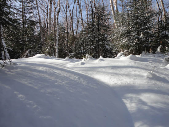
From there, I climbed up into the woods, then gradually increased my elevation as I broke out a variation of the Black Pond bushwhack in about 6-8" of powder. Climbing a bit higher than normal, I had some nice views through the trees toward Red Rock. This scenic route resulted in hitting spruce just prior to the Lincoln Brook Trail.
The trail breaking continued on the Lincoln Brook Trail and the snow depths increased as I headed over the second (snowbridged) water crossing. After the third (snowbridged again) crossing, I headed into the woods, found the large rock, and pushed my way onto an old logging road, which then turned and connected with the more open logging road leading into the birch glades of the "Brutus Bushwhack."
Nearing the top of that drainage, I opted to climb steeply into the woods. With the unpacked powder, it was slow going.
Eventually popping out onto the Owl's Head Path at a boulder, snow depths increased again with some knee deep areas. Upon reaching the ridge, the depth of the powder decreased, making for fairly smooth (albeit tricky in places due to spruce traps) sailing over to the old summit and then the highpoint.
For the descent, we followed our tracks back down to the Lincoln Brook Trail, then continued further down the trail to break out a better ending of the Black Pond bushwhack, by following an old logging road back up to our tracks (thus avoiding the spruce). We then headed out to Lincoln Woods, reaching the parking lot well after sunset.
| Hike Ratings |
|
Getting To Trailhead: |
Easy |
| Destination: |
Owl's Head |
|
Length: |
Very Difficult |
|
Steepness: |
Difficult |
|
Navigation: |
Difficult |
|
Views: |
Minimal |
|
Crowds: |
Minimal |
|
| Hike Stats |
|
Date Hiked: |
Saturday, January 15, 2011 |
| Hike Commenced: |
7:19 AM |
| Parking Elevation: |
1,170' |
| Destination: |
Owl's Head |
| Ascent Commenced: |
7:21 AM |
| Summit Reached: |
1:11 PM |
| Time Elapsed: |
05:50 |
| Trailhead Elevation: |
1,170' |
| Summit Elevation: |
4,025' |
| Vertical Gain: |
3,055' |
|
|
| Hike Ended: |
6:46 PM |
| Hike Time Elapsed: |
11:27 |
| Hike Vertical Gain: |
3,310' |
|
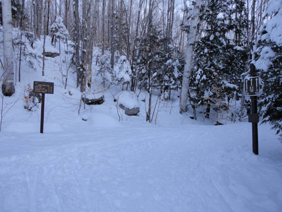
The Lincoln Woods Trail trailhead
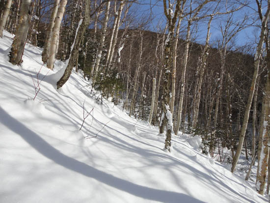
The birch glade, south of the slide
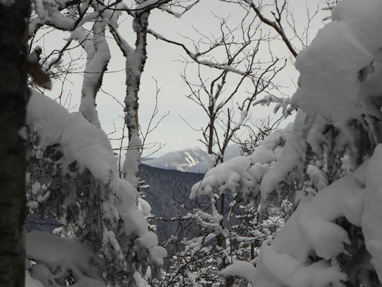
Slight views of Mt. Lowell from the 'new' summit of Owl's Head

Directions to trailhead: Take Route 112 East from I-93 past Loon to the Lincoln Woods WMNF fee parking area (left side of road).
Back to Owl's Head Profile
|


