Home
States
Colorado
Connecticut
Maine
Massachusetts
New Hampshire
New York
Rhode Island
Utah
Vermont
View All
Lists
NE 4,000 Footers
NE 100 Highest
NH 4,000 Footers
NH 100 Highest
NH 52 With A View
NH Belknap Range
NH Ossipee 10
Links
Trail Conditions
Trip Log
Sunrises
Sunsets
About
|
Peaked Mountain
Conway, NH
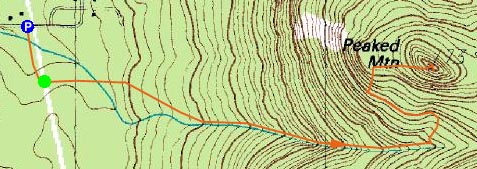
Trailheads, measurements, times, distances, and maps are all approximate and relative to the hike(s) as shown below.
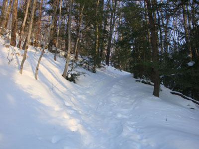
Looking up the Middle Mountain Trail
Route: Middle Mountain Trail, Peaked Mountain Trail, (Peaked Mountain), Peaked Mountain Trail, Middle Mountain Trail
Though clouds were moving in, I had some hope that I might be able to get somewhat of a sunset. With temperatures dropping, Peaked Mountain seemed like a decent place to go, rather than something with a higher elevation and more remote location.
The trail was somewhat busy down low, as some hikers and backcountry skiers were making their way out. Beyond the Black Cap junction, I had the trails to myself.
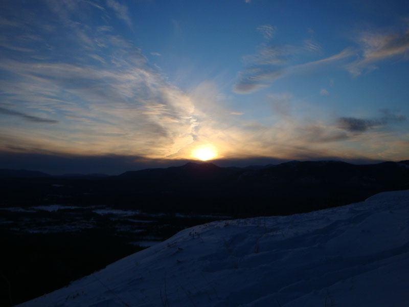
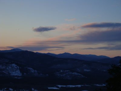
Racing the sun, I was able to make it to the summit with some time to spare. While the clouds were going to prevent any sort of dramatic sunset, it was nonetheless still a nice site. Perhaps the best colors were actually to the north, over Mt. Carrigain.
After watching the sun set into the clouds, the rapidly increasing winds and dropping temperatures were enough to convince me to head down. While I had additional layers I could have added, it just didn't seem worthwhile waiting for any sort of afterglow (which never ended up happening anyways).
Thanks to the snow, I was able to walk all the way back to the trailhead without using my headlamp.
| Hike Ratings |
|
Getting To Trailhead: |
Easy |
| Destination: |
Peaked Mountain |
|
Length: |
Moderate |
|
Steepness: |
Moderate |
|
Navigation: |
Easy |
|
Views: |
Excellent |
|
Crowds: |
Moderate |
|
| Hike Stats |
|
Date Hiked: |
January 14, 2009 |
| Hike Commenced: |
3:32 PM |
| Parking Elevation: |
535' |
| Destination: |
Peaked Mountain |
| Ascent Commenced: |
3:35 PM |
| Summit Reached: |
4:13 PM |
| Time Elapsed: |
00:38 |
| Trailhead Elevation: |
545' |
| Summit Elevation: |
1,739' |
| Vertical Gain: |
1,244' |
|
|
| Hike Ended: |
5:13 PM |
| Hike Time Elapsed: |
01:41 |
| Hike Vertical Gain: |
1,359' |
|
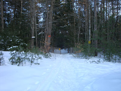
Middle Mountain Trail trailhead under the power lines
Looking at White Horse Ledge, Mt. Carrigain, Cathedral Ledge, and beyond from near the Peaked Mountain summit

The sunset as seen from Peaked Mountain


Directions to trailhead: From Routes 16/302 in North Conway, take Artist Falls Road past the railroad tracks. Take a right onto Thompson Road. A small Town of Conway/Pudding Pond Conservation Area signed parking lot will be on the right shortly thereafter.
Back to Peaked Mountain Profile
|