Home
States
Colorado
Connecticut
Maine
Massachusetts
New Hampshire
New York
Rhode Island
Utah
Vermont
View All
Lists
NE 4,000 Footers
NE 100 Highest
NH 4,000 Footers
NH 100 Highest
NH 52 With A View
NH Belknap Range
NH Ossipee 10
Links
Trail Conditions
Trip Log
Sunrises
Sunsets
About
|
Piper Mountain
Gilford, NH
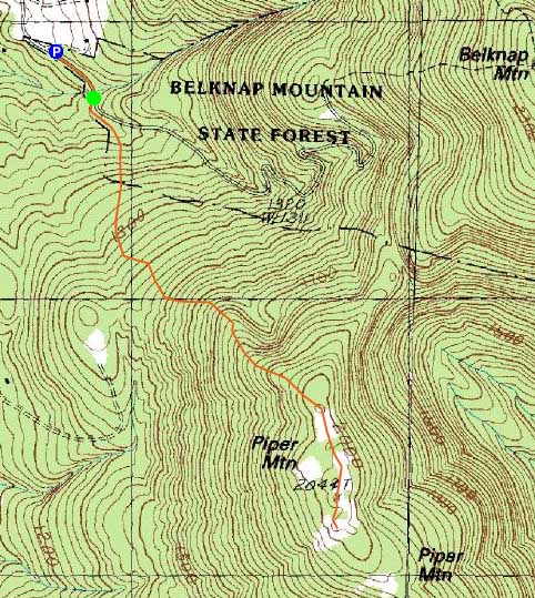
Trailheads, measurements, times, distances, and maps are all approximate and relative to the hike(s) as shown below.

Looking down the Piper Mountain Trail
Route: Piper Mountain Trail, green blazed trail, bushwhack, green blazed trail, Piper Mountain Trail
With nice weather, it seemed like a good opportunity to get in a quick sunset hike.
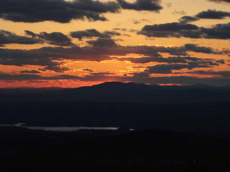
After parking near the Carriage Road gate, I headed up the Piper Mountain Trail on snowshoes. Nearing the top of the Piper Mountain Trail, I was pleasantly surprised to see a nice sunset setting up.
After crossing over the summit, I lightly bushwhacked to a western view ledge. The sun ended up setting into Ragged Mountain in a nice display of orange. With the mild temperatures, it ended up being the first pleasant sunset conditions I've had in awhile.
| Hike Ratings |
|
Getting To Trailhead: |
Easy |
| Destination: |
Piper Mountain |
|
Length: |
Moderate |
|
Steepness: |
Moderate |
|
Navigation: |
Easy |
|
Views: |
Excellent |
|
Crowds: |
Minimal |
|
| Hike Stats |
|
Date Hiked: |
Monday, March 8, 2010 |
| Hike Commenced: |
4:59 PM |
| Parking Elevation: |
1,030' |
| Destination: |
Piper Mountain |
| Ascent Commenced: |
5:01 PM |
| Summit Reached: |
5:38 PM |
| Time Elapsed: |
00:37 |
| Trailhead Elevation: |
1,010' |
| Summit Elevation: |
2,044' |
| Vertical Gain: |
1,064' |
|
|
| Hike Ended: |
6:23 PM |
| Hike Time Elapsed: |
01:49 |
| Hike Vertical Gain: |
1,214' |
|

The Piper Mountain Trail trailhead on the Carriage Road

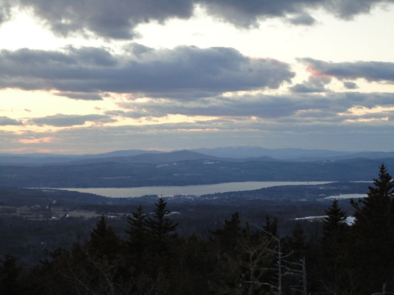
Looking at Mt. Cardigan from near the Piper Mountain summit

The sunset as seen from near the summit of Piper Mountain


Directions to trailhead: From Route 11A East (from Route 3), take a right on Hoyt Road. Continue down this road as it becomes Belknap Mountain Road. Look for Carriage Road on your left. There is a small parking lot just before the gate. Trailhead is down the road a bit, on the right after a small bridge.
Back to Piper Mountain Profile
|